Showing posts with label Montana. Show all posts

January 9, 2015

A white Christmas ski at Lubrecht

lubrecht_2014-12-25_066

On Christmas Day, we woke to fresh snow in Missoula, and after opening gifts decided to pack up the dogs and our cross-country skis and head for the trails at Lubrecht Experimental Forest.

While it was gray down in the valley, we were rewarded with a bit of blue sky, 4 to 6 inches of powder on top of trails that had been groomed the day before and few other people. The trails weren’t marked for the new season, but with an updated map downloaded to my iPhone, old maps still posted and experience skiing the area in the past we had no trouble finding our way.

We decided to follow the new “E” trail, which is listed at about 7 3/4 miles and ends at an overlook.
After leaving the parking lot and passing through a gate slightly to the southeast, we followed the southern portions of the “C” and “D” loops generally to the east. The powder-covered trail rose and fell through the forest, and we stopped at a couple of junctions to check our directions.

lubrecht_2014-12-25_006

Where the old “E” loop rejoined “D,” we followed it uphill more steeply into thicker trees. After switching back to the west, the forest thinned and we arrived at a downed tree that had blocked the groomer from continuing. We rounded the trunk and found ourselves in deeper, but still passable, powder and continued on, following a set of ski tracks.

Uphill a ways farther, the trees opened up and we could see the surrounding Blackfoot Valley and north to the Swan Mountains. After arriving at high point among the trees that was probably the overlook, we continued a short distance in the ski tracks before turning back.

lubrecht_2014-12-25_099

After returning to the “C” and “D” loops and slowing for a tired dog, we passed a few other parties of skiers enjoying the day on the way back to the start.

Here are more photos from Lubrecht Experimental Forest.

Distance: 7 3/4 miles out and back. (We went a short distance farther, totaling about 8 1/4 miles.)

Trailhead: Follow Interstate 90 about 5 miles east of Missoula to Bonner, then Montana Highway 200 east 26 miles to Lubrecht Experimental Forest.

January 2, 2015

A big, busy year of running in 2014

Start here, run up there, then back

Farther, higher, faster and harder pretty well define my year of running.

I started the year with an advanced marathon training class and found myself running at a Boston-qualifying pace that would have had me finishing about 45 minutes faster than my personal best.

While I didn't run an official marathon last year, I did finish two ultras, a couple of shorter trail races and several long training runs. Among them:


In all, I logged about 2,423 miles on my GPS in 2014 - with Bighorn at 52 miles and 6,500 feet of gain and The Rut at 32 miles and 11,000 feet topping the list.

Both were enjoyable experiences, and I plan to run them again this year.

Here's a slideshow of photos from this year's runs - and a link to a Rut video in which I briefly appear. (Look for the red hat at the Tram Dock aid station.)


A big thank-you to the friends with who were with me for many of last year's miles and Missoula's supportive running community!

October 26, 2014

Running to new heights at The Rut

Over Lone Peak

After starting summer with my longest run to date, I finished the season with my highest and hardest run: The Rut 50K, with 11,000 feet of elevation gain over the 11,166-foot summit of Lone Peak.

Organized by Missoula's Runner's Edge store, the race took place in mid-September at Big Sky Resort, between Bozeman and Yellowstone National Park. Being the final ultramarathon in the 2014 Skyrunner World Series, some of the biggest names in the sport were there: Kilian Jornet, Sage Canaday, Emelie Forsberg, Kasie Enman and others.  (I can now add "skyrunner" to my bio, apparently; for a primer, see this Trail Runner magazine article and video.)

We arrived the day before the 50K and settled into the condo we rented before visiting with friends at the start/finish area, attending my race meeting and Jen's aid station meeting, then eating dinner. On the way back to the condo to go to bed, I noticed the light atop Lone Peak appeared as if it were a star.

Start here, run up there, then back

Early the next morning, we walked to the start and Jen departed with her aid station crew. After watching the first wave of runners get underway at 6 a.m., it was my turn five minutes later.

Starting to a pre-dawn elk bugle, the second wave of streaming headlamps made its way gradually uphill. I soon found myself among a handful of familiar voices in as we slowly made our way uphill in a line. At the top of the first climb near 2 miles, the sun had risen enough to see the footing.

The next 5 1/2 miles were downhill to the Madison Village, eventually running on trails and ramps between rows of houses. Turning uphill again, the course steadily rose for 5 miles past the first aid station at 7 1/2 miles and into the forest.

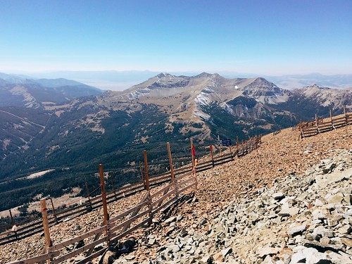
After another couple of short downhill stretches, I left the trees at about 14 miles and arrived at the first major climb for the day: Headwaters Ridge. Here, the course left the trail and scrambled steeply up the scree, rising a little more than 1,000 feet in a little less than 3/4 mile. At the top, a quick descent using a via ferrata line led to the narrow ridgeline and a fast run down 1,700 feet over 1 1/2 miles and into the forest. A couple of patches of snow left from a storm earlier in the week clung to the rocks, and careful footing was required as a misstep could send you tumbling downhill.

Follow the little yellow flags

Over then next 2 miles, the course climbed again into a sun-baked basin where the 18-mile aid station sat at the Lone Peak tram dock. Here, a small crew of Missoulians - including Jen - helped with drop bags, food and fluids. After refilling my hydration pack and eating some, I headed toward the start of Bonecrusher Ridge. In the end, Jen and the others would make it to the finish line before me.

A mile back down from the tram dock then slightly uphill, the course turned onto Bonecrusher Ridge, the highest climb of the day. In about 1 1/3 miles, the trail climbed 2,000 feet out of the trees and up the hot, rocky ridge - the tram dock directly below a nearly vertical drop to the side. On the steepest section near the top, it wasn't unusual to be on all fours in places. At the summit, it was nice to take another short break at the aid station to eat and catch my breath before continuing.

The view from the top of 11,000-foot Lone Peak

The 2,500-foot descent over the next 1 3/4 miles was the roughest part of the race on my the feet as the course took us over plate-sized slabs of rock that would shift underfoot on occasion. At the bottom, I stopped briefly to empty my shoes of gravel as well.

Back in the trees, the trail rain along the border of Big Sky Resort and the exclusive Yellowstone Club, dropping for a mile then climbing almost half a mile past one of the large homes. After two more miles of downhill, the course reached thicker forest and a 1-mile climb up muddy trails and over mountain bike ramps, occasionally aided by ropes. Near 27 1/2 miles, the trail reached the final aid station.

From there, the last 4 1/2 miles of the course were mostly downhill, crossing ski slopes, then rising slightly through the forest again. After passing behind one of the resort's large hotels, I arrived at the finish, covering about 32 miles in 9 hours.


A few post-race notes:

Slowest mile: Mile 21, with 1,424 feet of elevation gain, took 50:13. It also likely included some time at the Lone Peak aid station.

Fastest mile: Mile 4 - in the first downhill section - took 8:32.

Food: The spread wasn't as expansive as at the Bighorn Mountain Wild and Scenic Trail Run (see notes), but the mini dill pickles atop Lone Peak were delicious.

They meant well: As a spectator, what you say might not be interpreted how you intend. "You're almost there - just around the corner," said one spectator. To me, those words of encouragement indicate the finish is nearby, not a ridge called Bonecrusher. "Just eight little hills to go," said another spectator in the last couple of miles. Nothing was "little" at that point.

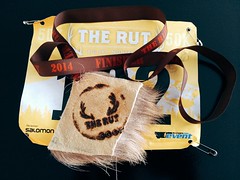
The "medal": This being The Rut, the elk hide finisher's "medal" was a unique touch - just have to keep my dog from getting it.

Elk hide, of course - it's The Rut

All in all, it was a great experience - and a fun way to start a weeklong vacation to Yellowstone National Park. And while it was a difficult race, I'll probably return!

October 12, 2014

Celebrating wilderness with solitude in Rattlesnake

boulder_lake_2014-09-01_052

I spent a lot of time in the Rattlesnake National Recreation Area and Wilderness this past summer, so it was only fitting that when we chose a place to hike two days before the 50th anniversary of the Wilderness Act it was there.

While the Rattlesnake is Missoula's backyard, accessed by most from the main trailhead on the north edge of the city, we hiked to Boulder Lake from the more remote West Fork of Gold Creek to the northeast and saw only two other people all day. The rough drive into the trailhead likely accounts for the decreased use - it's the only time the traction control light in our SUV has turned on on a dry road.

boulder_lake_2014-09-01_008

Once there, we hiked north on Trail 333 through an old burn, the Mineral Peak lookout visible to the south through the remaining snags and tall stalks of fireweed. The trail rose and fell gradually, crossed a couple of creeks, then entered forest just before a junction at 2 1/2 miles.

Continuing on Trail 333 to the northwest, we climbed a burned ridge, passing the wilderness boundary at 3 3/4 miles. From there, the trail continued up to a saddle below 7,293-foot Boulder Point. A short distance higher, we hiked a 1/4-mile side trail to the point, where we found the remains of lookout and views 800 feet down to the lake, north to the Mission Mountains and northeast the the Swan Range.

boulder_lake_2014-09-01_035

After returning to Trail 333, we continued up into the forest and a junction at 5 miles. Here, we followed the final steep switchbacks down 1 mile along a creek and past a marshy area, then down more to the lake shore and the point looming to the west.

boulder_lake_2014-09-01_082

After eating some food and letting the dogs swim and sniff around some moose tracks, we climbed up from the lake and hiked back to our car.

In Missoula, we truly are lucky to have treasures such as the Rattlesnake Wilderness - and the Selway-Bitterroot, Mission Mountains and Bob Marshall - so close.

Here are more photos from Boulder Lake.

Distance: 12 1/2 miles round trip, including 1/2 to Boulder Point and back.

Trailhead: From Bonner, drive about 8 3/4 miles east on Montana Highway 200, then turn northwest on Gold Creek Road, also known as Forest Road 126, and follow it 6 miles. Turn northwest on Forest Road 2103 and continue 5 miles, then turn onto Forest Road 4323 and continue 5 rough miles northwest to the West Fork Gold Creek trailhead.

October 11, 2014

Late-summer loop to Rattlesnake's Mosquito Peak

Mosquito Peak in the Rattlesnake Wilderness

Back in August, a friend and I set out early one morning on what would be our final long run before The Rut 50K, a 32-mile loop to Mosquito Peak in the Rattlesnake Wilderness.

The route took us up the Spring Gulch and down Rattlesnake Creek - trails we had covered earlier in the summer - linking them with the Wrangle Creek drainage. We had never been beyond Stuart Peak in the wilderness and were there on a smoky morning earlier in the summer; despite clouds overhead, we were rewarded this time with better views of the surrounding peaks.

Starting from the main trailhead for the Rattlesnake National Recreation Area, we followed Trail 515 half a mile north then turned up Spring Gulch on Trail 517. We followed this trail north as it rose above Spring Creek and switchbacked to the wilderness boundary at about 7 3/4 miles. From there, we continued as the trail steadily rose and fell on and alongside the ridgeline, past the Twin Lakes below Stuart Peak, then McKinley Lake and Worden Lake.

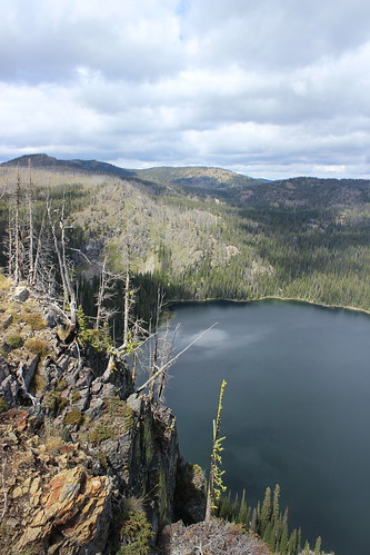
Big Lake, below Mosquito Peak in the Rattlesnake Wilderness

At about 11 1/2 miles, we veered northeast off the trail for a rougher route along the cliff edge, over a false summit and to 8,057-foot Mosquito Peak at about 12 miles. We stopped here to eat and take in the view of Big Lake, Little Lake and Glacier Lake below, and Point Six to the west, McLeod Peak to the north and Mineral Peak to the southeast.

Glacier Lake in the Rattlesnake Wilderness

After our break, we continued downhill to the northwest and back to Trail 517, then north slightly to the junction with Trail 502 above Glacier Lake at 12 3/4 miles. Here, we turned northeast on 502 and continued downhill past Glacier Lake, then stopped briefly at Little Lake. Back in the forest, we encountered too many downed trees over the trail as we switchbacked into the Wrangle Creek drainage.

Continuing east along the creek, we left the wilderness at about 18 miles near the confluence with Rattlesnake Creek. After crossing a concrete bridge over the creek where it cut down through bedrock, we rejoined the main Trail 515.

From there, it was about 14 miles back along the wide trail as it dropped to Franklin Bridge, then rose slightly beyond Poe meadow. After passing only two other people in the first 18 miles, we encountered several mountain bikers and hikers, then a full parking lot at the end.

In 7 hours and 45 minutes, we gained nearly 5,300 feet of elevation over more than 32 miles. Three weeks later at The Rut, we would need to double the gain and reach the 11,000-foot summit of Lone Peak in the same distance.

September 3, 2014

On the Stateline above Heart, Pearl lakes

heart_pearl_stateline_2014-08-17_126

I've lost count of the number of times we've been to Heart and Pearl lakes near Superior over the years, but one thing we had never done until recently was hike the portion of the Stateline Trail between the two.

We began by climbing Trail 171 south gradually along the east side of Trout Creek for about 2 miles, then switching back up the side of the valley and turning west to a junction at about 2 3/4 miles, crossing a few streams along the way.

At the junction, we continued west on switchbacks above Heart Lake into a high meadow that held the bare stalks of what must have been a beautiful beargrass bloom a month earlier. The trail then switchbacked up to the ridge that forms the border with Idaho and the junction with the Stateline Trail - Trail 738 - at about 4 1/3 miles. Here, we stopped to eat and saw the first of a handful of mountain goats in the distance along the rocky ridge.

heart_pearl_stateline_2014-08-17_101

The Stateline followed the ridge southeast, passing a rocky point at 4 3/4 miles and a chute still holding snow at 5 3/4, both providing views of the lakes below. Along the way, we found plenty of huckleberry bushes filled with juicy, tart fruit.

At about 6 miles, we left the Stateline at a junction with Trail 620 and dropped northeast to a saddle between Pearl and Dalton lakes. From there, we continued down Trail 175 and back west around Pearl Lake to its outlet at about 7 1/2 miles, then down again and north to the first junction below Heart Lake at 8 2/3 miles, letting the dogs swim multiple times along the way.

heart_pearl_stateline_2014-08-17_157

After that, we retraced Trail 171 back east and north 2 3/4 miles to our vehicle.

See more photos from Heart and Pearl lakes.

Distance: 11 1/2 mile loop.

Trailhead: From Superior, follow Diamond Match Road southeast and Trout Creek Road southwest - one turns into the other - for 19 miles.

August 27, 2014

Huckleberry bounty on a Blue Mountain run

Ran up to the Blue Mountain lookout, then climbed a few steps higher

Earlier this month, a couple of friends and I ran the length of the Blue Mountain National Recreation Trail - 20 miles round trip from the bottom of the recreation area to the lookout and observatory at the top.

We couldn't have timed it better with regard to western Montana's huckleberry season. A little below the 6,455-foot summit, we found ourselves surrounded by bushes bearing big purple berries.

From the main trailhead off Blue Mountain Road at the south end of Missoula, we started running west up Trail 3.01 at about 7 a.m. At about 2 1/2 miles, the route entered an area burned by the 2003 Black Mountain fire. For the next 4 1/2 miles, the trail switchbacked up among gray snags with little shade from the sun to a ridgeline.

A short distance past the ridge, greenery returned to the trees overhead, providing some relief from the heat. At about 8 1/4 miles, the trail crossed the road to the top of the mountain and re-entered the forest. Here, we found ourselves in the thick of the huckleberry bushes.

Ran up to the Blue Mountain lookout, then climbed a few steps higher

After a break to taste the fruit, we continued up the final switchbacks to the top of Blue Mountain, gaining about 3,600 feet of elevation over 10 miles. At the top, we climbed the steps up the underside of the lookout, took in the view of Lolo Peak and ate some food, then ran a short distance east to see the observatory.

As we backtracked down the mountain, we stopped at the huckleberry bushes again and filled a small plastic bag that I carried in my pack. Four hours and 45 minutes after starting, we were back at the trailhead.

At home the next morning, I turned the fruits of our labor into a pancake breakfast!

August 23, 2014

In Glacier Park, Fifty Mountain's majesty

fifty_mountain_2014-07-25_212

At the end of July, we made our annual trip north to Glacier National Park, and this year we took shuttling to its extreme.

In recent summers, we've become adept at using the park and private shuttle services to get to a trailhead, then spend a few days backpacking back to our vehicle. Usually, we'd board a shuttle in the morning and be on the trail within an hour or two.

This year, the only backcountry camping permits that were available for our preferred itineraries were at Goat Haunt and Fifty Mountain. After a short hike in the North Fork of the Flathead River drainage on the day of our arrival, we spent the entire second day of the trip in shuttles to Waterton Lakes National Park in Alberta and on a boat back to Goat Haunt in Glacier, the start of our trail, by dinner.

Still, while we're not likely to try that much shuttling again, we ended up in a fairly remote part of the park and enjoyed ourselves once on the trail. Standing in a field of glacier lilies above the Fifty Mountain campground at sunset, the view certainly lives up to the area's name.

Day 1: Howe Lake and Rocky Point
howe_lake_2014-07-22_039

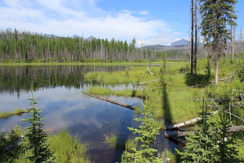
The day we arrived in Glacier, we secured our backcountry permit, set up our tent at the Fish Creek Campground, then drove northwest on the Inside North Fork Road to the Howe Lake trailhead.

From the road, the trail climbs gently through forest burned in the 2003 Robert fire for 2 miles. Today, new trees stand head high among the remaining gray snags.

Once at the small, quiet lake, the trail continues to Howe Ridge, above the western shore of Lake McDonald. We followed it hoping it would skirt the east shore of the lake, but turned around after about 1/2 mile.
rocky_point_2014-07-22_046

Later that evening, we walked the 2-mile Rocky Point nature loop from the campground, along the shore of Lake McDonald and back through the forest.

See more photos of Howe Lake and Rocky Point.

Distance: 5 miles round trip at Howe Lake; 2-mile loop to Rocky Point.

Trailhead: The Howe Lake trail begins about 5 1/2 miles northwest of the Fish Creek Campground on the Inside North Fork Road. The Rocky Point loop begins and ends in the campground.

Day 2: Shuttle to Goat Haunt
goat_haunt_2014-07-23_003

The second day of our trip was the most logistically challenging, needing to catch three shuttles to Waterton in time to board the last boat before border agents ended their day at Goat Haunt.

Waterton and Glacier make up an international peace park straddling the border with Canada, and Goat Haunt is the only location allowing trail access back to the United States. At this remote station, only U.S. and Canadian citizens with passports are allowed to cross south.

In the morning, we packed our vehicle and drove northeast on Going-to-the-Sun Road to The Loop, where we would be returning days later. From there, we boarded a free park shuttle and drove up the scenic road west to Logan Pass, on the Continental Divide. At the pass, we got off the west-side shuttle and on an east-side shuttle and continued down to St. Mary.

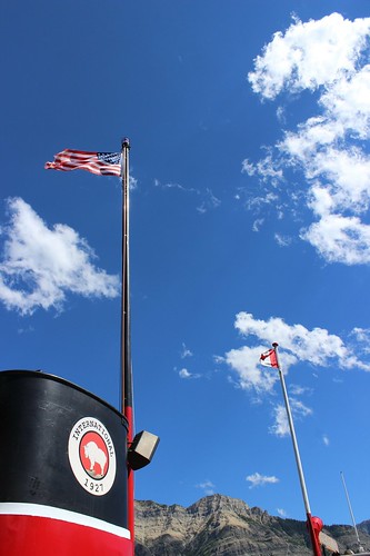
At St. Mary, we walked out of the park to the townsite and that afternoon took the paid Glacier Park Inc. East Side Shuttle to the Waterton visitor center near the Prince of Wales Hotel, crossing the border at Chief Mountain. From the visitor center, we walked to the dock on Upper Waterton Lake and bought tickets to take The International tour boat across to Goat Haunt. Before boarding the boat, we had enough time in the townsite to get a sandwich for lunch.
goat_haunt_2014-07-23_015

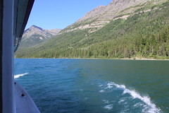
Aboard the 4 p.m. boat, we took a seat on the top deck and enjoyed the cruise south along the lake, viewing the logged swath and obelisks on each side marking the international boundary. Once off the boat, we walked a 1/4-mile path to the Goat Haunt ranger station and checked in with the border agents before returning to the camp adjacent to the dock.
goat_haunt_2014-07-23_074

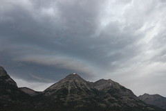
That night, storm clouds moved in - a preview of the weather in the forecast for the next day.

More photos from Goat Haunt are here.

Day 3: Waterton Valley Trail to Fifty Mountain
waterton_valley_2014-07-24_132

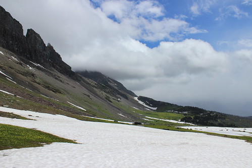
The first day of the backpacking portion of our trip, we woke to cloudy skies, and soon after eating breakfast and packing up at Goat Haunt it began to rain.

We've learned from past experience - Scotland, Olympic National Park, Glacier, Iceland - that a good rain coat, rain pants and pack cover make all the difference, so it didn't really faze us. Having checked in with the border agents the evening before, we set out south through the forested Waterton Valley.
waterton_valley_2014-07-24_018

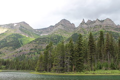
The first 6 miles were fairly uneventful - mostly hiking through the forest with little elevation gain, occasional creek crossings, and views of the mountaintops and the river. Occasionally, we got a break in the rain. At about 2 3/4 miles, we detoured west a little more than 1/3 of a mile and back to see Kootenai Lakes. At 5 miles, the trail over Stoney Indian Pass joined from the east.

The trail began its ascent toward the Continental Divide at a little more than 6 miles, switchbacking a couple of times before rising steeply to the southeast along a brushy mountainside. After turning east and switchbacking into and out of forest again, the trail reached its high point - a saddle above tree line at about 10 miles. Here, the clouds broke and we got our first real glimpse of the surrounding mountains.
waterton_valley_2014-07-24_077

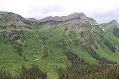
A little more than a mile downhill from the saddle, across snowfields and slightly into the forest, we reached the camp. It had started raining again, so we quickly set up our tent. After dinner and some card games, we called it a night.

Here are more photos from the Waterton Valley Trail.

Distance: About 11 3/4 miles one way, with detour to Kootenai Lakes.

Trailhead: Goat Haunt, reached by boat at the southern end of Upper Waterton Lake.

Day 4: Northern Highline Trail
north_highline_2014-07-25_050

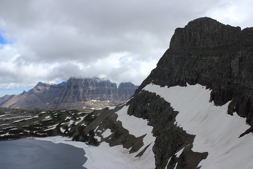
The next morning, I woke at sunrise - as is my habit when camping - and found the rain had stopped, but the sky was still filled with clouds. I wandered to the meadow above camp in time to see the first bright orange rays of daylight cresting Cathedral Peak.
fifty_mountain_2014-07-25_035

In the camp's food preparation area after others woke, we watched a grizzly sow forage on a ridge near the saddle we hiked over the previous day. While we heard the bear had a couple of cubs with her, we never saw them.

After briefly questioning whether we should hike back to The Loop early instead of staying for another day of rain, it became clear the clouds were lifting. As the multitude of surrounding mountains came into view, we set out southeast on the northern Highline Trail for the day.
north_highline_2014-07-25_031

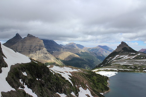
About 1 mile and one switchback above camp, we turned back northwest for a little more than 1/3 of a mile to the Sue Lake overlook. This notch in the ridge between Mount Kipp and Cathedral Peak provides views down to Sue Lake and over Pyramid Peak into the Mokowanis River drainage.
north_highline_2014-07-25_285

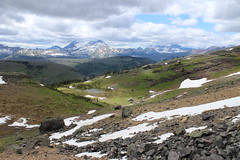
Back on the Highline, we continued southeast again, across rocky slopes and a handful of small snowfields into the Mineral Creek drainage. In the distance, we could see Swiftcurrent Mountain, the Garden Wall, the basin feeding Bird Woman Falls and Heavens Peak. About 2 1/2 miles from camp, we turned back.

That afternoon and evening, we relaxed by flying a kite and, after dinner, taking in sunset in the glacier lily-filled meadow.
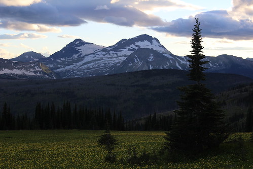
fifty_mountain_2014-07-25_230

See more photos from the northern Highline Trail.

Distance: About 5 3/4 miles round trip.

Trailhead: Fifty Mountain campground.

Day 5: Flattop Mountain Trail to The Loop
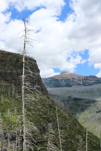
flattop_mountain_2014-07-26_171

On our final day in the backcountry, we ate breakfast and packed up under scattered clouds.

After leaving camp, we hiked downhill southwest to Kooteani Pass, a low spot on the Continental Divide, then briefly followed Kipp Creek before rising a short distance up Flattop Mountain at about 2 miles.
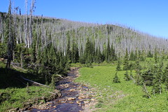
flattop_mountain_2014-07-26_023

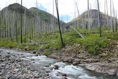
The trail south across Flattop continued, rising and dropping slightly along the way, through forests of gray snags left after the Trapper Creek fire of 2003. At about 4 1/2 miles, we passed a series of ponds in an unburned area, then dropped into the Flattop Creek drainage, where tall stalks of beargrass bloomed among more snags.

A little more than 6 miles along, we detoured less than a 1/4 mile to the Flattop campground for a break. Back on the main trail below the camp, we descended steeply along the creek, past several waterfalls. After a series of switchbacks and several snags that had fallen over the trail, we reached the valley floor at about 10 1/4 miles. Here, Swiftcurrent Mountain looms to the east and Heavens Peak to the west.
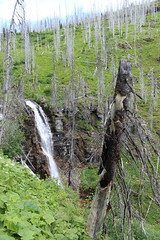
flattop_mountain_2014-07-26_123

A short distance later, we crossed Mineral Creek and continued about 1 2/3 miles southeast through the McDonald Creek Valley to a junction, then turned back northwest and hiked uphill toward The Loop. About 3/4 of a mile up, we reached the junction with the trail to Granite Park, turned southeast again and arrived at The Loop - and our vehicle - at 13 1/4 miles.
flattop_mountain_2014-07-26_202

Our feet weary from all of the downhill, we stopped along the Sun Road to soak them in McDonald Creek on the way home.

Here are more photos from the trail over Flattop Mountain.

Distance: 13 1/4 miles one way.

Trailhead: Fifty Mountain campground.
July 20, 2014

A smoky run up Stuart Peak

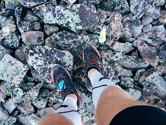
My feet atop Stuart Peak

Wildfire smoke filling the valley last week didn't deter a friend and I from getting out on a long run Saturday morning - in fact, an early start provided a short, clear window on our way up 7,971-foot Stuart Peak in the Rattlesnake Wilderness.

Looking up from the main Rattlesnake National Recreation Area trailhead we could see blue sky, but on the way down summer's heat and smoke from out-of-state fires set in.

We started out somewhat early following the main trail, Trail 515, north for 2/3 of a mile. From there, we followed the shadier Trail 517.1 up the east side of Spring Creek for about 1 2/3 miles, then crossed over to Trail 517 on the west side and continued. After the Wallman Trail veered off at about 3 miles, the trail began a steep section, reaching at junction with Trail 24.1 from the west at about 4 1/4 miles.

Rattlesnake Wilderness sign on the Stuart Peak trail

From the junction, we continued northeast on 517 up a couple of long stretches and a couple of series of switchbacks, the forest thinning and beargrass increasingly blooming as we rose. At 7 3/4 miles we reached the top of the switchbacks and the Rattlesnake Wilderness boundary. From there, we continued 1 1/4 miles on a flat to slightly uphill stretch to an overlook of Twin Lakes.

The final stretch followed a steep, rough trail along the ridgline to the southeast from Trail 517 about 1/2 mile to Stuart Peak, bringing our elevation gain to more than 4,200 feet. Most days, you can see south to Missoula and the Bitterroot Mountains or north across the wilderness to the Mission and Swan ranges. With the smoke however, we could see only the lakes below and other mountains in the immediate area.

Smoke and sun on my run up Stuart Peak

After stopping at the top for some photos and to eat, we backtracked to the trailhead, finding it hotter and smokier than when we left about 4 hours and 15 minutes earlier.


Beating the heat at 3 Bitterroot lakes

baker_lake_2014-07-13_100

To beat the heat last Sunday, we took the dogs on a hike to to a trio of lakes that lie just below 10,157-foot Trapper Peak, the highest in the Bitterroot Mountains. The trail to Baker, Middle and Gem lakes is short and steep, but worth the view.

baker_lake_2014-07-13_017

The trail begins uphill to the south of the parking area, then switchbacks steeply west to Boulder Point at a little less than half a mile. After a short section through the forest, the trail crosses a south-facing slope, descending slightly and passing through several open stretches filled with beargrass. The trail then climbs into the forest to Baker Creek, where fallen trees block the way. From here, it's easiest to walk uphill over the flat rock along the creek to the shore of Baker Lake at about 1 1/2 miles. Several campsites are available here, and Trapper Peak stands above the drainage to the west.

baker_lake_2014-07-13_034

Rounding the lake on either side - we went north, through a small boulder field - the trail continues along a marshy stretch of creek though the forest about another mile to Middle Lake, entering the Selway-Bitterroot Wilderness along the way.

baker_lake_2014-07-13_063

From Middle Lake, the trail stays north of the creek and rises steeply out of the forest onto more flat rock and along a cascade about 1/3 of a mile to Gem Lake. The clear pool of water sits with snow at its edge even in July, with the false summit of Trapper Peak directly above it to the west. The water was so cold, in fact, that the dogs opted not to swim at Gem.

After a short break - mostly spent swatting at mosquitoes - we made our way back downhill to the trailhead.

Here are more photos from Baker, Middle and Gem lakes.

Distance: 5 1/2 miles round trip.

Trailhead: From Darby, drive about 4 1/3 miles south on U.S. Highway 93 and turn onto West Fork Road. Follow West Fork Road south for 7 miles, then turn northwest onto Pierce Creek Road. (While this turn is listed as being signed in guidebooks and on websites, we found none; the road is adjacent to mile marker 7 and has fenced pastures on each side.) Drive uphill northwest through an intersection; at a second intersection about one mile up, continue northwest as directed by a sign 9 miles to the Baker Lake trailhead.

July 17, 2014

Sheep Mountain marathon before the marathon

My Missoula trail marathon today: Out Rattlesnake Creek, back over Sheep Mountain

Last Saturday - the day before the Missoula Marathon - a friend and I decided to run a marathon of our own up Rattlesnake Creek and back over Sheep Mountain and Blue Point.

The day was hot, so we started early, and after a few short side trips ended at 26 1/2 miles and nearly 5,100 feet of elevation gain.

My Missoula trail marathon today: Out Rattlesnake Creek, back over Sheep Mountain

From the main Rattlesnake National Recreation Area trailhead, we followed the wide Trail 515 for eight rolling miles to Franklin Bridge, stopping there to filter some water. A short distance up the hill from the bridge, we turned east on Trail 514 and climbed about 1 1/2 miles through the forest above the East Fork of the creek. When the trail reached another junction, we continued southeast downhill, still on 514, and crossed the creek, then climbed again through the forest thick with beargrass. At the next junction, a little more than 1 3/4 miles later, we continued southeast again a short distance until reaching Trail 513 between Sheep Mountain and Mineral Peak.

My Missoula trail marathon today: Out Rattlesnake Creek, back over Sheep Mountain

Turning west on 513, we followed the wide ridge southwest then switchbacked steeply up to the top of 7,646-foot Sheep Mountain at about 15 1/2 miles, where we took another break at a small stone-walled shelter. After eating and taking in the view, we continued about 3 3/4 miles along the open ridge over another small point, down below treeline and back up to the Blue Point junction. After a 1/2-mile out-and-back detour to the overlook, we returned to Trail 513 and followed the ridge down about 4 miles into Woods Gulch. After another brief stop to refill our packs with water, we continued west down to the trailhead and followed roads about a mile back to the main Rattlesnake trailhead.

After about six hot hours out we had our mountain marathon.

(Note: My GPS malfunctioned, resulting in all laps being recorded, but only half a map, so it isn't posted here.)

June 5, 2014

The run down to Bighorn

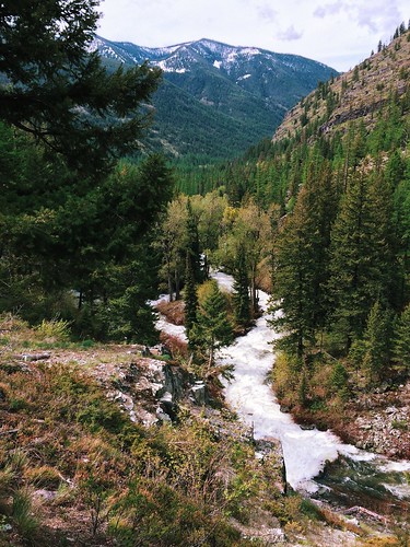
Rattlesnake Creek rapids through the forest

The taper has begun!

I've run my longest weekend - more than 54 miles, with a 31-mile Saturday and 23-mile Sunday - and longest week - 83 miles - and am in my last couple of weeks of preparation for the Bighorn Mountain Wild and Scenic 50-mile race.

A few statistics for Jan. 1 through June 1:

  • Number of runs: 96
  • Total miles: 1,123
  • Total elevation gain: 134,667 feet

In the middle of that period, I literally ran until my shoes fell apart - after more than 750 miles on that pair, the sole ripped in two places and peeled away during a race.

In the snow at Blue Mountain

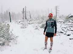
Missoula's particularly cold and snowy winter made for some challenging runs, even on roads. After a springlike weekend run through Hells Canyon on the Idaho-Oregon border in late March, I turned more to local mountains, but still managed to find lingering drifts and get caught in a late storm.

While the high-country snow is holding on, mountains around town have traded flakes for wildflowers. A friend and I even managed to get in a marathon over three of the city's iconic summits: Mount Sentinel/University Mountain, with the "M"; Mount Jumbo with the "L"; and the North Hills/Randolph Hill, with the peace sign.

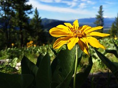
The hillsides of Mount Jumbo’s North Zone are alive with arrowhead balsamroot

If all goes according to plan, my long back-to-back weekend runs will be compressed into a single 50-miler through the Bighorn Mountains near Sheridan, Wyoming, on Saturday, June 21.