In October, we went up to the Seeley-Swan Valley and west to the Fish Creek area, where the larch trees were turning yellow. In November, I took one last walk up Mount Jumbo, in town, before it closed to the public for the season, then we went south in search of birds at Stevensville's Lee Metcalf National Wildlife Refuge.
Lake Elsina and Lake Dinah
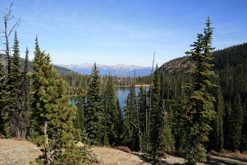
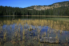
Lake Elsina and Lake Dinah sit in the Mission Mountains northwest of Seeley Lake and the end of this hike provides a beautiful view of the Swan Range to the east. We've been here several times over the years, and while it can be crowded at Lake Elsina we've only encountered a handful of people beyond.
The trail rounds the forested east side of Lake Esina, below, then climbs up through cliff bands. After leveling, it leaves the trees on a ledge above Lake Dinah with views of the Swan. The route ends by descending to the western shore of the Lake Dinah at 2.5 miles and a protrusion of land that would make an ideal campsite.
More photos from Lake Elsina and Lake Dinah are here.
Distance: 5 miles round trip.
Trailhead: To get to Lake Elsina, follow Montana Highway 83 about 4 3/4 miles north of Seeley Lake and turn west on Boy Scout Road. After about 3/4 of a mile more, turn north on Fawn Creek Road and follow the signs at several junctions for about 12 1/2 miles to the lake.
Burdette Creek
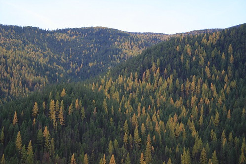
We'd only been out in the Fish Creek area west of Missoula one other time and were looking for an easy but new walk when we chose Burdette Creek. At the time we were there, the larch were golden and foliage lower to the ground was a palette of yellows, oranges and reds.
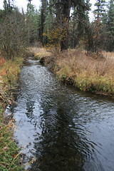
The trail begins by following an old road cut west and north, up and over a ridge behind private property, before dropping into the valley holding Burdette Creek. Shortly after reaching the bottom, the trail levels and crosses the creek at the 1 mile mark, then parallels it upstream to the north. Along the way, there are views of the creek and surrounding hills. We continued to a second creek crossing at 2.5 miles, then turned back.
A few more photos are here.
Distance: We hiked 5 miles round trip, but the trail continues.
Trailhead: To reach Burdette Creek, follow U.S. Highway 12 west of Lolo for 25 3/4 miles. Turn northwest on Fish Creek Road and follow it 9 miles to the trailhead. Fish Creek Road also can be accessed from Interstate 90 about 8 miles east of Alberton. The trailhead is then 22 miles south.
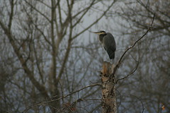
Lee Metcalf National Wildlife Refuge
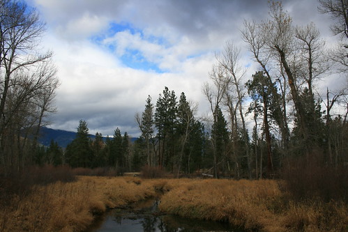
On the edge of Stevensville, Lee Metcalf National Wildlife Refuge is a good spot to watch birds in the Bitterroot Valley. There are a couple of miles worth of trail winding through tall cottonwoods along the east bank of the Bitterroot Valley. On our visit, we saw great blue herons, woodpeckers, kingfishers, a variety of waterfowl and more.
More Lee Metcalf photos are here.
Trailhead: The refuge's main trailhead is 1/3 mile east of Stevensville on the Eastside Highway, then 2 miles north on Wildfowl Lane.