October 5, 2011

Miles in Montana, beyond

Looking at the blog lately, it would appear we've been hiking more outside of Montana than in. The numbers bear that out as a whole, although Montana is the state with the most miles.

Here's our mileage and days on the trail by state since the start of May:
  • Montana: 37.3 miles over six days
  • Hawaii: 26 miles, three days
  • Oregon: 22.4 miles, three days
  • Utah: 15.8 miles, three days

Note that this also doesn't include dog walks and runs on trails near town.

Oregon's Cascades and coast

paradise_park_20110929_042

Last week, we returned to my home state of Oregon for a follow-up gathering to August's wedding and to visit friends who recently moved there. As usual, we took the opportunity to get out, hiking on the Oregon Coast and in the Cascade Mountains.

First up was a short trip to Hart's Cove at the Siuslaw National Forest's Cascade Head Scenic Research Area near Lincoln City, an easy drive west from our friends' house in Monmouth. We got a glimpse of the sun through the fog and took in crashing waves and a small waterfall that spills into the sea.

On the way back to Portland from Monmouth, we stopped by Silver Falls State Park in the low Cascades to walk the Trail of Ten Falls. It's similar to the Columbia River Gorge, with water flowing over basalt cliffs.

Finally, we took a day to drive up to Timberline Lodge on Mount Hood and hiked a section of the Timberline Trail/Pacific Crest Trail to Paradise Park. The path crosses the Zigzag Canyon to a wildflower-filled meadow that was still in bloom at the end of September.

Thanks go to PortlandHikers.org, which has helped us discover a couple of these and several other adventures in the area.

Oregon Coast: Hart's Cove

harts_cove_20110927_228

While visiting Monmouth, friends suggested going for a hike to Hart's Cove in the Coast Range near Lincoln City, which they had heard about. The next morning, three of us made the drive to the trailhead.

harts_cove_20110927_031

The trail begins by switchbacking down nearly 1,000 feet through a lush Sitka spruce and Western hemlock rainforest. At half a mile, it crosses Cliff Creek and continues generally north.

After crossing Chitwood Creek, the trail leaves the forest at an open headland at 2.7 miles, the destination. From the south side of the headland, the small Chitwood Falls can be seen dropping into Hart's Cove. A trail also leads closer to the water on the west side. All around, waves crash onto the steep, rocky coastline.

We had a bite to eat and played a game of cribbage while the morning fog cleared, then heard and saw sea lions offshore as we started the climb back to the trailhead.

harts_cove_20110927_137

See Hart's Cove photos here.

Distance: 5.4 miles round trip.

Trailhead: Turn west on the unsigned Forest Road 1861, about 8.75 miles north of Lincoln City on U.S. Highway 101, and follow it about four miles to the end.

Silver Falls State Park: Trail of Ten Falls

The Trail of Ten Falls at Silver Falls State Park, near Salem and Silverton, has a wonderful 8.7-mile trail through lush forest and along creeks that passes nine, 10 or 11 waterfalls along the way - depending on your definition of a waterfall. We broke up our drive back to Portland with a stop to hike. With photos of so many waterfalls, this trip seemed like a good candidate to try Storify's new slideshow feature. Follow along below.


More Silver Falls photos are here.

Mount Hood: Paradise Park

paradise_park_20110929_083

Jen had hiked on Mount Hood on a previous trip but had never been up to the historic Timberline Lodge, so we made a day trip of it from Portland. After a quick look in the hotel, we set out northwest on the Timberline Trail/Pacific Crest Trail.

paradise_park_20110929_129

The path passes behind the lodge and sets out under lifts on ski runs where I learned to downhill as a child. It crosses into the Mount Hood Wilderness and continues gently down through the forest and Little Zigzag Canyon, then past a trail junction. Along the way, the summit of Hood can be seen to the north, and Mount Jefferson and the Three Sisters to the south on clear days.

An overlook of the gaping Zigzag Canyon is reached at about 2.2 miles. Here, the view includes the rushing Zigzag River, the rocky Mississippi Head and above it Zigzag Glacier.

paradise_park_20110929_050

The trail then switchbacks steeply down through the trees for a mile to the river. Depending on the water level, the stream can be forded, or scramble across on rocks. Zigzag Falls can be seen a short distance upstream.

Not quite half a mile up out of the canyon, the trail reaches a junction with the 2.6-mile Paradise Park Loop. Here, we turned northeast and continued climbing out of the forest to the junction with the Paradise Park Trail at nearly 4.6 miles, where we found fields filled with blue lupine, purple asters, red paintbrushes and more.

paradise_park_20110929_065

A short distance above the junction, we stopped at a grassy overlook to take in the view, eat and fly a kite before backtracking to Timberline.

See pictures from Paradise Park here.

Distance: About 9.5 miles round trip. Paradise Park begins about 4.6 miles northwest of Timberline Lodge on Mount Hood, at the junction of the Paradise Park and Paradise Park Loop trails.

Trailhead: Behind Timberline Lodge, three-quarters of a mile east of Government Camp on U.S. Highway 26 and 5.3 miles northeast on Timberline Highway.

September 14, 2011

Island tri: Snorkeling, hiking, paddling Kauai

kalalau_20110901_221

After a busy August of work and hosting family and friends, we jetted to Hawaii for my brother's wedding on Kauai. We packed our backpacks and took the opportunity to explore some classic outdoors spots.

Before the wedding at Anini Beach, we checked out some colorful fish on a snorkeling outing. With equipment rented from a shop in Hanalei, seeing the sea life at Tunnels Beach was as easy as swimming into the mild surf from shore. The activity also allowed us to finally put Jen's underwater point-and-shoot camera to the test - we bought it a couple of years ago for a trip to Australia but never really dunked it. We spent a few hours with it in the saltwater, and it did a fine job on both photos and videos.

tunnels_20110828_029

After the wedding, we stayed around Hanalei for a handful of days for some post-family fun.

First was a three-day, two-night backpacking trip out the 11-mile Kalalau Trail on Kauai's famed Na Pali Coast. The trail was long, hot, humid and at times crowded, but the views - of the cliffs during the day and the sunsets and stars at night - were well worth it. On the middle day, we hiked upstream through the Kalalau Valley to a deep pool perfect for a swim then strolled out the beach. Read more about the trails below.

Back in Hanalei for our last full day on the island, we rented stand-up paddleboards and made our way up the calm river to the taro fields and down to the bay, where the surf picked up a bit.

From the wedding to the walking, it was a great vacation. Congratulations to the newlyweds, and thanks for the wonderful break!

Days 1 and 3: Kalalau Trail

kalalau_20110831_069

The Kalalau Trail is an 11-mile route along the dramatic fluted cliffs of Kauai's northern coast, beginning at Haena State Park and crossing into Na Pali Coast State Wilderness Park. Due to packing our bags at the wedding accommodations, last-minute shopping and taking a shuttle to the trailhead, we got a late-morning start on the trail.

The first couple of miles are on a wide, rocky path that climbs westward through shady vegetation then descends to a creek crossing and Hanakapi'ai Beach. It provides good views west along the Na Pali Coast, but is crowded.

kalalau_20110831_019

After crossing the first stream, the route switchbacks up out of the Hanakapi'ai Valley and leaves behind the crowd - except for the near constant buzz of helicopters in the sky above and procession of boats in the ocean below.

High above the water, the trail continues its westward traverse through thick vegetation, back into hanging valleys then out and around ridgelines that plunge to the water. Many of the ridges are accompanied by sets of switchbacks up and then down, adding elevation gain.

At six miles, the Hanakoa Valley and stream are reached. Here, there's a camp for backpackers not hiking the full 11 miles and a short trail - which we didn't take - that provides views of Hanakoa Falls, spilling from the mountains above. Running short on water, we filtered at a nearby creek then moved on.

kalalau_20110902_093

From Hanakoa, the trail continues into valleys and around ridges, but the land becomes drier and the vegetation more open. Soon, the trail reaches a rocky ravine that spills to the sea. After a short descent, to about 300 feet above the ocean, it rounds a narrow cliff called Crawler's Ledge - definitely not a place for a misstep.

kalalau_20110902_075

Beyond Crawler's Ledge, the traverse continues, with Kalalau Beach and the fluted cliffs above and beyond it coming into view. We reached this area in the late-afternoon heat and found our water running short, but pressed ahead.

After passing what appears to be a defunct camp, the trail makes a final climb around a ridge to the top of Red Hill, where the ground is rust colored and the view over the Kalalau Valley and beach is wide open.

Once down, the route crosses Kalalau Stream at 10.5 miles then a final hill before a straightaway to the camp and beach. As Jen filtered water again at the stream, I caught the sun setting before finding a suitable site for our tent under the trees just off a rocky part of the beach.

kalalau_20110902_011

Two days later, we had a much easier time on the way out due to a couple of changes. First, we started before 8 a.m., allowing us to get through the drier terrain in the morning hours. Second, we made a few more regular stops to filter water, no matter how much we had left, to ensure we had plenty to drink.

A few words about camping at Kalalau: Hawaii State Parks requires permits, which you can buy online and print at home. We met people who didn't have them and ours were never checked; nonetheless, we don't mind paying for management and preservation of special places. Unfortunately, while the trail is one of the most scenic we have hiked, the camps were some of the dirtiest we have seen and obviously the victims of years of abuse and/or neglect. Pack it in, pack it out, people. And don't get me started on the composting toilets.

More pictures from Kalalau Trail and beach are here and here.

Distance: 11 miles one way.

Trailhead: The Kalalau Trail begins at Haena State Park, about 7.25 miles west of Hanalei on Hawaii Highway 560, the Kuhio Highway.

Day 2: Kalalau Valley and beach

kalalau_20110901_079

The middle day of our backpacking trip was spent wandering around Kalalau.

That morning, we followed the end-of-valley trail upstream through the forest. Along the way we passed several cascades, stands of bamboo and old terraces where taro was once grown. The trail ends at a deep, cool pool, where we took a swim and ate a snack before returning to camp.

kalalau_20110901_115

Later in the day, we wandered a short distance up the beach past several sea caves - some of which people had set up camp in - at the base of the cliffs.

Distance: The end-of-valley trail is four miles round trip.

Trailhead: The end-of-the-valley trail begins just west of the Kalalau stream crossing, near Kalalau Beach.

August 2, 2011

Geography of Glacier's Triple Divide

In the previous post about our backpacking trip in Glacier National Park, I wrote about the hydrological rarity that is Triple Divide Peak. There, water flows to three major North American drainages: the Pacific, Atlantic and Hudson Bay. How rare is this feature? There are two others, one in Canada and one in Siberia.

Here's a map of Glacier's Triple Divide; click the markers for more information.


View Triple Divide Pass in a larger map

July 28, 2011

Glacier's Triple Divide Pass in three days

triple_divide_20110723_258

One of the biggest stories in Montana this spring and summer has been the deep snow left in the mountains from winter, and we encountered plenty on our anniversary trip to Glacier National Park.

This year, we wanted to camp in Glacier's backcountry again and had our sights set on a three-day 19.3-mile route from the Belly River in the northeast corner of the park south through Ptarmigan Tunnel to the Many Glacier area. Unfortunately, the opening date of the tunnel through Ptarmigan Wall was pushed back beyond our trip due to lingering snow. We also just missed the last available campsite on an alternate route over Red Gap Pass.

The night before we left, we settled on a three-day 23.5-mile route from Cut Bank on the park's east side west to Triple Divide Pass, then north to Red Eagle Lake and the town of St. Mary. Campsites were still available the night before we left Missoula, but only parts of the route were described in our hiking guide and the trail report said to be prepared for snow.

The next day, we drove north to the park and made the backcountry office in Apgar our first stop. Campsites were still open, so we secured a permit. All that was left was to cross the alpine Going-to-the-Sun Road - which was under construction and had its latest-ever opening due to snow - to the St. Mary area, where we had a frontcountry campsite reserved for the night. That afternoon, we took a short hike on St. Mary Lake, then had a restaurant dinner before heading to bed. In the morning, we woke early to leave the car at our exit point and catch a shuttle south.

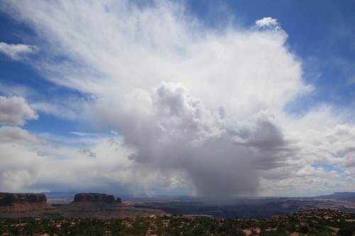
While rain fell most of the first day on the trail - fortunately, our shortest - we were rewarded with few clouds and a lot of sun for the longer second and third days. And while the campsites were full, we passed fewer than two dozen people on the trail the entire trip.

Day 1: Baring Creek to St. Mary Falls

st_mary_20110721_028

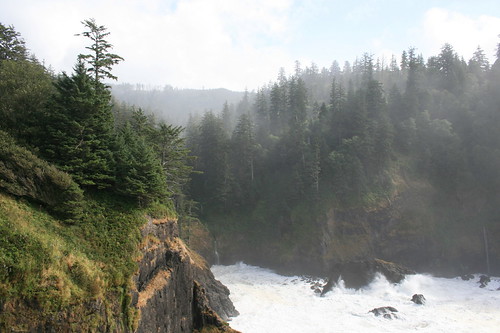
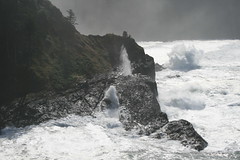
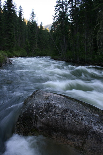
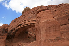
After driving up to Glacier from Missoula, we took this short hike around the northwestern side of St. Mary Lake to a couple of waterfalls. The skies looked stormy, but it never rained while we were on the trail.

From the trailhead near Sunrift Gorge, we hiked down Baring Creek to Baring Falls, along the edge of the lake and up to some cliffs, then into the forest to St. Mary Falls and a couple of other cascades.

st_mary_20110721_111

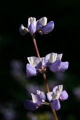
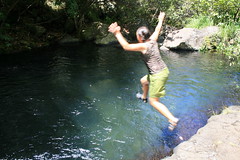
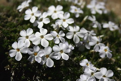
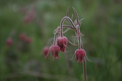
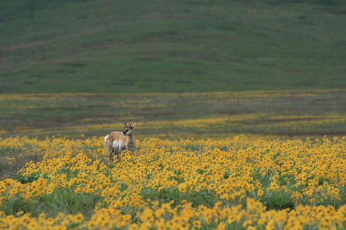
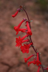
Along the way, we got our first glimpse of the park's abundant wildflowers and trailed a young deer for a short distance.

See more photos of the hike to St. Mary Falls here.

Distance: 4.2 miles round trip.

Trailhead: Sunrift Gorge parking area, about 10.5 miles west of St. Mary on Going-to-the-Sun Road.

Day 2: Cut Bank trailhead to Atlantic Creek

atlantic_creek_20110722_022

The next morning, we woke early and made our way to the stop for 
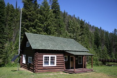
Glacier Park Inc.'s East Side Shuttle at the St. Mary Visitor Center. I parked at the nearby 1913 Ranger Station, where we would leave the trail, and returned for our pickup.

As we waited, we watched clouds move in and sheets of rain fall in the mountains where we would soon be backpacking. Luckily, I made an impulse purchase of pack covers a couple of days earlier that would turn out to be worth the money.

On this trip, getting to the trailhead was half the journey. The shuttle took us south from St. Mary, but would only drop us on the side of the highway five miles from the trail in the rain. We were prepared to walk up a dirt road to the trailhead, but lucked out when a couple of women who stopped to take pictures of horses in a field offered a ride instead.

The rain briefly let up at the trailhead, revealing a wildflower meadow and mountains through the clouds, but it soon set in again.

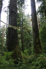
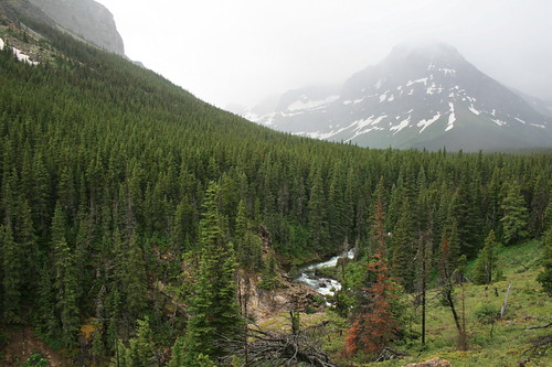
The hike roughly followed North Fork Cutbank Creek upstream in and out of the forest, and up a steep hill to the campground at Atlantic Creek. When we arrived, all that was dry was our packs and the parts of our bodies covered by rain gear - Jen had rain pants and a jacket, while I had only a jacket. (For me, the hike ranked among the top three wettest alongside the Costa Rican jungle and Olympic National Park; I wore rain pants in Scotland.)

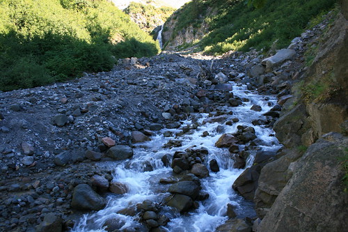
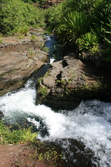
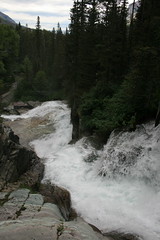
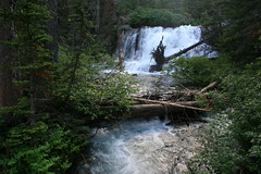
We pitched the tent on a site with good drainage and waited out the rain inside before dinner. After eating, the clouds broke and we took a short walk to Atlantic Falls.

atlantic_creek_20110722_055

More photos of the hike to the Atlantic Creek camp are here.

Distance: 4.3 miles one way.

Trailhead: 14 miles south of St. Mary on U.S. Highway 89 and five miles west on Cut Bank Creek Road.

Day 3: Atlantic Creek to Red Eagle Lake

triple_divide_20110723_278

The second day backpacking was our longest and hardest on the trail - and, thankfully, we had partly cloudy to clear skies.

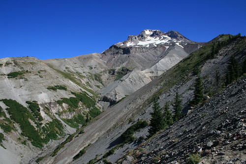
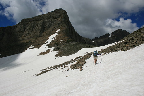
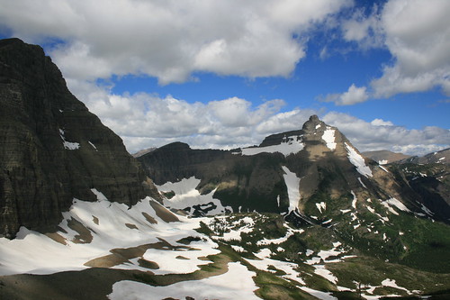
The trail started fairly level, but after a short distance turned uphill at a junction. From the junction, the trail climbs steadily along the southern side of Mount James for about 2.6 miles to Triple Divide Pass.

triple_divide_20110723_097

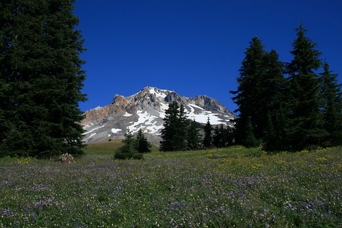
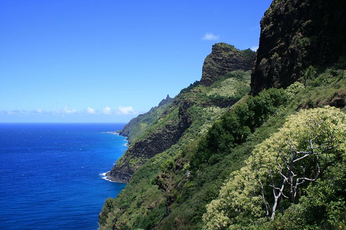
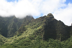
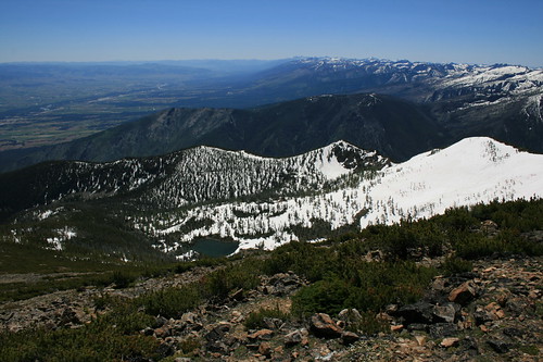
This section of trail was some of the most interesting of the trip. As it rose out of the trees, Medicine Grizzly Lake, Razoredge Mountain and Triple Divide Peak came into view, and alpine wildflowers grew from the rocks.

triple_divide_20110723_072

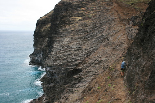
This is also where we began to encounter snowfields, short at first, then long on the final stretch to the pass. A couple of these fields provided extra interest. The bottom of one had melted enough to scramble under and cool off in the dripping snowmelt. Another had pulled away from the rock wall next to the trail enough to squeeze through with a pack.

triple_divide_20110723_269

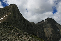
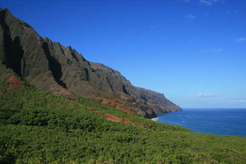
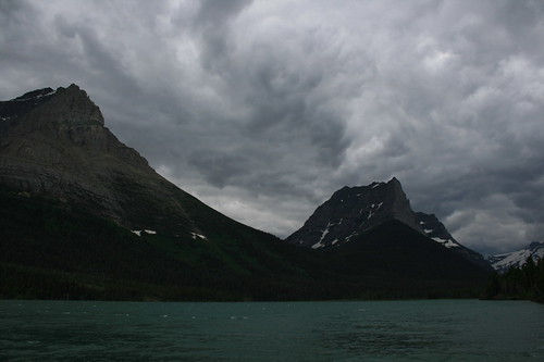
At the 7,397-foot pass, we took a break for food and pictures, and to understand the hydrologic rarity looming above: Triple Divide Peak, above left and at the top of the post. Situated on the Continental Divide, the mountain actually sends water falling on its summit to three different North American drainages. West of the peak, water flows to the Columbia River and the Pacific Ocean. To the east, it flows to the Atlantic via the Missouri and Mississippi rivers. And to the northeast, it ultimately flows to Hudson Bay.

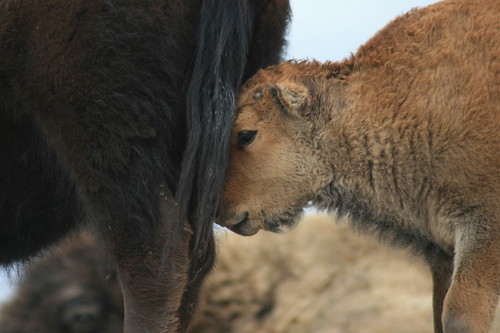
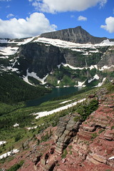
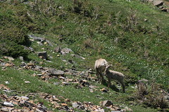
Only about three miles into our day at this point, we began down the Hudson Bay Creek drainage, crossing several more snow-covered switchbacks and passing a group of bighorn ewes and lambs.

triple_divide_20110723_315

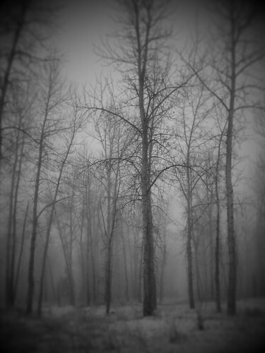
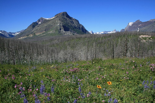
Shortly out of the snow, we forded a few creeks as we continued down the valley through shrubby meadows and forest. Soon, we reached forest burned by the 2006 Red Eagle fire, with silvery snags rising into the sky.

triple_divide_20110723_446

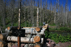
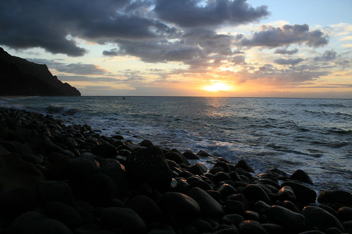
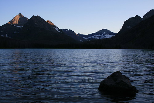
After reaching the valley bottom, we crossed Red Eagle Creek on two suspension bridges before rounding the southeastern side of Red Eagle Lake to our campsite above the shore, about eight miles from the pass. A clear night provided for a beautiful sunset and stars.

red_eagle_20110723_022

More photos of the route over Triple Divide Pass are here.

Distance: 11.6 miles one way.

Day 4: Red Eagle Lake to St. Mary

red_eagle_20110724_099

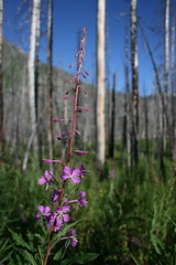
Our final day began by following the trail through rolling burned forestland - thick with soon-to-bloom fireweed - along Red Eagle Creek, crossing it two more times on suspension bridges.

red_eagle_20110724_037

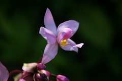
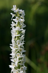
As we moved out of the old burn, meadows thick with wildflowers opened up and stands of aspens provided shade. Red paintbrush, blue lupine, golden blanketflower, white bog orchids and pink geraniums were abundant.

red_eagle_20110724_086

Past a beaver pond, we reached our car at the 1913 Ranger Station. Then it was back across the Sun Road and its construction zones to home.

See more photos of the Red Eagle Lake Trail here.

Distance: 7.6 miles one way.

Trailhead: 1913 Ranger Station, a short distance across Going-to-the-Sun Road from the St. Mary Visitor Center.

July 14, 2011

Snowy hike up St. Mary

st_mary_peak_20110709_127

After spending recent months recovering from leg injuries, we finally got out on our first real hike of the summer in western Montana last weekend.

(Over the winter, I developed very painful Achilles tendinitis in my left leg, and while recovering from that I overcompensated and developed less serious post-tibial tendinitis in my right leg. I've been working with a physical therapist on my running stride and hope to avoid recurrences.)

st_mary_peak_20110709_190

Jen recently declared her intention to hike up St. Mary Peak in the Bitterroot Mountains south of Missoula for the first time this summer. I've been up it before - once with each of the dogs - but she never has even though she's hiked steeper trails and to higher elevations. On Sunday, we set out early without the dogs and checked it off her list.

The day was beautiful - blue sky, not too hot on the mountain and a slight breeze - and the trail started out clear with abundant wildflowers off to the side. Through the first switchbacks, at about a mile, that changed as snow overtook the path. Though deep, it was firm and the route fairly obvious, so we continued. At one point, we did briefly lose the trail, but turned uphill until we found other tracks in the snow and followed them.

Eventually, the snow disappeared as the trail rose above treeline and revealed a sweeping view of the Bitterroot Valley. In the final mile, we crossed the rocky top of the mountain - which was covered in a variety of cushion plants - and one final patch of snow to the lookout at the top.

st_mary_peak_20110709_181

After lunch and some pictures, we started down for home, playing in the snow along the way.

More photos can be seen here.

Distance: 7.6 miles round trip.

Trailhead: From Missoula, drive about 25 miles south on U.S. Highway 93, past the Stevensville turnoff, and turn west on St. Mary's Road. Follow the signs about 11.6 miles up to the trailhead.

July 11, 2011

Far-away car camping in Idaho

selway_20110703_128

We decided to take a scenic drive and go car camping with the dogs over Fourth of July weekend.

Too busy to go both Saturday and Sunday nights, the question was, where would we find an available campsite on the second night? The answer: The Indian Creek campground along the Selway River deep in Idaho's forests.

The road to the campground is surrounded by wilderness - the Selway-Bitterroot to the north and the Frank Church-River of No Return to the south - and driving there takes about four hours from Missoula. In our time there, we only one other family camped nearby and we saw few other vehicles.

Getting there was something of an accomplishment for us. We have a brand-new SUV and have been reluctant to put the dogs in it. Gigi, in her mid-teens, has a thick coat and sheds constantly; 8-year-old Belle has never traveled well, getting anxiety attacks whenever she's in the car and drooling nonstop. (This was, by far, Belle's longest drive.) With plenty of covers to protect the interior and Belle tethered, we made the drive.

The campground sits next to a horsepacking trailhead where Indian Creek meets the Selway River. There's plenty of soothing sound from the rushing river as well as scenery to take in. A few trails leave from the area, but with Gigi too old for any real hiking, we mostly wandered and lazed during our stay.

selway_20110703_014

Considering all the water from this year's high snowpack, we were surprised that the mosquitoes weren't too bad. We all got some bites, but they really only bothered Belle, to the point that she tried to get in the tent on her own. She succeeded in getting between the ground cover and the floor of the tent. After some assistance, though, she was content inside.

selway_20110704_168

On the way home the next morning, we took a short side trip to the historic Magruder Ranger Station, which was closed but nonetheless in a nice setting.

See more photos here and here.

Directions: From Darby, drive 7.4 miles south on U.S. Highway 93, then turn southwest on the West Fork Road. After 11.3 miles, continue southwest on Nez Perce Road. After 16.1 miles, the road crosses into Idaho at Nez Perce Pass and becomes the Magruder Corridor Road. Turn north on Forest Road 6223 after 18.7 miles and continue 5.3 miles to the campground. This section of the Nez Perce/Magruder Corridor Road is a mixture of gravel and pavement.

May 23, 2011

Flora, fauna of the National Bison Range

bison_range_20110522_403

Spring has finally arrived in western Montana, bringing a bouquet of wildflowers and a bevy of wildlife to the Red Sleep Mountain Drive at the National Bison Range near Moiese.

What all did we see along the 19-mile scenic loop through the refuge?

bison_range_20110522_276

These flowers:
  • Arrowleaf balsamroot
  • Wild hyacinth
  • Prairie smoke
  • Prairie stars
  • Larkspur
  • Jacob's Ladder
  • Yellow paintbrush
  • Lupine

bison_range_20110522_107

These animals:
  • Bison, of course
  • Baby bison, of course
  • A black bear
  • Pronghorn antelope
  • Deer
  • Bluebirds
  • Meadowlarks
  • A pheasant
  • Red-winged blackbirds
  • Painted turtles

And more. Now is a great time to make the drive!

More photos from the National Bison Range are here.

bison_range_20110522_470

Distance: 19-mile loop drive. Near the top of the mountain, there are two short trails: the half-mile round-trip Bitterroot Trail and the 1-mile round-trip High Point Trail. There is also a mile-long nature trail near the range's picnic area.

Directions: From Missoula, drive 35 miles north on U.S. Highway 93 to Ravalli, then turn west on Highway 200. After about 6 miles, turn north on Highway 212 and drive about 4.5 miles to the entrance at Moiese.

To Utah, and to the trail

corona_arch_20110508_081

We recently returned from a weeklong vacation and visit to friends and family in Utah and Colorado, which also marked my return to hiking since injuring my Achilles tendon over the winter.

A brand-new car packed, we started our trip seeing friends in Salt Lake City and camping and hiking around Moab, Utah. The last time we were in Moab, flash floods drove us to a hotel and then out of the area - this time, we camped for a couple of nights, and found lodging for another. While there, we got into the redrocks in Arches and Canyonlands national parks and on some Bureau of Land Management land. In Canyonlands alone, I traveled about 10 miles of trail in a day - the most since my injury.

A snowy drive took us to Denver and more friends and family, then we traveled the long road home.

Below are the hikes we took in Utah.

Corona Arch

corona_arch_20110508_023

Corona Arch is the first hike Jen and I went on aside from walking our dog Gigi in the Missoula area.

After parking just off the highway, the trail ascends through the redrocks to the northeast, across a rail line, up a wash and then up a couple of ladders to a slickrock area at the base of cliff. Just before reaching the massive Corona Arch - with its 140-by-105-foot opening - Bow Tie Arch is perched high on the rock wall to the north.

Pictures from the Corona Arch trail are here.

Distance: 3 miles round trip.

Trailhead:On Utah Highway 279, 10 miles west of its junction with U.S. Highway 191 just northwest of Moab.

Arches National Park: Tower Arch

klondike_bluffs_20110509_082

Having hiked almost all of the established trails in Arches National Park, we decided to take a longer drive out the Salt Valley to the Klondike Bluffs and Tower Arch. The trail travels west up through the rocks, then down a valley and up again through redrock fins to the robust Tower Arch.

Photos from Arches are here.

Distance: 3.4 miles round trip.

Trailhead: From the park entrance northwest of Moab, travel about 12 miles north on the main road, five miles northwest past the Fiery Furnace area, then 8.3 miles south, northwest and south again to the Klondike Bluffs trailhead.

Canyonlands National Park: Neck Spring

neck_spring_20110510_110

A Canyonlands National Park ranger told us the Neck Spring trail would have an abundance of foliage due to its moisture, and she was right - plenty of desert wildflowers in spring.

After dropping down from the Island in the Sky mesa, the trail loops west then east through two spring areas. Water was trickling when we were there, but I wouldn't count on it in summer. The trail then climbs out of the canyon and onto slickrock, crosses the main park road in the area and returns to the start.

See photos from Canyonlands here.

Distance: 5.8-mile loop.

Trailhead: Travel about 11 miles northwest of Moab on U.S. Highway 191, then about 20.5 miles southwest and south on Utah Highway 313 to the Island in the Sky Visitor Center. The trailhead is 0.4 miles south of the visitor center.

Canyonlands: Murphy Point

murphy_point_20110510_016

The trail to Murphy Point has to be one of the straightest lines I've ever walked. From the main road, it travels southwest for 1.8 miles until it reaches Murphy Point - don't turn off for Murphy Hogback. The views extend south and west into canyon country.

See photos from Canyonlands here.

Distance: 3.6 miles round trip.

Trailhead: Travel about 11 miles northwest of Moab on U.S. Highway 191, then about 20.5 miles southwest and south on Utah Highway 313 to the Island in the Sky Visitor Center. The trailhead is 9.8 miles south of the visitor center.

April 10, 2011

Cleared to run

After more than 2 1/2 months on the mend for an Achilles injury, I appear to be in the clear for the most part.

I had a follow-up visit with the physical therapist a little more than a week ago that included a video analysis of my stride. Overall, my form is good, but I need to work on correcting the slight pronation of my right foot and bringing my pelvis forward some. I can still sense that there's a little less flexibility in my right Achilles, but that should work itself out over time.

The PT assigned me a new stretching routine that focuses on the pelvic area, which should also help with the pronation. Best of all, he gave me the go-ahead to increase my mileage by 10 percent whenever I feel comfortable.

I'm back up to three miles a day and just enjoying being on the move outside!

March 21, 2011

Step-by-step progress

Two months after injuring my Achilles tendon, I'm running again - albeit not far and not as fast.

It started with alternating walking and running for a mile on a treadmill for a week, then two miles. The first full mile I ran took 12 minutes, but felt great. Next, I increased the pace to a 10-minute mile.

On a sunny day a little more than a week ago, I ran a mile outside - finally, some fresh air and solid ground. Since then, I've doubled the distance to two miles and gotten back to a more normal pace of around eight minutes a mile.


At the end of this week, I check in with the physical therapist. To be sure, I have much further to go, but it's good to be moving again.

March 16, 2011

My recovery, in 140-charachter installments

This blog isn't the only place I've been chronicling my recovery from an Achilles tendon injury. I've been on the microblogging service Twitter for a while, and recently came across Storify, a new tool that lets users compile stories using tweets, blog posts, photos and other media. The result is below - and if you're interested, check back as I continue to update it.

February 28, 2011

Back inside, on the treadmill

I'm running again. OK, I'm alternating walking and jogging every couple of minutes for about a mile.

Four weeks after injuring my Achilles, the pain is gone. The tendon is still a bit tight, but it feels better every workout. I warm up with 10 minutes on an exercise bike, then switch to a treadmill. After more than a year of running outside rain, snow or shine, I'm back inside - in a storage room at the office with some fitness equipment and a sump pump. I went five miles in the past week.

Recovery is going to be slow, but I'm happy to be running again.

February 21, 2011

Achilles healing near home

tower_street_20110220_046

While I haven't been able to run, snowshoe or cross-country ski due to injury lately, I have been getting out on my usual morning walks with the dogs.

We've been taking it easy to give my Achilles tendon time to heal and hiking the short, level trails at the Tower Street Conservation Area on the edge of Missoula. It's not far from home and there isn't much to it - stands of cottonwood trees along the Clark Fork River - but it has been interesting to see through the winter.

Earlier this season, the river fully froze over and produced a big ice jam. When the water reaches the right temperature, slushy frazil ice forms and gathers in eddies along the river. And there's been a good variety of birds, including pileated woodpeckers, above, great blue herons, bald eagles and Canada geese, below.

tower_street_20110220_017

See a collection of photos from the past month here.

Trailhead: A little more than 1 mile west of South Reserve Street on South Third Street West in Missoula, then about a quarter-mile north on Tower Street.

Distance: There are a variety of trails; the main loop through the cottonwoods, along the river and back to the parking lot is about three-quarters of a mile.

February 7, 2011

New view at Hike MT

With a little downtime from running and cross-country skiing, I decided to give Hike MT a new look. This is only a stock Blogger template, but a bit more modern. And I've learned how to manipulate the background image, which I'll probably change from time to time depending on the season or where we've been.

A run of bad luck?

I had been debating whether I wanted to run a marathon or a series of half-marathons this year - there are interesting road and trail races around Missoula in every season. Now, it looks like I'll be focusing on getting back on my feet after a month of irregular activity and setbacks.

I finished December with a short family vacation sans running in the Yellowstone National Park area, then caught an out-of-the-ordinary cold, then Missoula was coated by freezing rain, then I ran into a minor complication with blood pressure medication.

Just when I was getting into my routine again, I injured my Achilles tendon. Around mile eight of a 13-mile run into the North Hills a week ago Saturday (below), I started to feel a little sore. I kept running, when in hindsight I probably should have walked the shortest route home. I stretched afterward, which felt OK. Later, pain set in. Sunday was worse. By Tuesday, the soreness had subsided some, but I was at the physical therapist.


I'd like to chalk it up to an increase this winter in running on snow- and ice-packed trails with uneven footing when I previously stuck to roads in the cold months, but I don't really know the cause.

I do know that an Achilles injury should be taken seriously and addressed as soon as possible. The PT put me on some specific stretches and the bike machine in my living room. It's not the North Hills, but I'm still moving. (Cross-country skiing is out, too.)

The first half-marathon of the year - the Snow Joke in Seeley Lake - is out, but I hope to be ready for some other races, or even a full, by summer. We'll see, though.

January 28, 2011

Photography fun on the go

tower_street_20110127_001

Jen and I both recently bought smartphones with decent cameras and have been putting them to use in our travels and everyday life.

You won't usually see the snapshots we take with them among the photos from our adventures, but you can find them online. My Twitpic collection is here, and Jen's is here. I've also started to use Picplz, which has some creative filters. The photo above is an example, from a foggy day at one our favorite dog-walking haunts.

As always, you can find galleries of our hiking and travel photos here, and my Flickr stream here.