Showing posts with label Running. Show all posts

January 2, 2015

A big, busy year of running in 2014

Start here, run up there, then back

Farther, higher, faster and harder pretty well define my year of running.

I started the year with an advanced marathon training class and found myself running at a Boston-qualifying pace that would have had me finishing about 45 minutes faster than my personal best.

While I didn't run an official marathon last year, I did finish two ultras, a couple of shorter trail races and several long training runs. Among them:


In all, I logged about 2,423 miles on my GPS in 2014 - with Bighorn at 52 miles and 6,500 feet of gain and The Rut at 32 miles and 11,000 feet topping the list.

Both were enjoyable experiences, and I plan to run them again this year.

Here's a slideshow of photos from this year's runs - and a link to a Rut video in which I briefly appear. (Look for the red hat at the Tram Dock aid station.)


A big thank-you to the friends with who were with me for many of last year's miles and Missoula's supportive running community!

October 26, 2014

Running to new heights at The Rut

Over Lone Peak

After starting summer with my longest run to date, I finished the season with my highest and hardest run: 
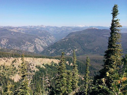
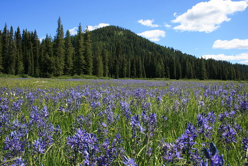
The Rut 50K, with 11,000 feet of elevation gain over the 11,166-foot summit of Lone Peak.

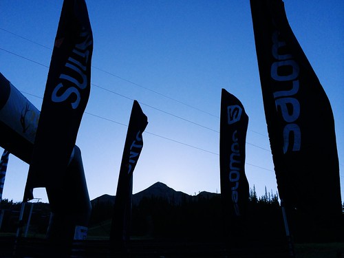
Organized by Missoula's Runner's Edge store, the race took place in mid-September at Big Sky Resort, between Bozeman and Yellowstone National Park. Being the final ultramarathon in the 2014 Skyrunner World Series, some of the biggest names in the sport were there: Kilian Jornet, Sage Canaday, Emelie Forsberg, Kasie Enman and others.  (I can now add "skyrunner" to my bio, apparently; for a primer, see this Trail Runner magazine article and video.)

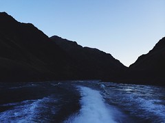
We arrived the day before the 50K and settled into the condo we rented before visiting with friends at the start/finish area, attending my race meeting and Jen's aid station meeting, then eating dinner. On the way back to the condo to go to bed, I noticed the light atop Lone Peak appeared as if it were a star.

Start here, run up there, then back

Early the next morning, we walked to the start and Jen departed with her aid station crew. After watching the first wave of runners get underway at 6 a.m., it was my turn five minutes later.

Starting to a pre-dawn elk bugle, the second wave of streaming headlamps made its way gradually uphill. I soon found myself among a handful of familiar voices in as we slowly made our way uphill in a line. At the top of the first climb near 2 miles, the sun had risen enough to see the footing.

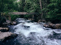
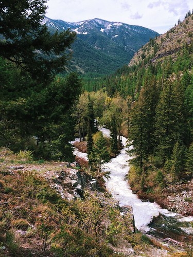
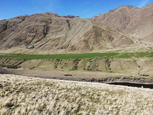
The next 5 1/2 miles were downhill to the Madison Village, eventually running on trails and ramps between rows of houses. Turning uphill again, the course steadily rose for 5 miles past the first aid station at 7 1/2 miles and into the forest.

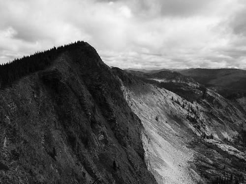
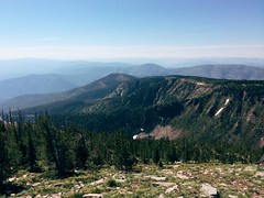
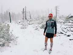
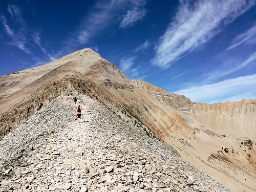
After another couple of short downhill stretches, I left the trees at about 14 miles and arrived at the first major climb for the day: Headwaters Ridge. Here, the course left the trail and scrambled steeply up the scree, rising a little more than 1,000 feet in a little less than 3/4 mile. At the top, a quick descent using a via ferrata line led to the narrow ridgeline and a fast run down 1,700 feet over 1 1/2 miles and into the forest. A couple of patches of snow left from a storm earlier in the week clung to the rocks, and careful footing was required as a misstep could send you tumbling downhill.

Follow the little yellow flags

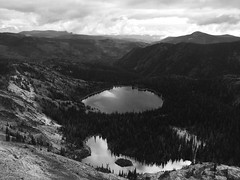
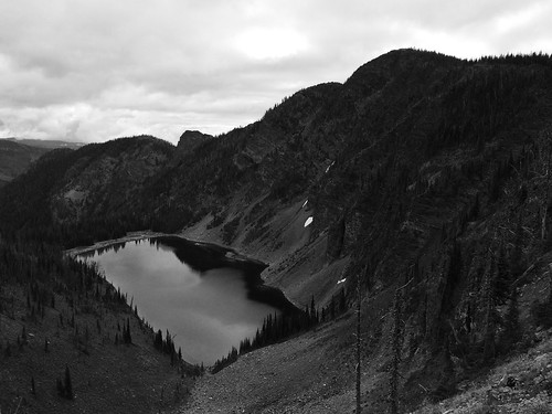
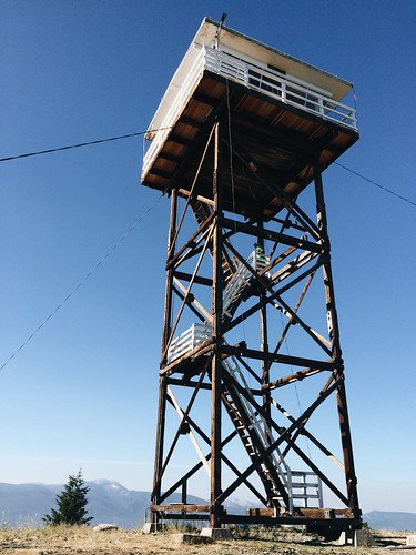
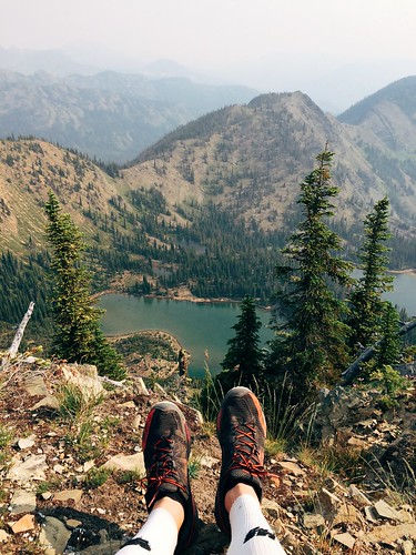
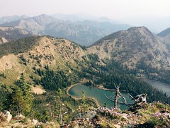
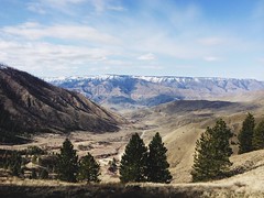
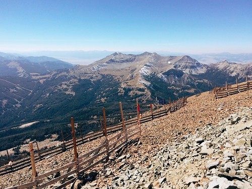
Over then next 2 miles, the course climbed again into a sun-baked basin where the 18-mile aid station sat at the Lone Peak tram dock. Here, a small crew of Missoulians - including Jen - helped with drop bags, food and fluids. After refilling my hydration pack and eating some, I headed toward the start of Bonecrusher Ridge. In the end, Jen and the others would make it to the finish line before me.

A mile back down from the tram dock then slightly uphill, the course turned onto Bonecrusher Ridge, the highest climb of the day. In about 1 1/3 miles, the trail climbed 2,000 feet out of the trees and up the hot, rocky ridge - the tram dock directly below a nearly vertical drop to the side. On the steepest section near the top, it wasn't unusual to be on all fours in places. At the summit, it was nice to take another short break at the aid station to eat and catch my breath before continuing.

The view from the top of 11,000-foot Lone Peak

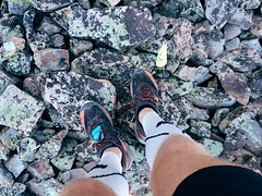
The 2,500-foot descent over the next 1 3/4 miles was the roughest part of the race on my the feet as the course took us over plate-sized slabs of rock that would shift underfoot on occasion. At the bottom, I stopped briefly to empty my shoes of gravel as well.

Back in the trees, the trail rain along the border of Big Sky Resort and the exclusive Yellowstone Club, dropping for a mile then climbing almost half a mile past one of the large homes. After two more miles of downhill, the course reached thicker forest and a 1-mile climb up muddy trails and over mountain bike ramps, occasionally aided by ropes. Near 27 1/2 miles, the trail reached the final aid station.

From there, the last 4 1/2 miles of the course were mostly downhill, crossing ski slopes, then rising slightly through the forest again. After passing behind one of the resort's large hotels, I arrived at the finish, covering about 32 miles in 9 hours.


A few post-race notes:

Slowest mile: Mile 21, with 1,424 feet of elevation gain, took 50:13. It also likely included some time at the Lone Peak aid station.

Fastest mile: Mile 4 - in the first downhill section - took 8:32.

Food: The spread wasn't as expansive as at the Bighorn Mountain Wild and Scenic Trail Run (see notes), but the mini dill pickles atop Lone Peak were delicious.

They meant well: As a spectator, what you say might not be interpreted how you intend. "You're almost there - just around the corner," said one spectator. To me, those words of encouragement indicate the finish is nearby, not a ridge called Bonecrusher. "Just eight little hills to go," said another spectator in the last couple of miles. Nothing was "little" at that point.

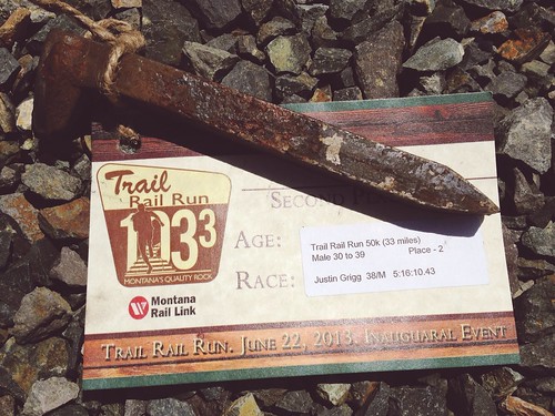
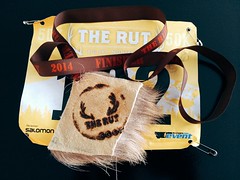
The "medal": This being The Rut, the elk hide finisher's "medal" was a unique touch - just have to keep my dog from getting it.

Elk hide, of course - it's The Rut

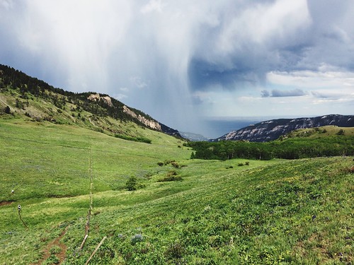
All in all, it was a great experience - and a fun way to start a weeklong vacation to Yellowstone National Park. And while it was a difficult race, I'll probably return!

October 11, 2014

Late-summer loop to Rattlesnake's Mosquito Peak

Mosquito Peak in the Rattlesnake Wilderness

Back in August, a friend and I set out early one morning on what would be our final long run before The Rut 50K, a 32-mile loop to Mosquito Peak in the Rattlesnake Wilderness.

The route took us up the Spring Gulch and down Rattlesnake Creek - trails we had covered earlier in the summer - linking them with the Wrangle Creek drainage. We had never been beyond Stuart Peak in the wilderness and were there on a smoky morning earlier in the summer; despite clouds overhead, we were rewarded this time with better views of the surrounding peaks.

Starting from the main trailhead for the Rattlesnake National Recreation Area, we followed Trail 515 half a mile north then turned up Spring Gulch on Trail 517. We followed this trail north as it rose above Spring Creek and switchbacked to the wilderness boundary at about 7 3/4 miles. From there, we continued as the trail steadily rose and fell on and alongside the ridgeline, past the Twin Lakes below Stuart Peak, then McKinley Lake and Worden Lake.

Big Lake, below Mosquito Peak in the Rattlesnake Wilderness

At about 11 1/2 miles, we veered northeast off the trail for a rougher route along the cliff edge, over a false summit and to 8,057-foot Mosquito Peak at about 12 miles. We stopped here to eat and take in the view of Big Lake, Little Lake and Glacier Lake below, and Point Six to the west, McLeod Peak to the north and Mineral Peak to the southeast.

Glacier Lake in the Rattlesnake Wilderness

After our break, we continued downhill to the northwest and back to Trail 517, then north slightly to the junction with Trail 502 above Glacier Lake at 12 3/4 miles. Here, we turned northeast on 502 and continued downhill past Glacier Lake, then stopped briefly at Little Lake. Back in the forest, we encountered too many downed trees over the trail as we switchbacked into the Wrangle Creek drainage.

Continuing east along the creek, we left the wilderness at about 18 miles near the confluence with Rattlesnake Creek. After crossing a concrete bridge over the creek where it cut down through bedrock, we rejoined the main Trail 515.

From there, it was about 14 miles back along the wide trail as it dropped to Franklin Bridge, then rose slightly beyond Poe meadow. After passing only two other people in the first 18 miles, we encountered several mountain bikers and hikers, then a full parking lot at the end.

In 7 hours and 45 minutes, we gained nearly 5,300 feet of elevation over more than 32 miles. Three weeks later at The Rut, we would need to double the gain and reach the 11,000-foot summit of Lone Peak in the same distance.

August 27, 2014

Huckleberry bounty on a Blue Mountain run

Ran up to the Blue Mountain lookout, then climbed a few steps higher

Earlier this month, a couple of friends and I ran the length of the Blue Mountain National Recreation Trail - 20 miles round trip from the bottom of the recreation area to the lookout and observatory at the top.

We couldn't have timed it better with regard to western Montana's huckleberry season. A little below the 6,455-foot summit, we found ourselves surrounded by bushes bearing big purple berries.

From the main trailhead off Blue Mountain Road at the south end of Missoula, we started running west up Trail 3.01 at about 7 a.m. At about 2 1/2 miles, the route entered an area burned by the 2003 Black Mountain fire. For the next 4 1/2 miles, the trail switchbacked up among gray snags with little shade from the sun to a ridgeline.

A short distance past the ridge, greenery returned to the trees overhead, providing some relief from the heat. At about 8 1/4 miles, the trail crossed the road to the top of the mountain and re-entered the forest. Here, we found ourselves in the thick of the huckleberry bushes.

Ran up to the Blue Mountain lookout, then climbed a few steps higher

After a break to taste the fruit, we continued up the final switchbacks to the top of Blue Mountain, gaining about 3,600 feet of elevation over 10 miles. At the top, we climbed the steps up the underside of the lookout, took in the view of Lolo Peak and ate some food, then ran a short distance east to see the observatory.

As we backtracked down the mountain, we stopped at the huckleberry bushes again and filled a small plastic bag that I carried in my pack. Four hours and 45 minutes after starting, we were back at the trailhead.

At home the next morning, I turned the fruits of our labor into a pancake breakfast!

July 20, 2014

A smoky run up Stuart Peak

My feet atop Stuart Peak

Wildfire smoke filling the valley last week didn't deter a friend and I from getting out on a long run Saturday morning - in fact, an early start provided a short, clear window on our way up 7,971-foot Stuart Peak in the Rattlesnake Wilderness.

Looking up from the main Rattlesnake National Recreation Area trailhead we could see blue sky, but on the way down summer's heat and smoke from out-of-state fires set in.

We started out somewhat early following the main trail, Trail 515, north for 2/3 of a mile. From there, we followed the shadier Trail 517.1 up the east side of Spring Creek for about 1 2/3 miles, then crossed over to Trail 517 on the west side and continued. After the Wallman Trail veered off at about 3 miles, the trail began a steep section, reaching at junction with Trail 24.1 from the west at about 4 1/4 miles.

Rattlesnake Wilderness sign on the Stuart Peak trail

From the junction, we continued northeast on 517 up a couple of long stretches and a couple of series of switchbacks, the forest thinning and beargrass increasingly blooming as we rose. At 7 3/4 miles we reached the top of the switchbacks and the Rattlesnake Wilderness boundary. From there, we continued 1 1/4 miles on a flat to slightly uphill stretch to an overlook of Twin Lakes.

The final stretch followed a steep, rough trail along the ridgline to the southeast from Trail 517 about 1/2 mile to Stuart Peak, bringing our elevation gain to more than 4,200 feet. Most days, you can see south to Missoula and the Bitterroot Mountains or north across the wilderness to the Mission and Swan ranges. With the smoke however, we could see only the lakes below and other mountains in the immediate area.

Smoke and sun on my run up Stuart Peak

After stopping at the top for some photos and to eat, we backtracked to the trailhead, finding it hotter and smokier than when we left about 4 hours and 15 minutes earlier.


July 17, 2014

Sheep Mountain marathon before the marathon

My Missoula trail marathon today: Out Rattlesnake Creek, back over Sheep Mountain

Last Saturday - the day before the Missoula Marathon - a friend and I decided to run a marathon of our own up Rattlesnake Creek and back over Sheep Mountain and Blue Point.

The day was hot, so we started early, and after a few short side trips ended at 26 1/2 miles and nearly 5,100 feet of elevation gain.

My Missoula trail marathon today: Out Rattlesnake Creek, back over Sheep Mountain

From the main Rattlesnake National Recreation Area trailhead, we followed the wide Trail 515 for eight rolling miles to Franklin Bridge, stopping there to filter some water. A short distance up the hill from the bridge, we turned east on Trail 514 and climbed about 1 1/2 miles through the forest above the East Fork of the creek. When the trail reached another junction, we continued southeast downhill, still on 514, and crossed the creek, then climbed again through the forest thick with beargrass. At the next junction, a little more than 1 3/4 miles later, we continued southeast again a short distance until reaching Trail 513 between Sheep Mountain and Mineral Peak.

My Missoula trail marathon today: Out Rattlesnake Creek, back over Sheep Mountain

Turning west on 513, we followed the wide ridge southwest then switchbacked steeply up to the top of 7,646-foot Sheep Mountain at about 15 1/2 miles, where we took another break at a small stone-walled shelter. After eating and taking in the view, we continued about 3 3/4 miles along the open ridge over another small point, down below treeline and back up to the Blue Point junction. After a 1/2-mile out-and-back detour to the overlook, we returned to Trail 513 and followed the ridge down about 4 miles into Woods Gulch. After another brief stop to refill our packs with water, we continued west down to the trailhead and followed roads about a mile back to the main Rattlesnake trailhead.

After about six hot hours out we had our mountain marathon.

(Note: My GPS malfunctioned, resulting in all laps being recorded, but only half a map, so it isn't posted here.)

June 29, 2014

50 miles of muddy running in the Bighorns

Remnants of a lightning storm that struck on The Haul at the Bighorn Mountain Trail Run

Mud and snow. Sun. Sweat. Thunder, lighting and rain. More mud. Oh, and a lot of junk food.

That about sums up my first 50-mile ultramarathon, the Bighorn Mountain Wild and Scenic Trail Run last weekend in Wyoming. Sure, it was difficult - but it was fun and I'd do it again.

After a couple of months of preparation - and a stop at Bighorn Canyon National Recreation Area with Jen - I woke early and drove with friends to the Jaws Trailhead near 8,800 feet in the Bighorn Mountains west of Dayton before sunrise. It was in the high 30s - not as cold as anticipated - so I didn't bother with gloves or a warm hat.

Sunrise at the start of the Bighorn Mountain Trail Run

At first light, and after a brief moose sighting at the trailhead, we were off, starting out on singletrack through forest and meadows, with plenty of mud and short stretches of snow. After about five miles, the terrain was mostly open, descending through grassy slopes and the occasional stand of trees, and crossing several streams. I had to take care not to start too fast as I have done in other races - there was a long day ahead. The canyon closed in around the Little Bighorn River and we returned to the forest before reaching the Footbridge checkpoint at about 18 miles.

After eating, changing my socks and grabbing my trekking poles from a drop bag at Footbrige, I made my way up The Wall, rising from about 4,800 feet to 6,300 feet in three miles. The going was slow, and clearings along the way provided opportunities for brief stops to take in the view of the Little Bighorn drainage below and the surrounding cliffs. Above the Dry Fork of the Little Bighorn, the singletrack continued up and down through forest and meadows for about seven miles. As the day warmed, the trail turned to a double track and opened up, climbing again to the Dry Fork checkpoint at about 34 miles and 7,600 feet.

A meal, sock change and pole drop later, I continued from Dry Fork back up to about 7,900 feet then down the Sheep Creek drainage. Here, the trail returned to singletrack and the last real ascent, a few hundred feet up The Haul at 7,600 feet. On The Haul, clouds moved in, rain fell, and thunder and lighting struck overhead - disconcerting when you're on an open pass, but also cooling in the hot afternoon. Unfortunately, the rain turned the trail to mud again, which stuck to my shoes and made it feel as if I were wearing bricks.

About five steep miles down through open meadows, the singletrack trail reaches forest again and continues along the Tongue River for a couple of miles to a trailhead at the end of Tongue Canyon Road. There, family, friends and others are allowed to follow runners, and Jen arrived on her bike with perfect timing while I was at the final aid station. She rode around me for a bit, falling back and going ahead to take some pictures.

Five more miles brought me back to Dayton and the finish in a park along the river at about 3,900 feet. After passing an encampment of people under a Run Wild Missoula tent on the final stretch, I crossed the line at about 52 miles in 11 hours 33 minutes and 42 seconds, 39th out of 117 runners. Ten feet beyond, I cooled off for a few minutes by sitting in the river.


In the days that followed, I had a few realizations - random and revealed by the information from my GPS:

At the aid stations, I ate a lot more food than during training, some healthy and some I haven't had in at least a decade. In addition to the water and gels I carried and consumed on the trail, here's what I remember eating and drinking:

  • Orange slices (usual favorite)
  • Watermelon slices (perhaps new favorite)
  • Pineapple slices
  • A plum
  • Red grapes
  • Almond-pistachio-dried cherry mix 
  • Green olives with pimentos (surprisingly good)
  • A peanut butter cookie (probably had sometime in the past decade, but don't remember when)
  • Cheez-Its (probably had sometime in the past decade, but don't remember when)
  • Cheetos (don't know the last time had)
  • Fritos (don't know the last time had)
  • Ruffles (probably had sometime in the past decade, but don't remember when)
  • Hummus, vegetarian "pepperoni," sriracha and tortilla wraps (homemade training food packed in drop bags)
  • An American cheese, yellow mustard and tortilla wrap (I like mustard)
  • An American cheese and tortilla wrap (different aid station; out of mustard)
  • A slice of mushroom and spinach pizza (wary of melted cheese, but so good)
  • Heed
  • Sprite (don't know the last time had)
  • 7-Up (don't know the last time had)
  • Ginger ale (probably had sometime in the past decade, but don't remember when)
  • A green apple freeze pop (while running with a couple of miles to go; don't know the last time had, but perfect)

While I feel like I hiked more of the uphill stretches than I did during training, I had less non-moving time than on those same runs. On my longest training runs - 26 and 31 miles - I had about and hour of non-moving time, compared with about 45 minutes during the 52-mile race.

My fastest mile was the last mile, at about 8:45. I had been told the last stretch of road was a grueling march for many, but vowed I would only walk a couple of small hills on it.

And, most of all, Missoula's enthusiastic and supportive running community was reinforced with the large, loud crowd under the Run Wild tent at the end.

On the way home, Jen and I took a couple of days to drive through Yellowstone National Park, so you'll likely see some pictures here. And back in Missoula, I removed the dried clumps of mud from my shoes, socks and compression sleeves using the garden hose with the nozzle on the "jet" setting.

I'm already on the run again and need to start thinking about The Rut 50K in September.

June 5, 2014

The run down to Bighorn

Rattlesnake Creek rapids through the forest

The taper has begun!

I've run my longest weekend - more than 54 miles, with a 31-mile Saturday and 23-mile Sunday - and longest week - 83 miles - and am in my last couple of weeks of preparation for the Bighorn Mountain Wild and Scenic 50-mile race.

A few statistics for Jan. 1 through June 1:

  • Number of runs: 96
  • Total miles: 1,123
  • Total elevation gain: 134,667 feet

In the middle of that period, I literally ran until my shoes fell apart - after more than 750 miles on that pair, the sole ripped in two places and peeled away during a race.

In the snow at Blue Mountain

Missoula's particularly cold and snowy winter made for some challenging runs, even on roads. After a springlike weekend run through Hells Canyon on the Idaho-Oregon border in late March, I turned more to local mountains, but still managed to find lingering drifts and get caught in a late storm.

While the high-country snow is holding on, mountains around town have traded flakes for wildflowers. A friend and I even managed to get in a marathon over three of the city's iconic summits: Mount Sentinel/University Mountain, with the "M"; Mount Jumbo with the "L"; and the North Hills/Randolph Hill, with the peace sign.

The hillsides of Mount Jumbo’s North Zone are alive with arrowhead balsamroot

If all goes according to plan, my long back-to-back weekend runs will be compressed into a single 50-miler through the Bighorn Mountains near Sheridan, Wyoming, on Saturday, June 21.

May 23, 2014

Faster finish and faster field at Paradise


I ran the 11 Miles to Paradise trail race Sunday and crossed the finish well more than 7 minutes faster than last year. While I moved up place-wise compared to last year, the change wasn't as great due to a fleeter field.

My training has been greatly increased through winter and spring as I prepare for the Bighorn Mountain Wild and Scenic 50-mile race, but when a couple of people told me they thought I'd finish Paradise in 1 hour and 20 minutes or less I wasn't so sure. Later, after calculating the pace - 7:37 per mile - it seemed within reach. The course is fairly level, but it would depend on the hillier second half.

I started with a 6:26 first mile - perhaps a bit too fast - but maintained through the hills and finished right at 1:20:2.05, in 34th place overall. Last year, when I finished in 46th at 1:27:53, that time would have put me in 20th place.

Still, I'm pleased, and I'm slowing down to go longer at Bighorn!

April 21, 2014

11 Miles to Paradise twice, and more


Last weekend marked a big step in my ultramarathon training - it was the first time I've put in back-to-back runs of 20 miles or more. In all, I covered about 46 miles.

On Saturday, a training partner and I ran partway up Missoula's Rattlesnake Valley on road, then continued on trail along the creek through the main corridor of the recreation area. By the time we turned around, we were crossing short patches of snow left from the hard winter. Once back in town, I made a warm, sunny detour to Reserve Street to pick up the car from Jen at work, ending at about 25 miles.

Sunday was something of a treat: Before Saturday's run, we were invited to join a small group in an Easter Sunday tradition of running out and back on the course for the 11 Miles to Paradise race.

After a brief stop at the Runner's Edge store downtown, we met the rest of the group at the Ferry Landing picnic area along the Clark Fork River 11 miles east of St. Regis on Montana Highway 135. The picnic area serves as the finish line for the race and would be our starting and ending point.

In the race, most of the hills are in the second half, meaning our run would put hills at both the start and the end. Our group of eight set out west through the forest, with glacier lilies and trillium blooming on the mossy ground and creeks flowing to the river below the trail. We stuck together to the race starting area, scrambling over a few downed trees and stopping to fuel a couple of times along the way. After a break at the race starting area, we backtracked to the finish a little short of 22 miles, stopping another couple of times and splitting up as legs tired.

When I woke that morning, I was a little concerned about how my legs would feel after the long weekend, but while tired in general I don't feel worse for wear than normal. That's probably a good thing, considering more of these weekends lie ahead on the way to the Bighorn Mountain Wild and Scenic 50-mile race.

March 24, 2014

A weekend run through Hells Canyon

Gorgeous views from the weekend’s 24.5-mile Hells Canyon Run

My running year is officially underway, although the first event was the unofficial Hells Canyon Run this past weekend. While I had a couple of problems, it wasn't a race and I had a great day overall.

On a March weekend, runners from around the Northwest arrive at Pittsburgh Landing on the Snake River, in the Hells Canyon National Recreation Area near White Bird, Idaho. There's a potluck dinner the night before, and you board the boat and pay the driver the next morning - the only parts appear even semi-organized. Runners then are ferried upriver to one of two dropoffs - at roughly 15 and 25 miles away - and make their way back along the Snake River National Recreation Trail. There are no aid stations, and you are responsible for your water, food, garbage and safety.

I heard about the run last year and decided to go after learning that this year's event might be the last. Friends let me carpool down with them and share a campsite, bringing the Missoula contingent to about 12 to 15. After the snowy winter at home, it was nice to find spring weather in the canyon - partly cloudy skies, warm days, chilly nights and the season's first wildflowers blooming.

Gorgeous views from the weekend’s 24.5-mile Hells Canyon Run

In the still-dark canyon at 6:15 Saturday morning, we boarded the first boat for the longer distance. About an hour later, we were dropped off on the rocky bank below Granite Creek rapids. After getting our gear organized, we started back down the trail in a line about 10 runners long.

The first 10 miles of trail steadily rose and fell through the trees and grassy fields, crossed the occasional creek and passed a couple of historic homesteads. At the first creek, a friend in the lead of our group made it across dry, a few others splashed a foot, wetting the rocks, and I slipped and sank both of my shoes. We kept moving - now in a group of three Missoulians - and after a few miles my feet warmed.

After occasional stops to eat and take pictures, we arrived at Sheep Creek, the dropoff for the shorter distance. A little more than five miles farther and we stopped again to eat and take pictures. Just after we started again, a Chinook helicopter came into view low over the river, which prompted another picture break. We would later learn it was part of a search for a missing man after a boat sank farther upriver.

Gorgeous views from the weekend’s 24.5-mile Hells Canyon Run

My real problem came with about nine miles to go, when I tripped and fell, bloodying my hand and knee and dazing myself. I've fallen several times during winter and gotten the occasional scrape, but this was the worst I've done. After a few minutes of collecting myself, we started again with the two bigger climbs of the day ahead.

A short distance later, we were standing on cliffs and looking down at the winding Snake directly below - one of the best views of the day. After dropping back to river level, we reached the historic Kirkwood Ranch and stopped to look in the small museum there that's accessible only by trail. Departing the ranch with about six miles to go, we made our steepest climb of the day up a series of switchbacks to a long traverse high above the river and watched as the search helicopter passed below us.

A couple of miles farther, we dropped to the river for the final stretch along the cliffs back to Pittsburgh Landing. My running partners graciously kept with me until the last two miles as I slowed after my fall, and I ran in with two other people we caught.

In the end we covered about 24.5 miles and 4,300 feet of elevation gain, although my GPS became disconnected from satellites a couple of times and logged a mile less.

Despite the problems, it was a beautiful day, and we followed it up with dinner back at camp in a group of about 10 Missoulians. The next day, we drove out of the canyon and headed for home.

Gorgeous views from the weekend’s 24.5-mile Hells Canyon Run

Here are more photos from Hells Canyon.

January 7, 2014

Stepping up my ultramarathons in 2014

After a successful year of running in 2013 - including my first ultramarathon, the Trail Rail Run 50K, and the Blue Mountain 30K - I've decided to push myself farther and harder in 2014.

Over the weekend, I registered for a couple of major regional trail ultras: The Bighorn Mountain Wild and Scenic Trail Run 50-mile race and The Rut 50K. The 50-mile race is about 20 more than my longest run and both have significant elevation gain compared to last year's mostly level 50K.

In it's 22nd year, the Bighorn starts west of Dayton, Wyo., and runs back to the town just north of Sheridan. It starts above 8,800 feet, reaches as high as 9,300 feet and runs down to 3,900 feet, with 12,800 feet of elevation gain in between.

The Rut 50K at Big Sky Resort south of Bozeman is in its second year, but has quickly risen to prominence. Organized by local shop the Runner's Edge and world-class ultramarathoners Mike Foote and Mike Wolfe, who both call Missoula home, it recently was named the 2014 Skyrunner World Series Ultra Final. It gains 10,000 feet of elevation over its course between 7,500 and 11,100 feet.

I'd be lying if I said I wasn't at least a little nervous, but I've been running well for the past year - building speed and distance, and taking to the trails no matter the weather. I've also joined a spring marathon training group through Run Wild Missoula to continue that progress through winter.

There probably still will be smaller races along the way, and as always I'll be posting updates here!

December 1, 2013

Fast-paced Turkey Day 8K


I decided to enter one more race this year at the last minute - and came away with a bit of a surprise.

The Turkey Day 8K on Thanksgiving is the only race less than 10 miles that I've entered in several years. I prefer running a bit longer and on trails instead of pavement - but the hat looked nice.

I crossed the finish line in 18th place out of more than 600 at 31 minutes and 38.38 seconds, a pace of 6:22 per mile. That is, by pace, the fastest race I've run since high school track and cross country, more than 20 years ago. (And if I ran faster back then, it would have been at a shorter distance.)

I don't plan to start entering a lot of short races, but it'll be interesting to see how I run in longer events in the next year.

October 22, 2013

A fall 30K to finish my race year


I recently ran my first Blue Mountain 30K - Missoula's second longest race and a beautiful fall event!

The course climbs and descends the trails and forest roads of the Blue Mountain National Recreation Area on the southwest edge of town, gaining 3,500 feet of elevation and topping out at Hayes Point. Held in early October, the morning began brisk but warmed as the sun rose in the sky and the forest was awash in greens, yellows and oranges. (Speaking of oranges, the mimosa with a mile to go was a nice touch!)

After running most of the course in September with a couple of friends, I figured I'd finish in about 3 hours and 15 minutes. With about three miles to go on race day, I realized I had a chance at being under 3 hours. In the end, I crossed the line in 18th place overall at 2:53.35.

Blue Mountain was likely my final race of the year, but I'll be back at it in 2014 with some of my favorite events and, hopefully, some new ones.

June 23, 2013

2nd place in my first 50K race

Trail Rail Run award

I ran my first 50K race - the Trail Rail Run - yesterday and it turned out great!

I was a little slower than I thought I'd be and the route was a couple of miles long (33.5 instead of 31), but I came home with the second-place award for my age group, men 30-39. Granted, it was out of six. My official finish time was 5:16:10.43, for a pace of 9:26 per mile.

The run was quite nice, traveling through the forest along old railroad beds from Taft to St. Regis. The first 10 miles included a couple of trestles and a tunnel, adding a unique element. The first and final thirds were the most scenic, for the most part shady and near the St. Regis River, while the middle was under a full, hot sun.

This was the first race I've run at or longer than marathon distance since injuring my Achilles tendon in 2010, and it's become clear that work I've put in for the past couple of years has paid off. In both a 26-mile training run a few weeks back and the first 26 miles of the race, I bested my fastest marathon by more than 10 minutes.

Here's a look at yesterday's race:


April 19, 2013

My first ultramarathon

A couple of weeks ago, I went ahead and registered for my first ultramarathon - the 50K event in the inaugural Trail Rail Run!

The course starts near Lookout Pass and travels former rail beds through the forest along Interstate 90 to St. Regis. There's only one real hill and the route has an easy grade, which appealed to me since I last ran a marathon three years ago. It also seems like a fun course due to a couple of trestles and a tunnel.

Running has been going well this spring after posting a PR in February in the Snow Joke Half Marathon. I've been sticking primarily to trails and have logged a couple of fast 20-mile mornings so far. A training plan I'll roughly be following works up to a couple of 26-mile runs before tapering. (Perhaps I should have just entered a couple of marathons!)

Along the way, I'm also entered in the 11 Miles to Paradise trail race, which runs through the woods along the Clark Fork River and ends with lunch at a hot springs resort. I ran it last year, and it's quite pleasant overall.

If you're looking for more information on scenic races - mostly trail, but some road - in western Montana this spring, read this article I wrote for Missoula magazine and the Missoulian.

February 24, 2013

A PR to start my 2013 running


I ran my first race of 2013 on Saturday - the Snow Joke Half Marathon around Seeley Lake - and set a PR in the process.

I've realized that the Snow Joke is the only road half marathon I run, but being in February it isn't necessarily the fastest around. The first 5 1/2 miles and last half mile are along a highway, which usually is mostly clear and wet, but the seven miles around the back of the lake are on a road covered with a mix of slush, packed snow and ice.

That said, my finish time was 1 hour, 39 minutes and 31 seconds - more than two minutes faster than my previous half marathon best. It was good enough for 63rd place out of 594 total runners and 36th out of 139 in the men's 16-39 division. Here's the finish line video.

I plan to run at least a couple of more races, sticking with last year's theme of picking some of the more interesting ones. I'll probably do 11 Miles to Paradise - a trail race along the Clark Fork River - again, and would like to try the 50K or 30K in the Trail Rail Run on old railroad beds between Mullan, Idaho, and St. Regis.

July 1, 2012

13.1 miles to wildflowers in Idaho

packer_meadows_20120630_041

Saturday saw us at Lolo Pass, off U.S. Highway 12 along the Montana-Idaho border, for two reasons: I was running the Mountain to Meadow Half Marathon, and camas flowers were blooming in Packer Meadows.

Every year in late June, the meadows fill with blue flowers, and the run passes by the fields and is usually around the peak bloom - fitting two of my interests.

The run on forest roads just inside Idaho went well and might have been one of my best half marathon finishes, although it should come with an asterisk. The last time I ran the race, it was two weeks before the Missoula Marathon, making it ideal for a final long run before tapering. This year, it was just one week before the marathon, likely limiting the field. Nonetheless, I finished in 1 hour, 50 minutes and 13 seconds, about 8 1/2 minutes faster than my previous best on the course. The time was good enough for 21st overall, 15th among men and fifth in my category.

After the race, we took a stroll about a mile back down the road to the meadows for some photos of the flowers. The bloom was about at its peak last Wednesday, according to the Lolo Pass Visitor Center's Facebook page. Although they were beginning to wilt, the blue blooms still were plentiful.

Here are a few more views of the flowers.

June 10, 2012

A quicker Pengelly Double Dip


Yesterday's Pengelly Double Dip trail race up University Mountain and Mount Sentinel far exceeded my expectations. My time of 2 hours, 18 minutes and 26 seconds was about 16 1/2 minutes faster than the only other time I've run the race and, more importantly, I accomplished it without any injury.

If you've been reading this blog or my Twitter stream for the past year and a half, you know I've been working back from an Achilles tendon injury. That time has been filled with physical therapy and slow progress. I got back to running races this year with a plan to enter some of the more fun events in the area, and started with the Snow Joke Half Marathon in January and the 11 Miles to Paradise trail race in May.

The Double Dip, however, is much more work - a trail half marathon with more than 3,000 feet of cumulative elevation gain up two mountains on the edge of town. It first switchbacks up to the "M" from the valley floor, then crosses the Sentinel fire road and works its way around into Pattee Canyon. It then ascends University Mountain, drops back to a saddle and rises up Sentinel. After returning to the saddle, it switchbacks down to the Clark Fork River and returns to the start.

My main concern in getting back to races has been reinjuring my leg, especially at the Pengelly, with all of the climbing. About a week and a half ago, I ran the course at what I thought was a slow pace to make sure I could handle it - turned out, I did it slightly faster than the first time I raced.

At the start yesterday, I again set out to run it slowly. I also purposely didn't look at the time or pace elements on my GPS until I had reached the valley floor with about a mile to go. To my surprise, I was well ahead of my previous time.

Looking back at the stats, I started the race at a slightly slower pace and was able to run the top mile - with the steepest climb - much faster than last time.

As for my plan to stick to more interesting races this year, I've got at least one more this summer - the Mountain to Meadow half marathon at Lolo Pass - and possibly a short road/trail race - the Ten Spoon 10K on the summer solstice at a local winery!

May 28, 2012

On the run, and on the trail

I ran my first race of the spring/summer season last weekend, and it was a fast, fun one. The 11 Miles to Paradise race takes place on a trail through the Lolo National Forest between St. Regis and Quinn's Hot Springs, outside of Paradise.

Being that it follows the Clark Fork River downstream, there's an overall elevation loss - which probably helped to increase the pace - but there are a few climbs. The first half is fairly level and fast with one notable rise, while the second half has most of the uphill and ends with a quick descent.


This year was only the second for the race, but it's well-organized, with shuttles to the start and back from the finish and lunch and a soak in the hot springs provided for all runners!