Showing posts with label Cross-country skiing. Show all posts

January 9, 2015

A white Christmas ski at Lubrecht

lubrecht_2014-12-25_066

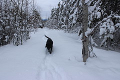
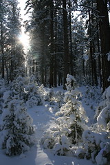
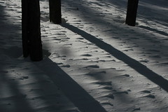
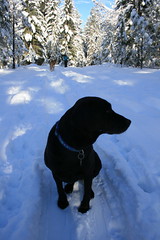
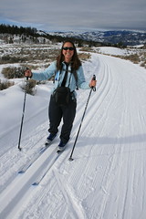
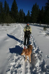
On Christmas Day, we woke to fresh snow in Missoula, and after opening gifts decided to pack up the dogs and our cross-country skis and head for the trails at Lubrecht Experimental Forest.

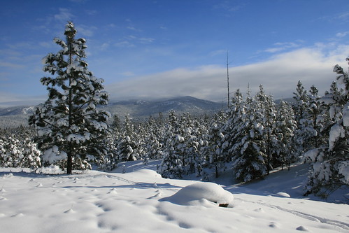
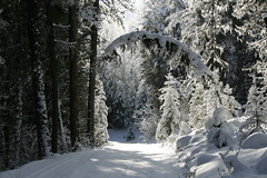
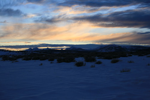
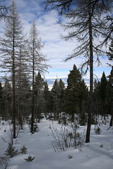
While it was gray down in the valley, we were rewarded with a bit of blue sky, 4 to 6 inches of powder on top of trails that had been groomed the day before and few other people. The trails weren’t marked for the new season, but with an updated map downloaded to my iPhone, old maps still posted and experience skiing the area in the past we had no trouble finding our way.

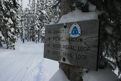
We decided to follow the new “E” trail, which is listed at about 7 3/4 miles and ends at an overlook.
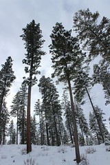
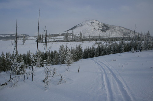
After leaving the parking lot and passing through a gate slightly to the southeast, we followed the southern portions of the “C” and “D” loops generally to the east. The powder-covered trail rose and fell through the forest, and we stopped at a couple of junctions to check our directions.

lubrecht_2014-12-25_006

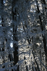
Where the old “E” loop rejoined “D,” we followed it uphill more steeply into thicker trees. After switching back to the west, the forest thinned and we arrived at a downed tree that had blocked the groomer from continuing. We rounded the trunk and found ourselves in deeper, but still passable, powder and continued on, following a set of ski tracks.

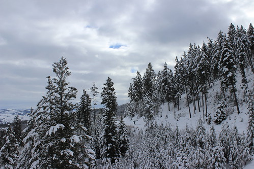
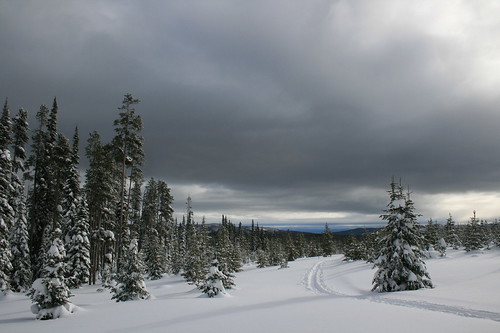
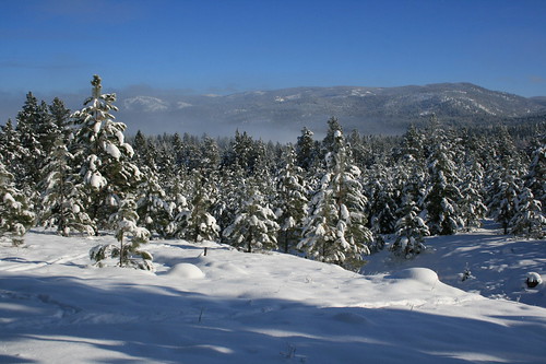
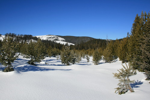
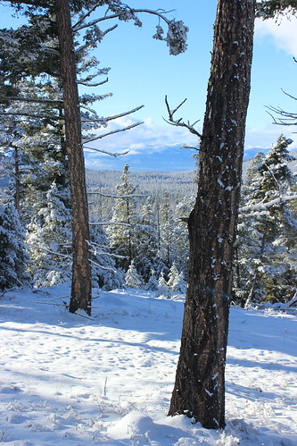
Uphill a ways farther, the trees opened up and we could see the surrounding Blackfoot Valley and north to the Swan Mountains. After arriving at high point among the trees that was probably the overlook, we continued a short distance in the ski tracks before turning back.

lubrecht_2014-12-25_099

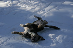
After returning to the “C” and “D” loops and slowing for a tired dog, we passed a few other parties of skiers enjoying the day on the way back to the start.

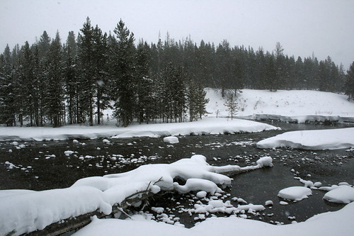
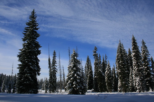
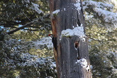
Here are more photos from Lubrecht Experimental Forest.

Distance: 7 3/4 miles out and back. (We went a short distance farther, totaling about 8 1/4 miles.)

Trailhead: Follow Interstate 90 about 5 miles east of Missoula to Bonner, then Montana Highway 200 east 26 miles to Lubrecht Experimental Forest.

February 4, 2014

Canine-friendly cross-country skiing at Como Trails

como_trails_20140202_066

On Sunday, we traveled south of Hamilton to give the dog-friendly Como Trails cross-country ski area a try and found near solitude, encountering only a handful of people in the first and last mile.

There are plenty of places around Missoula to ski with dogs, but Como is one of only two that allows them on groomed trails. (The other is at Lubrecht Experimental Forest.) It's also the newest cross-country ski area in the region, opening in the winter of 2009-10, and this was our first trip there.

The trails begin above the shores of Lake Como, weaving over and among the ridges to the south. Not being familiar with them, we chose a loop that included Panorama Point, hoping for a good view.

como_trails_20140202_024

Our route began on a groomed road, then turned onto a narrower trail through the trees. After about 1 1/2 miles, we ascended a steep, untracked section of powder called Uff-Da to Panorama Point. Atop the ridge, we could see the surrounding mountains - the Bitterroots continuing to the west and the Sapphires across the valley to the east - but Lake Como was out of sight, beyond a ridge to the north.

After stopping briefly at the point, we followed a flat trail along the ridge to the next junction, then turned south and skied down to the Chute, which drops steeply to a lower trail at about three miles.

From the bottom of the Chute, it's five miles back to the parking lot on a wide, groomed trail that rolls through a relatively open forest of tall pine trees. Along the way, we passed a couple of parcels of fenced-off property that required a little dog calling - there were horses in one area - but otherwise were no trouble.

como_trails_20140202_070

We never did get a view of the lake, but there are more trails to explore in the future.

Here are more photos from skiing at Como Trails.

Distance: 8-mile loop. The area has a total of more than 30 miles of groomed trail.

Trailhead: Parking for Como Trails is 12 1/2 miles south of Hamilton on U.S. Highway 93, then 4 miles west on Lake Como Road, above the boat ramp.

February 5, 2013

Skiing with Josey at Lubrecht Forest

lubrecht_20130113_050

One of our favorite winter activities is cross-country skiing with our dogs, and we recently took Josey on her first real outing.

Only a handful of official cross-country ski trails in the area allow dogs, and one of our favorites is the University of Montana's Lubrecht Experimental Forest, east of Missoula. Set in the Garnet Mountains, Lubrecht has a variety of trails that are maintained by the Missoula Nordic Ski Club, allowing you to piece together routes of most any length.

lubrecht_20130113_026

As is our habit, we set out shortly after waking up and arrived at the trailhead when only a few cars are parked in the lot. Combining the C and D trails gave us a loop of about 6 miles and got us back to the car as the parking lot is filling up. This beginner and intermediate circuit travels counterclockwise through the forest starting to the northeast, with some short climbs, smooth downhill glides and occasional sunny clearings.

lubrecht_20130113_044

Josey started out all over the place - not understanding that she should pace herself, as Belle has learned - but eventually settled in alongside us as she lost energy. Back at the car, we had our fill of frosty forest air and a couple of tired dogs.

See more pictures from Lubrecht here.

Distance: Loop about 6 miles.

Trailhead: From Missoula, the Lubrecht Experimental forest is 5 miles east on Interstate 90 to Bonner, then 26 miles east on Highway 200.

January 24, 2011

We skied the CDT

chief_joseph_20110123_026

Over the weekend, we decided to check out the cross-country ski trails at Chief Joseph Pass, south of Hamilton where the Continental Divide sidles up to the Idaho-Montana border, for the first time.

With 5 1/2 feet of snow on the ground and a fresh dusting of powder, it was worth the 95-mile drive.

There were a handful of vehicles and people in the parking lot when we arrived, but on the trail we found ourselves mostly on our own.

The Bitterroot Cross Country Ski Club maintains a network of 24 kilometers of well-marked, groomed trails that are easy to link together into loops of varying lengths.

chief_joseph_20110123_005

Never having skied at Chief Joseph before, we chose to start on the Continental Divide Trail.

About half a mile in, on the edge of Picnic Meadow, we caught a glimpse of a "snowbow" arcing over the Gordon Reese Cabin. After a brief stop to check out the cabin, we skied up and down, through lodgepole pine forest and meadows along Broadway, the Gold Medal Loop, Timber, Solitude and the Vista View Loop. For a while, the sun was shining through breaks in the clouds, and despite the noise of wind, it was never too blustery.

After another stop at the cabin, the sky turned gray and we skied back to the trailhead via Moose and the Lost Trail Loop, shy of 7 miles and satisfied.

chief_joseph_20110123_090

See photos from Chief Joseph Pass here.

Distance: About 6 3/4 miles. (24 kilometers of groomed trails available, with more ungroomed terrain.)

Directions: The Chief Joseph Pass trailhead is about 47 miles south of Hamilton on U.S. Highway 93, then 1 mile east on Montana Highway 43.

January 1, 2011

Year-end Yellowstone ski

indian_creek_20101228_028

With family visiting for Christmas this year, we thought it would be fun to take a quick trip down to Yellowstone National Park. Mom had been to the area before, but was busy with work so didn't get to see the wilderness or wildlife - both of which we found.

Normally when we visit Yellowstone in winter, we look for an inexpensive room in Gardiner. This being the holidays and with family in tow, we booked rooms early at Chico Hot Springs Resort. We had never visited before, and the pools and food lived up to friends' hype.

tower_junction_20101227_009

The first afternoon in the area, we took a drive out the park's north road to the Lamar Valley, viewing winter-white scenery, bison, coyotes and elk along the way. On the way back out of the park, we scheduled an early snowcoach shuttle to go cross-country skiing the next morning. At Chico that night, we ate well and took a quick dip in the warm pool before turning in.

The next morning, we rose before dawn and drove back to the hotel at Mammoth Hot Springs in the park, to rent gear for Mom and catch the shuttle up to the Indian Creek warming hut for some skiing. After a bumpy snowcoach ride to Indian Creek - and a brief panic over the frozen-shut door of the hut - we skied a short loop in windy, snowy weather, then waited for our pickup to return to Mammoth.

mammoth_20101228_080

On the way out of the park that afternoon, Mom got another wildlife treat - foraging bighorn sheep on the slopes above the road. Back at Chico, we ate and soaked some more, then hit the sack.

The next morning, the forecast for western Montana was foul, so we skipped a morning trip to the park and headed for home. The drive was harrowing, but the trip was worth it.

See photos from our winter visit to Yellowstone here.

Indian Creek Loop

The easiest way to reach Indian Creek is by snowcoach shuttle from the hotel in Mammoth Hot Springs. Compared to other snowcoach tours, it's a bargain at a little more than $16, including taxes. Maps of the trails are available at the ski shop in Mammoth or here.

The trail we set out on from the warming hut makes a 2 1/4-mile counterclockwise circuit through a summer campground and along Indian and Obsidian creeks. It has gentle ups and downs, and the Gallatin Mountains are visible when there's no snow. With a little exploring, we covered about 3 1/10 miles.

Distance: About 2 1/4 miles round trip.

Trailhead: From the hotel in Mammoth, take the snowcoach shuttle about 8 1/2 miles south on the snow vehicle road to Indian Creek.

December 6, 2010

Cross-country season is here

lubrecht_20101205_036

We recently brought our cross-country skis up from the basement and over the weekend went on our first real outing of the season. With partly cloudy skies in town we made the short drive up the Blackfoot Valley to the Lubrecht Experimental Forest.

We arrived to only two other cars in the lot and set out on firm, groomed snow. We chose the 6.4-mile "D" loop, one of five marked trails that can be combined for a distance of your liking.

lubrecht_20101205_023

The counterclockwise loop begins in rolling forestland - a nice mix of up, down and around. At a couple of spots along the way, logs were still piled up from a recent tree-thinning operation in the battle against pine bark beetles.

On the north side of the loop, after the grooming ends but before the trail briefly crosses onto Paws Up Ranch property, the trees open. Here, the forest offered a beautiful sunny view of the surrounding Garnet Range.

lubrecht_20101205_058

Down through the forest again and off of Paws up Property - be sure to close any gates you open - the trail climbs up through a narrow gully called the Luge. Due to the shade of the forest, heavy frost was clinging to moss hanging from branches. This season, there are also a few downed trees to duck under and navigate around.

Out of the gully, the grooming begins again where the loop reconnects with shorter trails. We glided down past Jones Pond and a shelter before returning to a full parking lot. The entire circuit, we saw only one other party until nearing the cars.

lubrecht_20101205_069

See photos from Lubrecht here.

Distance: 6.4-mile loop. (Variety of loops available, from 1 mile to 8.3 miles.)

Trailhead: From Missoula, drive 5 miles east on Interstate 90 to Bonner, then 26 miles east on Highway 200 to the University of Montana's Lubrecht Experimental Forest facilities.

February 7, 2010

Snowy Yellowstone

blacktail_plateau_20100130_061

A recent three-day weekend gave us the opportunity to explore Yellowstone National Park more than ever before.

For some reason, we've never really spent any time in Yellowstone. Previously, we drove through a couple of times and took in the roadside sights, but the park wasn't our destination. And we spent a long winter weekend there several years ago, but without the right gear and the cooperation of the weather we didn't get out very far.

This time, though, we packed both snowshoes and cross-country skis, and even saw some sunshine.

Yellowstone's north entrance at Gardiner is just a four-hour drive from Missoula, and we managed to find a cheap hotel room a few blocks from Roosevelt Arch on short notice. From Gardiner, you can drive up to Mammoth, Wyo., and out the park's north road, the only one open to automobiles in winter.

Marked ski and snowshoe trails can be found around Mammoth and Tower Junction, and in the northeast corner of the park. Maps are available at the ski shop in Mammoth and here.

blacktail_plateau_20100130_006

Our first day in the park, we went on a sunny ski up the Blacktail Plateau, then drove out the north road to watch wildlife in the Lamar Valley as the light faded.

On Day 2, our only full day in the park, we took a snowcoach shuttle from Mammoth south to Indian Creek and returned on skis, the morning snow giving way to another afternoon of sun. After getting back to Mammoth, we took a short walk through the travertine terraces.

The third day, we returned to the Lamar Valley for the morning, where we took in the sights and sounds of the park's wolves before driving home.

Check out photos here, as well as this video (headphones help for hearing the wolves near the end):


Blacktail Plateau

From its west end, the Blacktail Plateau Trail climbs a groomed road for six miles, then drops two miles to its eastern terminus, providing sweeping, snowy views along the way. We set out the afternoon we arrived and skied close to half of it under blue sky and sun. At one point, we found several canine tracks along the trail - they appeared to be too big to be coyotes and pets aren't allowed, so we guessed they were wolves.

Distance: Full trail is 8 miles one way; we skied about 6 1/2 miles round trip.

Trailhead: West-end trailheads are eight and nine miles east of Mammoth; east-end trailhead is just under 1 1/2 miles west of Tower Junction.

Sheepeater-Bunsen Peak

sheepeater_bunsen_20100131_026

This was the highlight of the trip - for $15 plus tax, we took the snowcoach shuttle from the hotel in Mammoth south to Indian Creek and skied back to town. We were the only passengers in the snowcoach and wouldn't see any other skiers the entire day.

From Indian Creek, we went a short distance along the road and connected with the ungroomed Sheepeater Trail across Swan Lake Flats. Along the way, the snow stopped falling and the sky cleared some, and at one point we paused for a small herd of bison to move off the trail. We then connected with the groomed Bunsen Peak Trail and dropped steeply down a canyon to Mammoth, taking in views of frozen Osprey Falls and the mountains around town. A short walk down the road from the trail's end brought us back to our car at the hotel.

Distance: About 7 3/4 miles one way.

Trailhead: From the hotel in Mammoth, take the snowcoach shuttle about 8 1/2 miles south on the snow vehicle road to Indian Creek.

January 8, 2010

Skiing in the new year

lolo_pass_20100103_029

It's been pretty brown in town this winter - the leaves never fully fell, and it seems like there's been more deep freeze than snowfall. Cross-country ski season began last weekend, however, with our annual New Year's outing.

Originally, I wanted to go to the new Como Trails Cross Country Ski Area south of Hamilton, where dogs are allowed. After reading on the Missoula Nordic Ski Club site about having to hike up to snow, though, we settled on a trip up Lolo Pass without the pups.

The day started out with a handful of vehicles in the parking area and the trails shrouded in fog, but after 6 3/4 miles of skiing the sun was out and the lot was packed.

See some photos here.

Distance: Trails from 1.2 to 14 miles are available; some are shared with snowmobiles. We did a 6 3/4-mile loop that incorporated parts of the Glade Creek and Packer Meadows trails.

Trailhead: From Missoula, drive 9 miles south on U.S. Highway 93 to Lolo, then 32 miles west on U.S. Highway 12 to the Lolo Pass Visitor Center, just over the border in Idaho. (Parking costs $5.)

February 16, 2009

Back to Lubrecht

lubrecht_forest_20090215_003

We made our second trip of the winter up to the Lubrecht Experimental Forest cross-country ski trails near Greenough over the weekend. And after weeks of being stuck at home with a cone on to protect stitches in her ear, Belle got to come along, too. (Another dog bit her back in January.)

Looking for a bit more of a challenge, I suggested we take part of the difficult loop, which the brochure says is steeper and requires "advanced braking and turning techniques." I got what I asked for.

After a quick ski out from the lower loops, we began to climb, putting down the first tracks in a fresh dusting of snow and gaining a total of about 900 feet. There was a payoff though: We encountered no other skiers for much of the day, and the view from the high section of trail included the Blackfoot Valley below and the whitecapped Swan Range in the distance (and we had a couple of tired dogs later that night).

Of course, what goes up, must come down - fast. Despite our not-so-advanced techniques, we descended to the lower loops and made it back to the car in one piece.

See more photos here.

Distance: About 7.25-mile loop. (Variety of loops available, from 1 mile to 8.3 miles.)

Trailhead: From Missoula, drive 5 miles east on Interstate 90 to Bonner, then 26 miles east on Highway 200 to the University of Montana's Lubrecht Experimental Forest facilities.

February 8, 2009

Blue sky skiing

lolo_pass_20090208_029

After being cooped up for a few weeks, we finally got out, just over the border to the Lolo Pass cross-country ski trails in Idaho. (The dogs stayed home, though, as they're not allowed on the groomed trails.) And, as you can see from the picture above, it was a perfect blue sky day.

Arriving before the crowd, we put together a route roughly seven miles long by connecting part of the Glade Creek Loop and the Packer Meadows Loop.

The last time we skied the Packer Meadows Loop, we started on the northern portion, which seemed to send us up a lot of the steeper sections of trail. This time, we started on the southern portion and got to enjoy glide down those sections.

See more photos here, and check out those brand-new skis Jen is sporting.

Distance: About 7-mile loop. (Variety of trails available, from 1.2 miles to 14 miles.)

Trailhead: From Missoula, drive 9 miles south on U.S. Highway 93 to Lolo, then 32 miles west on U.S. Highway 12 to the Lolo Pass Visitor Center, just over the border in Idaho. (Parking costs $5.)

January 16, 2009

In the news

Here's a story I wrote for the paper about our last ski outing. Too bad that's not all I do at work.

January 4, 2009

First foray of '09

lubrecht_forest_20090104_081

Today, we went on our first adventure of the new year - cross-country skiing in the Lubrecht Experimental Forest near Greenough, east of Missoula.

After an icy drive up the Blackfoot River corridor, we set out on a dog-friendly trail under sunny skies. At the end of the day, we had covered 6.4 miles and racked up one high-speed face-plant (Jen) and one back flop as a result of showing off (me).

As usual, there are plenty of photos and a video (below). And even though I was behind the camera, I managed to get some footage of myself - look for red skis me, shadow me and me me.

Distance: 6.4-mile loop. (Variety of loops available, from 1 mile to 8.3 miles.)

Trailhead: From Missoula, drive 5 miles east on Interstate 90 to Bonner, then 26 miles east on Highway 200 to the University of Montana's Lubrecht Experimental Forest facilities.