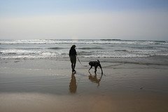
Earlier this month, we made our way out to Portland and the Oregon coast for a friend's wedding, and our new dog Josey got to come along.
A former Humane Society dog that we adopted at the end of March, Josey has firmly attached herself to our family and was not ready to stay in a boarding facility; the only choice was to pack a bag for her and see how she did on a long trip.
Fortunately, she did great in the car and everywhere we took her, and we conveniently were stopping at relatives' house and the wedding was at Beverly Beach State Park, where we camped. She even lucked out and got to go to a dog-friendly restaurant and microbreweries - one even prepared her a bowl of rice and pork!
And as with most of our trips, we found some trails to hike and other spots to get out in the Columbia River Gorge and at the beach.
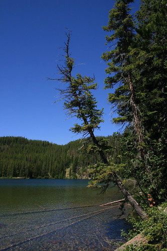
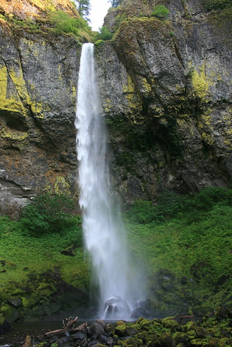
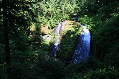
 Upper McCord Creek and Elowah falls
On the way into Portland, we stopped in the
Columbia River Gorge National Scenic Area to take Josey on a walk before our arrival. A quick search on my iPhone turned up the
Friends of the Columbia Gorge's hike planning website. There, we found the route to Upper McCord Creek Falls and Elowah Falls, which we had never been to.
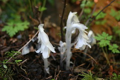
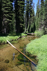
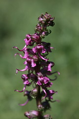
The hike begins by paralleling Interstate 84 up through the trees for the first two-thirds of a mile to a junction. Along the way, we found red columbine and white Indian pipe flowers.
From the junction, we switchbacked about three-quarters of a mile uphill, then rounded a cliff to Upper McCord Creek Falls, a small divided waterfall in a lush gulch.
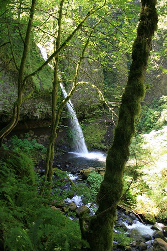
After returning to the junction, we continued four-10ths of a mile down a few switchbacks and back into a large amphitheater at the base of 289-foot Elowah Falls. Here, we stopped for a bite to eat - and Josey for a drink from the creek - then went back to the car and on to the city.
See more photos of Upper McCord Creek and Elowah falls
here.
Distance: About 3 1/2 miles out and back.
Trailhead: About 27 miles east of Portland on Interstate 84, take Exit 35. Turn left, then right and follow the Northeast Frontage Road a little over two miles east to the trailhead parking area.
Ponytail, Oneonta and Triple falls
The next day, we returned to the Gorge for a hike that we had done on a previous visit when the weather wasn't as nice.
Follow the trail next to 176-foot Horsetail Falls uphill to the east for about a quarter mile, then switch back to the west. Ponytail Falls is around a bend after about another quarter mile; here, walk behind the stream of water pouring from a rocky overhang.
In the next three-quarters of a mile, the trail passes overlooks from cliffs above the Columbia River to the west, then turns south and switchbacks down to a bridge over Oneonta Gorge and a 60-foot waterfall. Josey was skeptical of the bridge, with its slotted surface revealing the creek below, but eventually crossed.
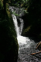
Uphill from the bridge, continue south at the junction with the Oneonta Trail upstream to an overlook of the 64-foot Triple Falls at about 2 1/4 miles. Slightly farther up the trail, another bridge provides access to the creek above the falls. We ate a little here, then turned around.

More photos of Ponytail, Oneonta and Triple falls are
here.
Distance: About 4 1/2 miles out and back.
Trailhead: About 27 miles east of Portland on Interstate 84, take Exit 35. Turn right and drive about one-quarter of a mile, then turn left onto the Historic Columbia River Highway. Continue west about 1 1/4 miles to the Horsetail Falls parking area.
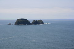
Cape Meares
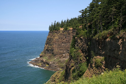
Driving south between Tillamook and the Newport area, we opted for the Three Capes Scenic Route. The
Cape Meares State Scenic Viewpoint, with its 1890s lighthouse, is the northernmost of the three - Cape Lookout and Cape Kiwanda are the other two - and the only one we stopped at due to time and crowds.
Here, a half-mile trail loops the cape's cliffs to the lighthouse, providing coastal views to the north and south.
 Here
Here are some photos of the view from Cape Meares.
Distance: 1/2 mile loop.
Trailhead: Cape Meares is 10 miles west of Tillamook on U.S. Highway 101.
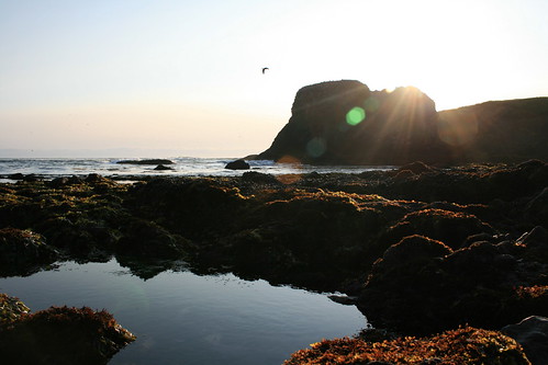
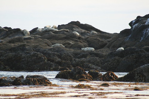
Yaquina Head
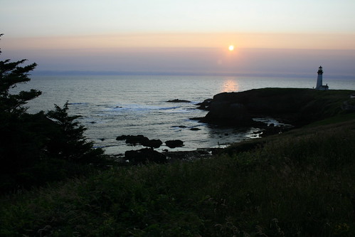
After arriving at
Beverly Beach State Park and eating dinner, we drove south to the
Yaquina Head Outstanding Natural Area on the north end of Newport to view the setting sun.
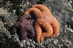
Parking at the lighthouse at the end of the headland, we walked down to Cobble Beach, where we saw tide pools, a variety of seabirds and seals basking on the rocks offshore.
 Here
Here are more pictures from Yaquina Head.
Distance: Minimal.
Trailhead: The Yaquina Head entrance station is about 1/3 of a mile west of U.S. Highway 101 on Northwest Lighthouse Drive at the north end of Newport.
Devil's Punchbowl

The morning of the wedding, we took a couple of short drives to do some sightseeing - the first was to
Devil's Punchbowl State Natural Area.
Devil's Punchbowl is a basin in a rocky headland into which seawater crashes. It can be viewed from above, or from the inside by walking down to the beach from a short trail near the end of C Avenue, then south on the sand. Tide pools are also found here.
More pictures from Devil's Punchbowl are
here.
Distance: Minimal.
Trailhead: To get to Devil's Punchbowl, drive about 7 miles north of Newport on U.S. Highway 101, then veer left on Otter Crest Loop. After a little less than 1/2 mile, turn west on First Street and continue a little less than 1/2 mile to the parking area.
Cape Perpetua
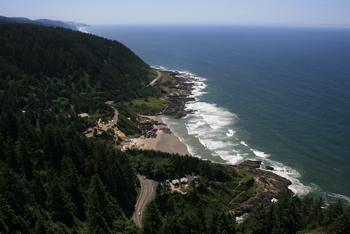
At the
Cape Perpetua Scenic Area, the Siuslaw National Forest meets the sea at the base of steep cliffs.
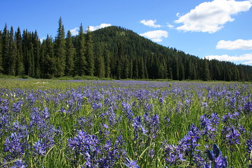
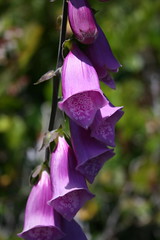
Here, we drove up to a scenic overlook then hiked down most of the St. Perpetua Trail and back up, viewing several wildflowers along the way. There were more trails in the area, but we were on a schedule to be at the wedding, so didn't really explore much.
More pictures from Cape Perpetua are
here.
Distance: About 2 1/2 miles out and back.
Trailhead: Cape Perpetua is 2 1/2 miles south of Yachats on U.S. Highway 101. The top of the St. Perpetua Trail is about 3/4 of a mile up Forest Road 55 then nearly a mile up Forest Road 5553.