Showing posts with label Wyoming. Show all posts

January 2, 2015

A big, busy year of running in 2014

Start here, run up there, then back

Farther, higher, faster and harder pretty well define my year of running.

I started the year with an advanced marathon training class and found myself running at a Boston-qualifying pace that would have had me finishing about 45 minutes faster than my personal best.

While I didn't run an official marathon last year, I did finish two ultras, a couple of shorter trail races and several long training runs. Among them:


In all, I logged about 2,423 miles on my GPS in 2014 - with Bighorn at 52 miles and 6,500 feet of gain and The Rut at 32 miles and 11,000 feet topping the list.

Both were enjoyable experiences, and I plan to run them again this year.

Here's a slideshow of photos from this year's runs - and a link to a Rut video in which I briefly appear. (Look for the red hat at the Tram Dock aid station.)


A big thank-you to the friends with who were with me for many of last year's miles and Missoula's supportive running community!

December 8, 2014

Off the boardwalk, finally, in Yellowstone Park

norris_basin_2014-09-16_097

After running The Rut 50K at Big Sky Resort back in September - I know, I'm behind - we continued south to Yellowstone for our first stay in the national park.

We've been to Yellowstone several times - usually for a long weekend in winter or just driving through at other times of the year, staying in gateway towns. Considering how much we get out, it's odd that we've never really spent time there. Driving from home, after all, takes a similar amount of time as getting to the east side of Glacier National Park.

This time, we camped inside the park four nights and spent one rainy night in a hotel in Cooke City. And for the first time aside from our winter visits, we left the park roads and boardwalks behind for a few trails.

Our trip began in the Madison and Old Faithful areas, then moved to Norris and the Grand Canyon of the Yellowstone, then the Lamar Valley before we drove home. Along the way, we saw some of the park's most popular sights and occasionally escaped the crowds.

Day 1

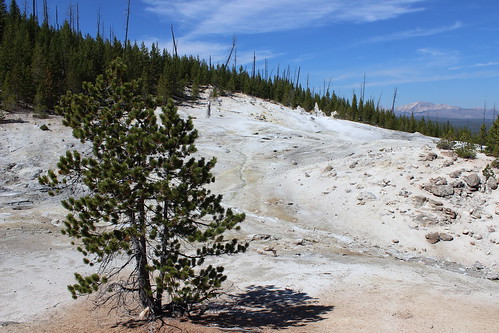
Monument Geyser Basin
monument_basin_2014-09-14_039

Having raced the day before, we started with a short hike to Monument Geyser Basin after setting up our campsite at Madison.

The trail began along the west bank of the Gibbon River and continued north upstream for a fairly level 1/2 mile. Turning back southwest, we climbed steeply for a little more than 1/2 a mile, taking in views north across forest and meadows to the mountains at the south end of the Gallatin Range.
monument_basin_2014-09-14_049

At the top of the trail, we turned west and continued a short distance to the small geyser basin at about 1 1/2 miles. After viewing the steam rising from rocks and cones, we followed the route back to the trailhead.

Here are more photos from Monument Geyser Basin.

Distance: About 3 miles out and back.

Trailhead: Drive about 8 2/3 miles northeast of Madison.. The trail starts at a turnout on the west side of the road, just south of a bridge over the Gibbon River.

Ice Lake and Little Gibbon Falls
ice_lake_2014-09-14_058

From the Ice Lake trailhead, we followed the level trail west past the south end of the lake to a junction with the Howard Eaton Trail.

Here, we turned north and hiked along the west shore of the lake, past campsites then into the forest to a log crossing over the narrow Gibbon River. Once across, we continued uphill north to a junction with the Wolf Lake Trail at about 2 1/3 miles and turned southeast.
ice_lake_2014-09-14_035

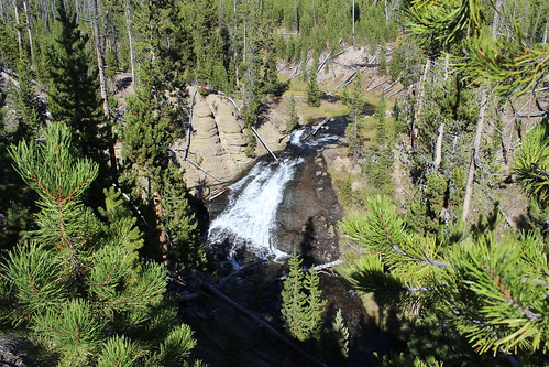
We followed the Wolf Lake Trail to a second log crossing, just above Little Gibbon Falls, then uphill a short distance to good views of the falls through the trees.

After taking in the falls, we continued down the trail through Virginia Meadows to the road. Back on pavement, we hiked about 1/2 mile southwest to the Ice Lake trailhead.

View more photos of Ice Lake and Little Gibbon Falls.

Distance: About a 4 1/2-miles loop.

Trailhead: The Ice Lake trailhead is about 3 1/2 miles east of Norris.

Day 2

Lower Geyser Basin
lower_basin_2014-09-15_018

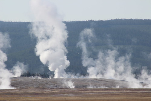
On the way to our hikes for the day, we drove through the Lower Geyser Basin and on a loop back to Firehole Lake.

From the road between Madison and Old Faithful, we could see across the meadow to a bison herd and the steaming geysers.
firehole_lake_drive_2014-09-15_037

On the east side of the road, we turned onto the Firehole Lake Drive and wound 3 1/3 miles north, stopping for short walks at Great Fountain Geyser and Firehole Lake. The road was in the news last summer when it was briefly closed after heat from underground melted and damaged the surface.

Here are more photos from Lower Geyser Basin and Firehole Lake.

Directions: The Firehole Lake Drive begins about 9 miles south of Madison.

Lone Star Geyser
lone_star_2014-09-15_036

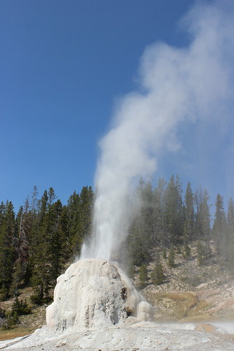
We chose the hike to Lone Star Geyser because it's known to have one of the more regular and predictable eruptions in the park, about every three hours. Unfortunately, we missed the main eruption, but did see a smaller one.
lone_star_2014-09-15_004

From the trailhead, we followed the nearly level old road south along the Firehole River, crossing it on a bridge after about 2/3 mile. The road continued along the river south, curving east to a junction with the Spring Creek Trail then west again to the geyser at 2 1/2 miles.

After watching a smaller eruption, we decided to hike a bit farther and turn back in time to see the larger one. The main eruption came early, however, and we just missed it. Rather than wait, we backtracked to the trailhead.

View more photos from Lone Star Geyser.

Distance: About 5 miles out and back.

Trailhead: The Lone Star Geyser trailhead is about 3 3/4 miles southeast of Old Faithful.

Biscuit Basin and Mystic Falls
biscuit_basin_2014-09-15_117

We finished our second day with a hike up to the Biscuit Basin overlook and back to Mystic Falls.
biscuit_basin_2014-09-15_017

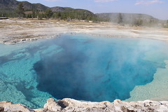
We started west on the boardwalk, past the colorful, steaming pools of water, and continued onto the trail that led to the Little Firehole River. After a short distance, we turned uphill at a junction, switchbacking north to an overlook of the basin.

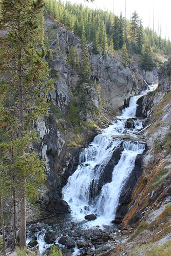
From the overlook, we continued west to a junction with the Fairy Creek Trail. Here, we switchbacked south down to a viewpoint for Mystic Falls, where the Little Firehole cascades out of a narrow canyon to the rocks below.

biscuit_basin_2014-09-15_092

From the viewpoint, we followed the river east, back to the junction then the boardwalk.

Here are more photos from Biscuit Basin and Mystic Falls.

Distance: About 3 miles round trip with a large loop beyond the boardwalk.

Trailhead: Biscuit Basin is about 2 1/2 miles north of Old Faithful.

Day 3

Mount Washburn
mount_washburn_2014-09-16_047

After moving to the Norris campground the next morning, we started with an uphill hike to the top of 10,243-foot Mount Washburn.

The summit is most easily reached from two trailheads - Dunraven Pass and Chittenden Road. We chose the route from Dunraven Pass because it was about 3/4 mile longer.

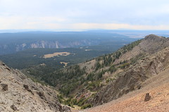
The trail - an old road - started steeply to the east, with Dunraven Peak behind us. After about 2/3 mile, we turned north and began a series of long switchbacks up through and eventually above the forest. At the southern switchbacks, the Grand Canyon of the Yellowstone could be seen cutting through the plateau below; on the northern ones, the lookout could be seen atop Mount Washburn.
mount_washburn_2014-09-16_119

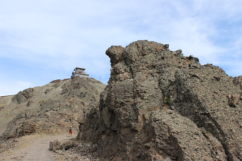
After the last switchback at about 2 1/2 miles, we followed a rocky ridge to a junction with the Chittenden Road and Washurn Spurt Trail. From here, we hiked the last short 1/3-mile loop up to the lookout.

The lookout is more modern than those we've been to on mountaintops around home, with an indoor observation room, an outdoor viewing platform, living space for a ranger and numerous antennas. (And full cellphone service.) It's also a fairly popular destination, and we saw numerous people at the top.

mount_washburn_2014-09-16_067

After a brief stop to take in the 360-degree view, we started down. On the way back, we hiked a short distance out the singletrack Washburn Spur, where we briefly found solitude. The trail continued down to the Grand Canyon, and will have to be fully explored on a future visit.

View more photos from Mount Washburn.

Distance: About 7 miles out and back to the top of Mount Washburn. We added about 1/2 mile on the Washburn Spur Trail.

Trailhead: The Dunraven Pass trailhead is about 4 3/4 miles north of Canyon Village.

Norris Geyser Basin
norris_basin_2014-09-16_103

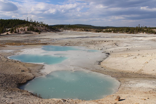
On the way back to camp that afternoon, we stopped at Norris to take in the geyser basin - one of the most surreal parts of the park with it's high concentration of thermal features. We briefly stopped at Norris in June, but were on a tight schedule so didn't see the entire area.

Two loops round the Porcelain Basin and Back Basin on trail and boardwalk. We started with the Porcelain Basin, highlighted by the jetlike Porcelain Springs, the Colloidal Pool and regularly erupting Constant Geyser.
norris_basin_2014-09-16_208

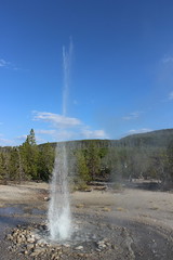
The walk around the Back Basin Was highlighted by the Vixen Geyser and the bubbling Green Dragon Spring. Cistern Spring, which is connected to Steamboat Geyser, was blue when we visited in June. After an eruption of Steamboat two weeks earlier, however, it appeared muddy.
norris_basin_2014-09-16_225

Here are more photos from Norris Geyser Basin.

Distance: Two loop trails totaling about 2 miles. A couple of short spurs can add about 1/4 mile.

Trailhead: At Norris.

Day 4

Grand Canyon of the Yellowstone
grand_canyon_yellowstone_2014-09-17_028

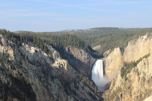
The next day, we went to one of the most popular parts of the park - the Grand Canyon of the Yellowstone - but we got far enough off the pavement to leave the crowd behind.

We started at Artist Point, taking in the view of the Lower Falls from the south rim of the canyon, and hiked to Sublime Point, about 1 3/4 miles to the northeast. Along the way, sunlight reached deeper into the canyon - highlighting the reds, oranges, yellows and whites of its walls - and eventually to the Yellowstone River at the bottom.
grand_canyon_yellowstone_2014-09-17_122

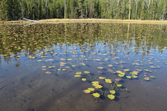
About 3/4 mile back along the rim, we turned south past Lily Pad Lake and continued about 1/3 mile to the Ribbon Lake Trail. After about 1 2/3 miles northeast, we reached the top of Silver Cord Cascade and Ribbon Lake, stopping on the shore for a break.

grand_canyon_yellowstone_2014-09-17_152

After hiking back southwest to Lily Pad Lake, we continued about 3/4 mile past a thermal area, taking in a bubbling mud pool and stopping again for a break along the edge of Clear Lake. At a junction a short distance past Clear Lake, we turned west are hiked to the Uncle Tom's Point trailhead, crossing the South Rim Drive.

grand_canyon_yellowstone_2014-09-17_180

After taking in closer views of Upper and Lower Falls, we followed the paved South Rim Trail about a mile back the Artist Point trailhead.

View more photos from the Grand Canyon of the Yellowstone.

Distance: About an 8 1/2-mile loop with a couple of out-and-back segments.

Trailhead: The Artist Point trailhead is about 2 1/3 miles south of Canyon, then 1 2/3 miles northeast on South Rim Drive.

Mud Volcano, LeHardys Rapids and the Hayden Valley
hayden_valley_2014-09-17_021

After hiking the Grand Canyon, we spent the rest of the afternoon driving south toward Fishing Bridge and Yellowstone Lake, stopping along the way for short walks at Mud Volcano and LeHardys Rapids and to take in the view in the Hayden Valley.
mud_volcano_2014-09-17_025

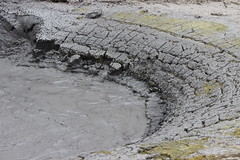
At Mud Volcano, a 2/3-mile trail loops up and back down the hillside, passing several steaming, bubbling and roiling hydrothermal features, including the namesake volcano, Churning Cauldron and Black Dragon's Cauldron.

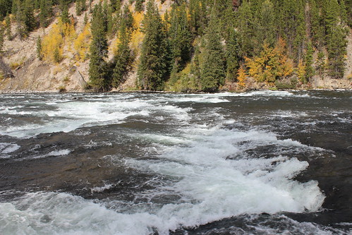
South of Mud Volcano, we stopped at LeHardys Rapids after seeing some colorful trees on the opposite side of the Yellowstone River. Along the short riverside trail, we also found waterfowl paddling among the rapids and rocks.
lehardys_rapids_2014-09-17_012

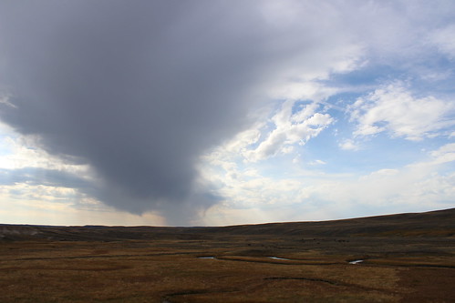
On the way back to Canyon Village and the Norris campground, we pulled off the road in the broad, grassy Hayden Valley as storm clouds rolled above a herd of bison.

Here are more photos from Mud Volcano, LeHardys Rapids and the Hayden Valley.

Distance: The Mud Volcano loop is 2/3 of a mile. The walk along the river at LeHardys Rapids is about 1/4 mile out and back.

Trailhead: Mud Volcano is 10 miles south and of Canyon Village. LeHardys Rapids is about 3 miles farther south. The Hayden Valley is between the Grand Canyon and Mud Volcano.

Day 5

Blacktail Plateau, Lamar Valley and Soda Butte Creek
lamar_valley_2014-09-18_113

When we woke the next morning, it was obvious the day would be rainy. Based on the forecast, we had already reserved a hotel room in Cooke City, outside the northeast corner of the park, so we decided to drive that way - if the weather cleared enough, we would find a hike; if not, at least it would be scenic.

Over Dunraven Pass and west of Tower Junction, we began our sightseeing on the 7-mile, one-way Blacktail Plateau Drive. As rain fell, we saw a couple of bison and across the plateau to the Gallatin Range.

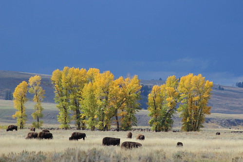
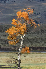
East of Tower Junction, we drove back and forth along park's north road, through the Lamar Valley and up the Soda Butte Creek drainage. We saw plenty of bison, as well as golden cottonwoods and aspens.
lamar_valley_2014-09-18_110

At one point, a break in the clouds seemed as if it would allow us to hike up toward Specimen Ridge through a petrified forest, but when we arrived at the trailhead rangers were temporarily closing the area due to an elk carcass that was attracting wolves and a grizzly bear. A ranger recommended returning the next day, when the carcass likely would be gone.
lamar_valley_2014-09-18_131

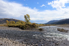
We drove back toward Cooke City, where we thought we could get in a couple of short hikes to waterfalls just outside the park, but thunder and lightning forced us to head for the hotel.

View more photos from the Blacktail Plateau, Lamar Valley and Soda Butte Creek.

Directions: The Blacktail Plateau Drive begins about 9 miles west of Tower Junction. The Lamar Valley is east of Tower Junction, between Slough Creek and Soda Butte Creek. Soda Butte Creek run between the northeast entrance to the park and the Lamar Valley.

Day 6

Petrified Forest
petrified_forest_2014-09-19_036

The next morning, we drove back west into the park and stopped to hike up to the Petrified Forest, before going home - the warning signs about the elk carcass having been removed.

We started south up the sage-covered hill in thick fog. Eventually, we could see the outlines of a couple of other people and bison beyond them. We stopped to talk briefly, then continued uphill, curving off the trail to keep the bison at a safe distance.

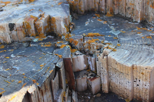
Up through a stand of trees, we turned west at a junction and soon found our first petrified stump. Hiking higher, we found several more stumps - their intricate rings crumbling in small, angular pieces - before reaching an open ridgeline.

petrified_forest_2014-09-19_027

After the fog cleared, we looped east then back north to the trail we came up, then went off through the sage to the west again to avoid the bison. After making our way around the herd, which had moved closer to the trailhead and begun to cross the road, we reached our car and departed for home.

Here are more photos from the Petrified Forest.

Distance: About 3 1/2 miles out and back, with a short loop up to Specimen Ridge. We hiked only about 1 mile up.

Trailhead: The Petrified Forest trail begins at a turnout about 5 miles east of Tower Junction and 3/4 miles west of the road leading to the Slough Creek campground, near a bridge over the Lamar River.
July 4, 2014

The road home through Yellowstone

midway_geyser_basin_2014-06-22_083

After the Bighorn Mountain Wild and Scenic Run near Sheridan, Wyoming, we turned back toward home - but as with the drive down, we took the slower road and came through Yellowstone National Park.

On the first of day of our two-day drive, we came west through Cody and the east entrance, over Sylvan Pass, past Yellowstone Lake, north to the geyser basins along the Firehole River and down the Madison River to West Yellowstone. The second day, we drove back up the Madison, then the Gibbon River to the Norris Geyser Basin, departing the park on the north at Gardiner. Along the way, we saw full rivers and waterfalls, colorful thermophiles, bubbling mud and steaming pools - and got stuck in summer wildlife jams, first for bison and then for a bear.

Since it was a tour of roadside attractions, I decided to put my photos together in a slideshow.

July 3, 2014

Big canyon, bighorns, wild horses on the state border

devil_canyon_2014-06-18_002

On our trip to Wyoming recently, we took the longer, more scenic route south and camped for a night at Bighorn Canyon National Recreation Area, which straddles the border with Montana north of Lovell.

While it's perhaps better known as a boating destination, we found a couple of short trails with spectacular views of the canyon's colorful cliffs, as well as wildflowers and wildlife. (I was taking it easy before the Bighorn Mountain Wild and Scenic Trail Run, anyway.)

The day we arrived, we drove the main road north from our campsite at Horseshoe Bend along the west rim of the canyon to its end, stopping at a few spots along the way.

Devil Canyon Overlook

devil_canyon_2014-06-18_148

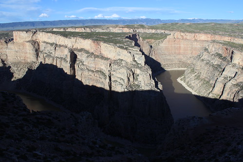
The first was Devil Canyon Overlook, where you can look down 1,000 feet to Bighorn Lake from a fenced-off parking lot. Below, Porcupine Creek enters the lake from the east.

That evening, we returned to the overlook and found ourselves amid a herd of grazing bighorn ewes and lambs. We also caught the last daylight rising up the canyon walls and lighting the rocks at the top.

devil_canyon_2014-06-18_032

Location: From Lovell, drive about 2 1/2 miles east on U.S. Highway 14A, 15 1/2 miles north on Wyoming Highway 37 and 1/2 mile east on the overlook road.

Sullivan's Knob Trail

sullivans_knob_2014-06-18_007

A short distance north on the road, we pulled over and hiked the Sullivan's Knob Trail, rounding a rocky outcrop and dropping slightly to the edge of the canyon.

Along the way, we found an abundance of prickly pear cactus in bloom, as well as birds.

Distance: 1 mile round trip.

Trailhead: From Lovell, drive about 2 1/2 miles east on U.S. Highway 14A and 16 miles north on Wyoming Highway 37.

Ranger Delight Trail

ranger_delight_2014-06-18_057

After driving to the Barry's Landing boat ramp at the end of the paved road, we turned back and stopped south of the overlook at the Ranger Delight Trail.

Here, the trail climbed to the canyon edge above a large bend in the lake and provided a view back to the red rocks near our campsite.

Distance: 1/2 mile round trip.

Trailhead: From Lovell, drive about 2 1/2 miles east on U.S. Highway 14A and 14 miles north on Wyoming Highway 37.

crooked_creek_2014-06-19_133

Before we departed for Sheridan the next morning, we made another quick drive up to the overlook. On the way, we found a few wild horses just inside the Pryor Mountain Wild Horse Range near Crooked Creek.

More photos of Bighorn Canyon are here.

June 29, 2014

50 miles of muddy running in the Bighorns

Remnants of a lightning storm that struck on The Haul at the Bighorn Mountain Trail Run

Mud and snow. Sun. Sweat. Thunder, lighting and rain. More mud. Oh, and a lot of junk food.

That about sums up my first 50-mile ultramarathon, the Bighorn Mountain Wild and Scenic Trail Run last weekend in Wyoming. Sure, it was difficult - but it was fun and I'd do it again.

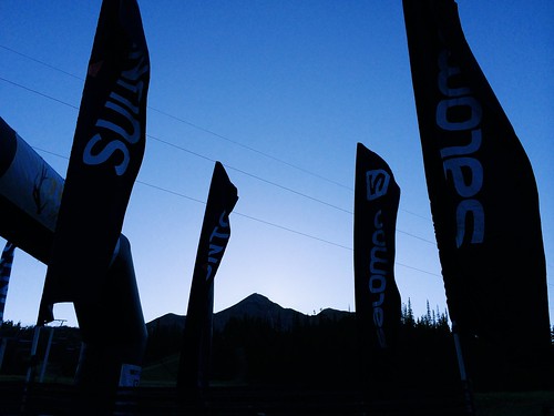
After a couple of months of preparation - and a stop at Bighorn Canyon National Recreation Area with Jen - I woke early and drove with friends to the Jaws Trailhead near 8,800 feet in the Bighorn Mountains west of Dayton before sunrise. It was in the high 30s - not as cold as anticipated - so I didn't bother with gloves or a warm hat.

Sunrise at the start of the Bighorn Mountain Trail Run

At first light, and after a brief moose sighting at the trailhead, we were off, starting out on singletrack through forest and meadows, with plenty of mud and short stretches of snow. After about five miles, the terrain was mostly open, descending through grassy slopes and the occasional stand of trees, and crossing several streams. I had to take care not to start too fast as I have done in other races - there was a long day ahead. The canyon closed in around the Little Bighorn River and we returned to the forest before reaching the Footbridge checkpoint at about 18 miles.

After eating, changing my socks and grabbing my trekking poles from a drop bag at Footbrige, I made my way up The Wall, rising from about 4,800 feet to 6,300 feet in three miles. The going was slow, and clearings along the way provided opportunities for brief stops to take in the view of the Little Bighorn drainage below and the surrounding cliffs. Above the Dry Fork of the Little Bighorn, the singletrack continued up and down through forest and meadows for about seven miles. As the day warmed, the trail turned to a double track and opened up, climbing again to the Dry Fork checkpoint at about 34 miles and 7,600 feet.

A meal, sock change and pole drop later, I continued from Dry Fork back up to about 7,900 feet then down the Sheep Creek drainage. Here, the trail returned to singletrack and the last real ascent, a few hundred feet up The Haul at 7,600 feet. On The Haul, clouds moved in, rain fell, and thunder and lighting struck overhead - disconcerting when you're on an open pass, but also cooling in the hot afternoon. Unfortunately, the rain turned the trail to mud again, which stuck to my shoes and made it feel as if I were wearing bricks.

About five steep miles down through open meadows, the singletrack trail reaches forest again and continues along the Tongue River for a couple of miles to a trailhead at the end of Tongue Canyon Road. There, family, friends and others are allowed to follow runners, and Jen arrived on her bike with perfect timing while I was at the final aid station. She rode around me for a bit, falling back and going ahead to take some pictures.

Five more miles brought me back to Dayton and the finish in a park along the river at about 3,900 feet. After passing an encampment of people under a Run Wild Missoula tent on the final stretch, I crossed the line at about 52 miles in 11 hours 33 minutes and 42 seconds, 39th out of 117 runners. Ten feet beyond, I cooled off for a few minutes by sitting in the river.

In the days that followed, I had a few realizations - random and revealed by the information from my GPS:

At the aid stations, I ate a lot more food than during training, some healthy and some I haven't had in at least a decade. In addition to the water and gels I carried and consumed on the trail, here's what I remember eating and drinking:

  • Orange slices (usual favorite)
  • Watermelon slices (perhaps new favorite)
  • Pineapple slices
  • A plum
  • Red grapes
  • Almond-pistachio-dried cherry mix 
  • Green olives with pimentos (surprisingly good)
  • A peanut butter cookie (probably had sometime in the past decade, but don't remember when)
  • Cheez-Its (probably had sometime in the past decade, but don't remember when)
  • Cheetos (don't know the last time had)
  • Fritos (don't know the last time had)
  • Ruffles (probably had sometime in the past decade, but don't remember when)
  • Hummus, vegetarian "pepperoni," sriracha and tortilla wraps (homemade training food packed in drop bags)
  • An American cheese, yellow mustard and tortilla wrap (I like mustard)
  • An American cheese and tortilla wrap (different aid station; out of mustard)
  • A slice of mushroom and spinach pizza (wary of melted cheese, but so good)
  • Heed
  • Sprite (don't know the last time had)
  • 7-Up (don't know the last time had)
  • Ginger ale (probably had sometime in the past decade, but don't remember when)
  • A green apple freeze pop (while running with a couple of miles to go; don't know the last time had, but perfect)

While I feel like I hiked more of the uphill stretches than I did during training, I had less non-moving time than on those same runs. On my longest training runs - 26 and 31 miles - I had about and hour of non-moving time, compared with about 45 minutes during the 52-mile race.

My fastest mile was the last mile, at about 8:45. I had been told the last stretch of road was a grueling march for many, but vowed I would only walk a couple of small hills on it.

And, most of all, Missoula's enthusiastic and supportive running community was reinforced with the large, loud crowd under the Run Wild tent at the end.

On the way home, Jen and I took a couple of days to drive through Yellowstone National Park, so you'll likely see some pictures here. And back in Missoula, I removed the dried clumps of mud from my shoes, socks and compression sleeves using the garden hose with the nozzle on the "jet" setting.

I'm already on the run again and need to start thinking about The Rut 50K in September.
June 5, 2014

The run down to Bighorn

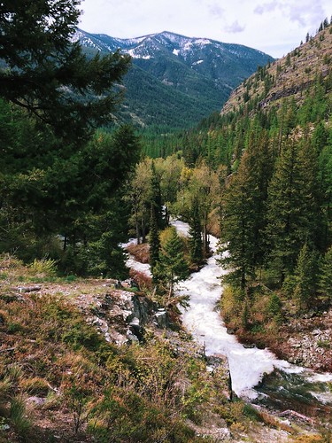
Rattlesnake Creek rapids through the forest

The taper has begun!

I've run my longest weekend - more than 54 miles, with a 31-mile Saturday and 23-mile Sunday - and longest week - 83 miles - and am in my last couple of weeks of preparation for the Bighorn Mountain Wild and Scenic 50-mile race.

A few statistics for Jan. 1 through June 1:

  • Number of runs: 96
  • Total miles: 1,123
  • Total elevation gain: 134,667 feet

In the middle of that period, I literally ran until my shoes fell apart - after more than 750 miles on that pair, the sole ripped in two places and peeled away during a race.

In the snow at Blue Mountain

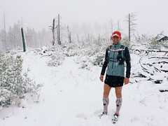
Missoula's particularly cold and snowy winter made for some challenging runs, even on roads. After a springlike weekend run through Hells Canyon on the Idaho-Oregon border in late March, I turned more to local mountains, but still managed to find lingering drifts and get caught in a late storm.

While the high-country snow is holding on, mountains around town have traded flakes for wildflowers. A friend and I even managed to get in a marathon over three of the city's iconic summits: Mount Sentinel/University Mountain, with the "M"; Mount Jumbo with the "L"; and the North Hills/Randolph Hill, with the peace sign.

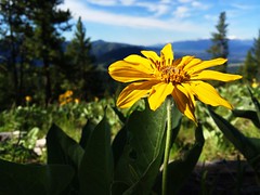
The hillsides of Mount Jumbo’s North Zone are alive with arrowhead balsamroot

If all goes according to plan, my long back-to-back weekend runs will be compressed into a single 50-miler through the Bighorn Mountains near Sheridan, Wyoming, on Saturday, June 21.

January 7, 2014

Stepping up my ultramarathons in 2014

After a successful year of running in 2013 - including my first ultramarathon, the Trail Rail Run 50K, and the Blue Mountain 30K - I've decided to push myself farther and harder in 2014.

Over the weekend, I registered for a couple of major regional trail ultras: The Bighorn Mountain Wild and Scenic Trail Run 50-mile race and The Rut 50K. The 50-mile race is about 20 more than my longest run and both have significant elevation gain compared to last year's mostly level 50K.

In it's 22nd year, the Bighorn starts west of Dayton, Wyo., and runs back to the town just north of Sheridan. It starts above 8,800 feet, reaches as high as 9,300 feet and runs down to 3,900 feet, with 12,800 feet of elevation gain in between.

The Rut 50K at Big Sky Resort south of Bozeman is in its second year, but has quickly risen to prominence. Organized by local shop the Runner's Edge and world-class ultramarathoners Mike Foote and Mike Wolfe, who both call Missoula home, it recently was named the 2014 Skyrunner World Series Ultra Final. It gains 10,000 feet of elevation over its course between 7,500 and 11,100 feet.

I'd be lying if I said I wasn't at least a little nervous, but I've been running well for the past year - building speed and distance, and taking to the trails no matter the weather. I've also joined a spring marathon training group through Run Wild Missoula to continue that progress through winter.
There probably still will be smaller races along the way, and as always I'll be posting updates here!

January 1, 2011

Year-end Yellowstone ski

indian_creek_20101228_028

With family visiting for Christmas this year, we thought it would be fun to take a quick trip down to Yellowstone National Park. Mom had been to the area before, but was busy with work so didn't get to see the wilderness or wildlife - both of which we found.

Normally when we visit Yellowstone in winter, we look for an inexpensive room in Gardiner. This being the holidays and with family in tow, we booked rooms early at Chico Hot Springs Resort. We had never visited before, and the pools and food lived up to friends' hype.

tower_junction_20101227_009

The first afternoon in the area, we took a drive out the park's north road to the Lamar Valley, viewing winter-white scenery, bison, coyotes and elk along the way. On the way back out of the park, we scheduled an early snowcoach shuttle to go cross-country skiing the next morning. At Chico that night, we ate well and took a quick dip in the warm pool before turning in.

The next morning, we rose before dawn and drove back to the hotel at Mammoth Hot Springs in the park, to rent gear for Mom and catch the shuttle up to the Indian Creek warming hut for some skiing. After a bumpy snowcoach ride to Indian Creek - and a brief panic over the frozen-shut door of the hut - we skied a short loop in windy, snowy weather, then waited for our pickup to return to Mammoth.

mammoth_20101228_080

On the way out of the park that afternoon, Mom got another wildlife treat - foraging bighorn sheep on the slopes above the road. Back at Chico, we ate and soaked some more, then hit the sack.

The next morning, the forecast for western Montana was foul, so we skipped a morning trip to the park and headed for home. The drive was harrowing, but the trip was worth it.

See photos from our winter visit to Yellowstone here.

Indian Creek Loop

The easiest way to reach Indian Creek is by snowcoach shuttle from the hotel in Mammoth Hot Springs. Compared to other snowcoach tours, it's a bargain at a little more than $16, including taxes. Maps of the trails are available at the ski shop in Mammoth or here.

The trail we set out on from the warming hut makes a 2 1/4-mile counterclockwise circuit through a summer campground and along Indian and Obsidian creeks. It has gentle ups and downs, and the Gallatin Mountains are visible when there's no snow. With a little exploring, we covered about 3 1/10 miles.

Distance: About 2 1/4 miles round trip.

Trailhead: From the hotel in Mammoth, take the snowcoach shuttle about 8 1/2 miles south on the snow vehicle road to Indian Creek.

February 7, 2010

Snowy Yellowstone

blacktail_plateau_20100130_061

A recent three-day weekend gave us the opportunity to explore Yellowstone National Park more than ever before.

For some reason, we've never really spent any time in Yellowstone. Previously, we drove through a couple of times and took in the roadside sights, but the park wasn't our destination. And we spent a long winter weekend there several years ago, but without the right gear and the cooperation of the weather we didn't get out very far.

This time, though, we packed both snowshoes and cross-country skis, and even saw some sunshine.

Yellowstone's north entrance at Gardiner is just a four-hour drive from Missoula, and we managed to find a cheap hotel room a few blocks from Roosevelt Arch on short notice. From Gardiner, you can drive up to Mammoth, Wyo., and out the park's north road, the only one open to automobiles in winter.

Marked ski and snowshoe trails can be found around Mammoth and Tower Junction, and in the northeast corner of the park. Maps are available at the ski shop in Mammoth and here.

blacktail_plateau_20100130_006

Our first day in the park, we went on a sunny ski up the Blacktail Plateau, then drove out the north road to watch wildlife in the Lamar Valley as the light faded.

On Day 2, our only full day in the park, we took a snowcoach shuttle from Mammoth south to Indian Creek and returned on skis, the morning snow giving way to another afternoon of sun. After getting back to Mammoth, we took a short walk through the travertine terraces.

The third day, we returned to the Lamar Valley for the morning, where we took in the sights and sounds of the park's wolves before driving home.

Check out photos here, as well as this video (headphones help for hearing the wolves near the end):


Blacktail Plateau

From its west end, the Blacktail Plateau Trail climbs a groomed road for six miles, then drops two miles to its eastern terminus, providing sweeping, snowy views along the way. We set out the afternoon we arrived and skied close to half of it under blue sky and sun. At one point, we found several canine tracks along the trail - they appeared to be too big to be coyotes and pets aren't allowed, so we guessed they were wolves.

Distance: Full trail is 8 miles one way; we skied about 6 1/2 miles round trip.

Trailhead: West-end trailheads are eight and nine miles east of Mammoth; east-end trailhead is just under 1 1/2 miles west of Tower Junction.

Sheepeater-Bunsen Peak

sheepeater_bunsen_20100131_026

This was the highlight of the trip - for $15 plus tax, we took the snowcoach shuttle from the hotel in Mammoth south to Indian Creek and skied back to town. We were the only passengers in the snowcoach and wouldn't see any other skiers the entire day.

From Indian Creek, we went a short distance along the road and connected with the ungroomed Sheepeater Trail across Swan Lake Flats. Along the way, the snow stopped falling and the sky cleared some, and at one point we paused for a small herd of bison to move off the trail. We then connected with the groomed Bunsen Peak Trail and dropped steeply down a canyon to Mammoth, taking in views of frozen Osprey Falls and the mountains around town. A short walk down the road from the trail's end brought us back to our car at the hotel.

Distance: About 7 3/4 miles one way.

Trailhead: From the hotel in Mammoth, take the snowcoach shuttle about 8 1/2 miles south on the snow vehicle road to Indian Creek.