At the end of July, we made our annual trip north to Glacier National Park, and this year we took shuttling to its extreme.
In recent summers, we've become adept at using the park and private shuttle services to get to a trailhead, then spend a few days backpacking back to our vehicle. Usually, we'd board a shuttle in the morning and be on the trail within an hour or two.
This year, the only backcountry camping permits that were available for our preferred itineraries were at Goat Haunt and Fifty Mountain. After a short hike in the North Fork of the Flathead River drainage on the day of our arrival, we spent the entire second day of the trip in shuttles to Waterton Lakes National Park in Alberta and on a boat back to Goat Haunt in Glacier, the start of our trail, by dinner.
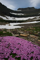
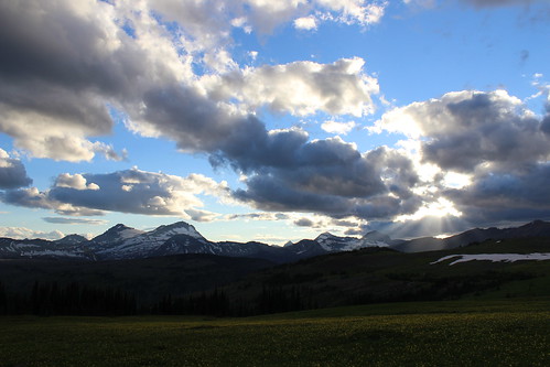
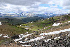
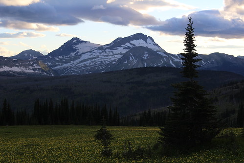
Still, while we're not likely to try that much shuttling again, we ended up in a fairly remote part of the park and enjoyed ourselves once on the trail. Standing in a field of glacier lilies above the Fifty Mountain campground at sunset, the view certainly lives up to the area's name.
Day 1: Howe Lake and Rocky Point
The day we arrived in Glacier, we secured our backcountry permit, set up our tent at the Fish Creek Campground, then drove northwest on the Inside North Fork Road to the Howe Lake trailhead.
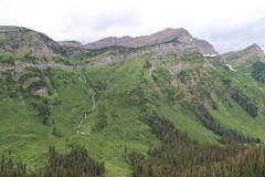
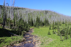
From the road, the trail climbs gently through forest burned in the 2003 Robert fire for 2 miles. Today, new trees stand head high among the remaining gray snags.
Once at the small, quiet lake, the trail continues to Howe Ridge, above the western shore of Lake McDonald. We followed it hoping it would skirt the east shore of the lake, but turned around after about 1/2 mile.
Later that evening, we walked the 2-mile Rocky Point nature loop from the campground, along the shore of Lake McDonald and back through the forest.
See more photos of Howe Lake and Rocky Point.
Distance: 5 miles round trip at Howe Lake; 2-mile loop to Rocky Point.
Trailhead: The Howe Lake trail begins about 5 1/2 miles northwest of the Fish Creek Campground on the Inside North Fork Road. The Rocky Point loop begins and ends in the campground.
Day 2: Shuttle to Goat Haunt
The second day of our trip was the most logistically challenging, needing to catch three shuttles to Waterton in time to board the last boat before border agents ended their day at Goat Haunt.
Waterton and Glacier make up an international peace park straddling the border with Canada, and Goat Haunt is the only location allowing trail access back to the United States. At this remote station, only U.S. and Canadian citizens with passports are allowed to cross south.
In the morning, we packed our vehicle and drove northeast on Going-to-the-Sun Road to The Loop, where we would be returning days later. From there, we boarded a free park shuttle and drove up the scenic road west to Logan Pass, on the Continental Divide. At the pass, we got off the west-side shuttle and on an east-side shuttle and continued down to St. Mary.
At St. Mary, we walked out of the park to the townsite and that afternoon took the paid Glacier Park Inc. East Side Shuttle to the Waterton visitor center near the Prince of Wales Hotel, crossing the border at Chief Mountain. From the visitor center, we walked to the dock on Upper Waterton Lake and bought tickets to take The International tour boat across to Goat Haunt. Before boarding the boat, we had enough time in the townsite to get a sandwich for lunch.
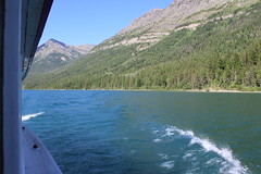
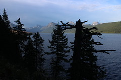
Aboard the 4 p.m. boat, we took a seat on the top deck and enjoyed the cruise south along the lake, viewing the logged swath and obelisks on each side marking the international boundary. Once off the boat, we walked a 1/4-mile path to the Goat Haunt ranger station and checked in with the border agents before returning to the camp adjacent to the dock.
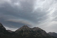
That night, storm clouds moved in - a preview of the weather in the forecast for the next day.
More photos from Goat Haunt are here.
Day 3: Waterton Valley Trail to Fifty Mountain
The first day of the backpacking portion of our trip, we woke to cloudy skies, and soon after eating breakfast and packing up at Goat Haunt it began to rain.
We've learned from past experience - Scotland, Olympic National Park, Glacier, Iceland - that a good rain coat, rain pants and pack cover make all the difference, so it didn't really faze us. Having checked in with the border agents the evening before, we set out south through the forested Waterton Valley.
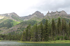
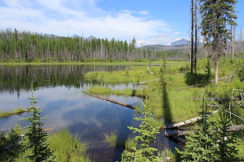
The first 6 miles were fairly uneventful - mostly hiking through the forest with little elevation gain, occasional creek crossings, and views of the mountaintops and the river. Occasionally, we got a break in the rain. At about 2 3/4 miles, we detoured west a little more than 1/3 of a mile and back to see Kootenai Lakes. At 5 miles, the trail over Stoney Indian Pass joined from the east.
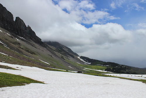
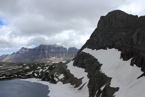
The trail began its ascent toward the Continental Divide at a little more than 6 miles, switchbacking a couple of times before rising steeply to the southeast along a brushy mountainside. After turning east and switchbacking into and out of forest again, the trail reached its high point - a saddle above tree line at about 10 miles. Here, the clouds broke and we got our first real glimpse of the surrounding mountains.
A little more than a mile downhill from the saddle, across snowfields and slightly into the forest, we reached the camp. It had started raining again, so we quickly set up our tent. After dinner and some card games, we called it a night.
Here are more photos from the Waterton Valley Trail.
Distance: About 11 3/4 miles one way, with detour to Kootenai Lakes.
Trailhead: Goat Haunt, reached by boat at the southern end of Upper Waterton Lake.
Day 4: Northern Highline Trail
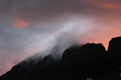
The next morning, I woke at sunrise - as is my habit when camping - and found the rain had stopped, but the sky was still filled with clouds. I wandered to the meadow above camp in time to see the first bright orange rays of daylight cresting Cathedral Peak.
In the camp's food preparation area after others woke, we watched a grizzly sow forage on a ridge near the saddle we hiked over the previous day. While we heard the bear had a couple of cubs with her, we never saw them.
After briefly questioning whether we should hike back to The Loop early instead of staying for another day of rain, it became clear the clouds were lifting. As the multitude of surrounding mountains came into view, we set out southeast on the northern Highline Trail for the day.
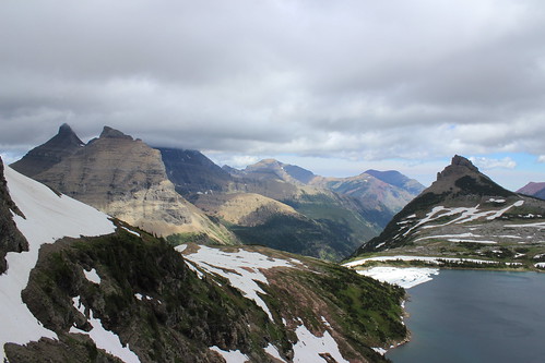
About 1 mile and one switchback above camp, we turned back northwest for a little more than 1/3 of a mile to the Sue Lake overlook. This notch in the ridge between Mount Kipp and Cathedral Peak provides views down to Sue Lake and over Pyramid Peak into the Mokowanis River drainage.
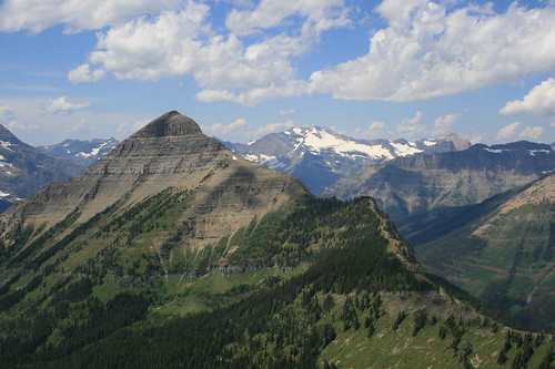
Back on the Highline, we continued southeast again, across rocky slopes and a handful of small snowfields into the Mineral Creek drainage. In the distance, we could see Swiftcurrent Mountain, the Garden Wall, the basin feeding Bird Woman Falls and Heavens Peak. About 2 1/2 miles from camp, we turned back.
That afternoon and evening, we relaxed by flying a kite and, after dinner, taking in sunset in the glacier lily-filled meadow.
See more photos from the northern Highline Trail.
Distance: About 5 3/4 miles round trip.
Trailhead: Fifty Mountain campground.
Day 5: Flattop Mountain Trail to The Loop
On our final day in the backcountry, we ate breakfast and packed up under scattered clouds.
After leaving camp, we hiked downhill southwest to Kooteani Pass, a low spot on the Continental Divide, then briefly followed Kipp Creek before rising a short distance up Flattop Mountain at about 2 miles.
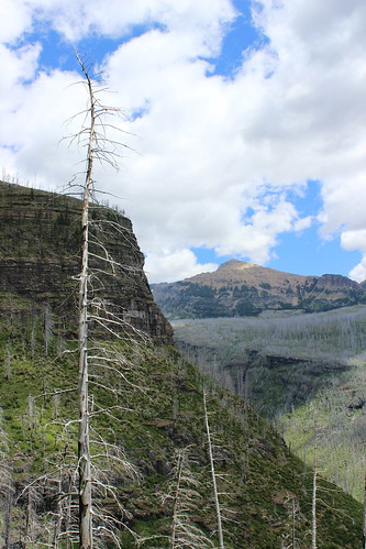
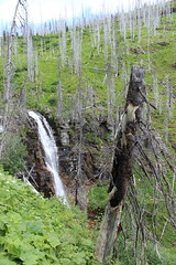
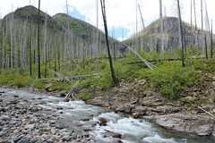
The trail south across Flattop continued, rising and dropping slightly along the way, through forests of gray snags left after the Trapper Creek fire of 2003. At about 4 1/2 miles, we passed a series of ponds in an unburned area, then dropped into the Flattop Creek drainage, where tall stalks of beargrass bloomed among more snags.
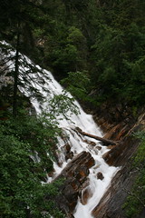
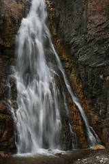
A little more than 6 miles along, we detoured less than a 1/4 mile to the Flattop campground for a break. Back on the main trail below the camp, we descended steeply along the creek, past several waterfalls. After a series of switchbacks and several snags that had fallen over the trail, we reached the valley floor at about 10 1/4 miles. Here, Swiftcurrent Mountain looms to the east and Heavens Peak to the west.
A short distance later, we crossed Mineral Creek and continued about 1 2/3 miles southeast through the McDonald Creek Valley to a junction, then turned back northwest and hiked uphill toward The Loop. About 3/4 of a mile up, we reached the junction with the trail to Granite Park, turned southeast again and arrived at The Loop - and our vehicle - at 13 1/4 miles.
Our feet weary from all of the downhill, we stopped along the Sun Road to soak them in McDonald Creek on the way home.
Here are more photos from the trail over Flattop Mountain.
Distance: 13 1/4 miles one way.
Trailhead: Fifty Mountain campground.