Showing posts with label Lolo National Forest. Show all posts

October 12, 2014

Celebrating wilderness with solitude in Rattlesnake

boulder_lake_2014-09-01_052

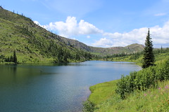
I spent a lot of time in the Rattlesnake National Recreation Area and Wilderness this past summer, so it was only fitting that when we chose a place to hike two days before the 50th anniversary of the Wilderness Act it was there.

While the Rattlesnake is Missoula's backyard, accessed by most from the main trailhead on the north edge of the city, we hiked to Boulder Lake from the more remote West Fork of Gold Creek to the northeast and saw only two other people all day. The rough drive into the trailhead likely accounts for the decreased use - it's the only time the traction control light in our SUV has turned on on a dry road.
boulder_lake_2014-09-01_008

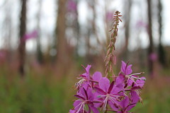
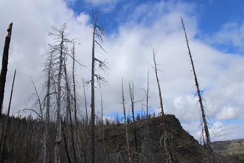
Once there, we hiked north on Trail 333 through an old burn, the Mineral Peak lookout visible to the south through the remaining snags and tall stalks of fireweed. The trail rose and fell gradually, crossed a couple of creeks, then entered forest just before a junction at 2 1/2 miles.

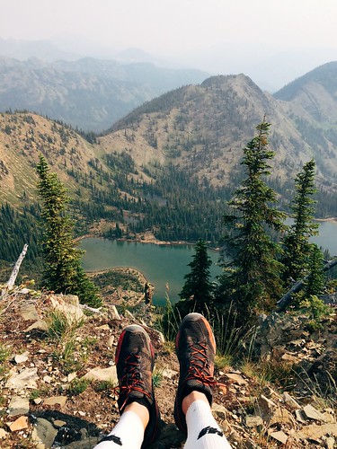
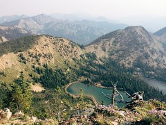
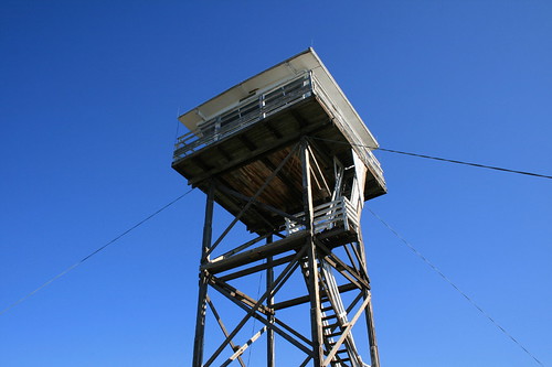
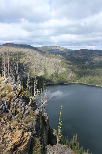
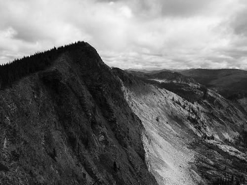
Continuing on Trail 333 to the northwest, we climbed a burned ridge, passing the wilderness boundary at 3 3/4 miles. From there, the trail continued up to a saddle below 7,293-foot Boulder Point. A short distance higher, we hiked a 1/4-mile side trail to the point, where we found the remains of lookout and views 800 feet down to the lake, north to the Mission Mountains and northeast the the Swan Range.
boulder_lake_2014-09-01_035

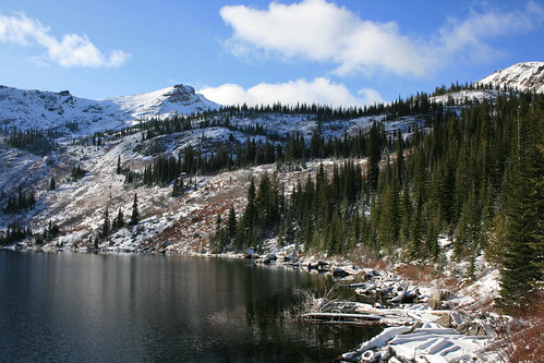
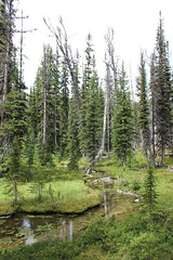
After returning to Trail 333, we continued up into the forest and a junction at 5 miles. Here, we followed the final steep switchbacks down 1 mile along a creek and past a marshy area, then down more to the lake shore and the point looming to the west.
boulder_lake_2014-09-01_082

After eating some food and letting the dogs swim and sniff around some moose tracks, we climbed up from the lake and hiked back to our car.

In Missoula, we truly are lucky to have treasures such as the Rattlesnake Wilderness - and the Selway-Bitterroot, Mission Mountains and Bob Marshall - so close.

Here are more photos from Boulder Lake.

Distance: 12 1/2 miles round trip, including 1/2 to Boulder Point and back.

Trailhead: From Bonner, drive about 8 3/4 miles east on Montana Highway 200, then turn northwest on Gold Creek Road, also known as Forest Road 126, and follow it 6 miles. Turn northwest on Forest Road 2103 and continue 5 miles, then turn onto Forest Road 4323 and continue 5 rough miles northwest to the West Fork Gold Creek trailhead.

October 11, 2014

Late-summer loop to Rattlesnake's Mosquito Peak

Mosquito Peak in the Rattlesnake Wilderness

Back in August, a friend and I set out early one morning on what would be our final long run before The Rut 50K, a 32-mile loop to Mosquito Peak in the Rattlesnake Wilderness.

The route took us up the Spring Gulch and down Rattlesnake Creek - trails we had covered earlier in the summer - linking them with the Wrangle Creek drainage. We had never been beyond Stuart Peak in the wilderness and were there on a smoky morning earlier in the summer; despite clouds overhead, we were rewarded this time with better views of the surrounding peaks.

Starting from the main trailhead for the Rattlesnake National Recreation Area, we followed Trail 515 half a mile north then turned up Spring Gulch on Trail 517. We followed this trail north as it rose above Spring Creek and switchbacked to the wilderness boundary at about 7 3/4 miles. From there, we continued as the trail steadily rose and fell on and alongside the ridgeline, past the Twin Lakes below Stuart Peak, then McKinley Lake and Worden Lake.

Big Lake, below Mosquito Peak in the Rattlesnake Wilderness

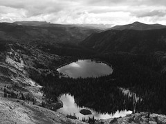
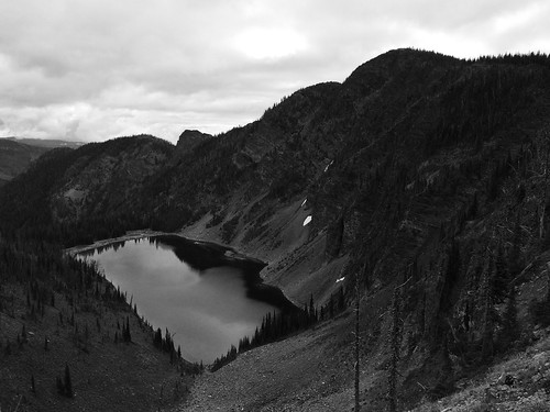
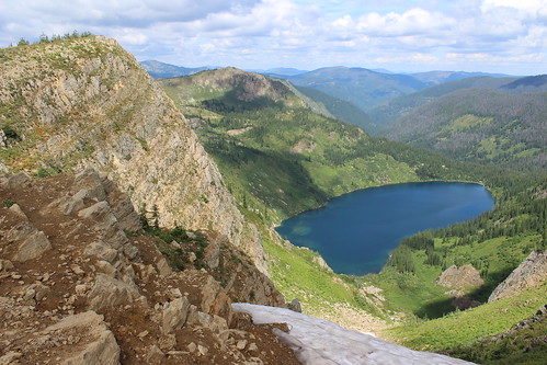
At about 11 1/2 miles, we veered northeast off the trail for a rougher route along the cliff edge, over a false summit and to 8,057-foot Mosquito Peak at about 12 miles. We stopped here to eat and take in the view of Big Lake, Little Lake and Glacier Lake below, and Point Six to the west, McLeod Peak to the north and Mineral Peak to the southeast.

Glacier Lake in the Rattlesnake Wilderness

After our break, we continued downhill to the northwest and back to Trail 517, then north slightly to the junction with Trail 502 above Glacier Lake at 12 3/4 miles. Here, we turned northeast on 502 and continued downhill past Glacier Lake, then stopped briefly at Little Lake. Back in the forest, we encountered too many downed trees over the trail as we switchbacked into the Wrangle Creek drainage.

Continuing east along the creek, we left the wilderness at about 18 miles near the confluence with Rattlesnake Creek. After crossing a concrete bridge over the creek where it cut down through bedrock, we rejoined the main Trail 515.

From there, it was about 14 miles back along the wide trail as it dropped to Franklin Bridge, then rose slightly beyond Poe meadow. After passing only two other people in the first 18 miles, we encountered several mountain bikers and hikers, then a full parking lot at the end.

In 7 hours and 45 minutes, we gained nearly 5,300 feet of elevation over more than 32 miles. Three weeks later at The Rut, we would need to double the gain and reach the 11,000-foot summit of Lone Peak in the same distance.

September 3, 2014

On the Stateline above Heart, Pearl lakes

heart_pearl_stateline_2014-08-17_126

I've lost count of the number of times we've been to Heart and Pearl lakes near Superior over the years, but one thing we had never done until recently was hike the portion of the Stateline Trail between the two.

We began by climbing Trail 171 south gradually along the east side of Trout Creek for about 2 miles, then switching back up the side of the valley and turning west to a junction at about 2 3/4 miles, crossing a few streams along the way.

At the junction, we continued west on switchbacks above Heart Lake into a high meadow that held the bare stalks of what must have been a beautiful beargrass bloom a month earlier. The trail then switchbacked up to the ridge that forms the border with Idaho and the junction with the Stateline Trail - Trail 738 - at about 4 1/3 miles. Here, we stopped to eat and saw the first of a handful of mountain goats in the distance along the rocky ridge.

heart_pearl_stateline_2014-08-17_101

The Stateline followed the ridge southeast, passing a rocky point at 4 3/4 miles and a chute still holding snow at 5 3/4, both providing views of the lakes below. Along the way, we found plenty of huckleberry bushes filled with juicy, tart fruit.

At about 6 miles, we left the Stateline at a junction with Trail 620 and dropped northeast to a saddle between Pearl and Dalton lakes. From there, we continued down Trail 175 and back west around Pearl Lake to its outlet at about 7 1/2 miles, then down again and north to the first junction below Heart Lake at 8 2/3 miles, letting the dogs swim multiple times along the way.

heart_pearl_stateline_2014-08-17_157

After that, we retraced Trail 171 back east and north 2 3/4 miles to our vehicle.

See more photos from Heart and Pearl lakes.

Distance: 11 1/2 mile loop.

Trailhead: From Superior, follow Diamond Match Road southeast and Trout Creek Road southwest - one turns into the other - for 19 miles.

July 20, 2014

A smoky run up Stuart Peak

My feet atop Stuart Peak

Wildfire smoke filling the valley last week didn't deter a friend and I from getting out on a long run Saturday morning - in fact, an early start provided a short, clear window on our way up 7,971-foot Stuart Peak in the Rattlesnake Wilderness.

Looking up from the main Rattlesnake National Recreation Area trailhead we could see blue sky, but on the way down summer's heat and smoke from out-of-state fires set in.

We started out somewhat early following the main trail, Trail 515, north for 2/3 of a mile. From there, we followed the shadier Trail 517.1 up the east side of Spring Creek for about 1 2/3 miles, then crossed over to Trail 517 on the west side and continued. After the Wallman Trail veered off at about 3 miles, the trail began a steep section, reaching at junction with Trail 24.1 from the west at about 4 1/4 miles.

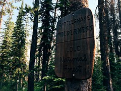
Rattlesnake Wilderness sign on the Stuart Peak trail

From the junction, we continued northeast on 517 up a couple of long stretches and a couple of series of switchbacks, the forest thinning and beargrass increasingly blooming as we rose. At 7 3/4 miles we reached the top of the switchbacks and the Rattlesnake Wilderness boundary. From there, we continued 1 1/4 miles on a flat to slightly uphill stretch to an overlook of Twin Lakes.

The final stretch followed a steep, rough trail along the ridgline to the southeast from Trail 517 about 1/2 mile to Stuart Peak, bringing our elevation gain to more than 4,200 feet. Most days, you can see south to Missoula and the Bitterroot Mountains or north across the wilderness to the Mission and Swan ranges. With the smoke however, we could see only the lakes below and other mountains in the immediate area.

Smoke and sun on my run up Stuart Peak

After stopping at the top for some photos and to eat, we backtracked to the trailhead, finding it hotter and smokier than when we left about 4 hours and 15 minutes earlier.


July 17, 2014

Sheep Mountain marathon before the marathon

My Missoula trail marathon today: Out Rattlesnake Creek, back over Sheep Mountain

Last Saturday - the day before the Missoula Marathon - a friend and I decided to run a marathon of our own up Rattlesnake Creek and back over Sheep Mountain and Blue Point.

The day was hot, so we started early, and after a few short side trips ended at 26 1/2 miles and nearly 5,100 feet of elevation gain.

My Missoula trail marathon today: Out Rattlesnake Creek, back over Sheep Mountain

From the main Rattlesnake National Recreation Area trailhead, we followed the wide Trail 515 for eight rolling miles to Franklin Bridge, stopping there to filter some water. A short distance up the hill from the bridge, we turned east on Trail 514 and climbed about 1 1/2 miles through the forest above the East Fork of the creek. When the trail reached another junction, we continued southeast downhill, still on 514, and crossed the creek, then climbed again through the forest thick with beargrass. At the next junction, a little more than 1 3/4 miles later, we continued southeast again a short distance until reaching Trail 513 between Sheep Mountain and Mineral Peak.

My Missoula trail marathon today: Out Rattlesnake Creek, back over Sheep Mountain

Turning west on 513, we followed the wide ridge southwest then switchbacked steeply up to the top of 7,646-foot Sheep Mountain at about 15 1/2 miles, where we took another break at a small stone-walled shelter. After eating and taking in the view, we continued about 3 3/4 miles along the open ridge over another small point, down below treeline and back up to the Blue Point junction. After a 1/2-mile out-and-back detour to the overlook, we returned to Trail 513 and followed the ridge down about 4 miles into Woods Gulch. After another brief stop to refill our packs with water, we continued west down to the trailhead and followed roads about a mile back to the main Rattlesnake trailhead.
After about six hot hours out we had our mountain marathon.

(Note: My GPS malfunctioned, resulting in all laps being recorded, but only half a map, so it isn't posted here.)

May 23, 2014

Faster finish and faster field at Paradise


I ran the 11 Miles to Paradise trail race Sunday and crossed the finish well more than 7 minutes faster than last year. While I moved up place-wise compared to last year, the change wasn't as great due to a fleeter field.

My training has been greatly increased through winter and spring as I prepare for the Bighorn Mountain Wild and Scenic 50-mile race, but when a couple of people told me they thought I'd finish Paradise in 1 hour and 20 minutes or less I wasn't so sure. Later, after calculating the pace - 7:37 per mile - it seemed within reach. The course is fairly level, but it would depend on the hillier second half.

I started with a 6:26 first mile - perhaps a bit too fast - but maintained through the hills and finished right at 1:20:2.05, in 34th place overall. Last year, when I finished in 46th at 1:27:53, that time would have put me in 20th place.

Still, I'm pleased, and I'm slowing down to go longer at Bighorn!

April 21, 2014

11 Miles to Paradise twice, and more


Last weekend marked a big step in my ultramarathon training - it was the first time I've put in back-to-back runs of 20 miles or more. In all, I covered about 46 miles.

On Saturday, a training partner and I ran partway up Missoula's Rattlesnake Valley on road, then continued on trail along the creek through the main corridor of the recreation area. By the time we turned around, we were crossing short patches of snow left from the hard winter. Once back in town, I made a warm, sunny detour to Reserve Street to pick up the car from Jen at work, ending at about 25 miles.

Sunday was something of a treat: Before Saturday's run, we were invited to join a small group in an Easter Sunday tradition of running out and back on the course for the 11 Miles to Paradise race.

After a brief stop at the Runner's Edge store downtown, we met the rest of the group at the Ferry Landing picnic area along the Clark Fork River 11 miles east of St. Regis on Montana Highway 135. The picnic area serves as the finish line for the race and would be our starting and ending point.

In the race, most of the hills are in the second half, meaning our run would put hills at both the start and the end. Our group of eight set out west through the forest, with glacier lilies and trillium blooming on the mossy ground and creeks flowing to the river below the trail. We stuck together to the race starting area, scrambling over a few downed trees and stopping to fuel a couple of times along the way. After a break at the race starting area, we backtracked to the finish a little short of 22 miles, stopping another couple of times and splitting up as legs tired.

When I woke that morning, I was a little concerned about how my legs would feel after the long weekend, but while tired in general I don't feel worse for wear than normal. That's probably a good thing, considering more of these weekends lie ahead on the way to the Bighorn Mountain Wild and Scenic 50-mile race.

October 27, 2013

Golden trees and lower flows at Morrell Falls

morrell_falls_20131020_115

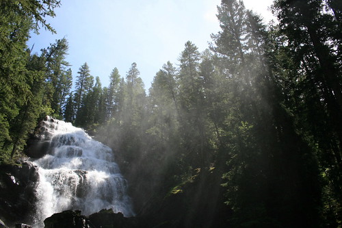
Morrell Falls, outside of Seeley Lake, is a classic western Montana hike, and now is one of the best times of the year to see it.

In the spring, beargrass grows thick in the open forest near the start and a torrent of whitewater cascades over the cliff at the end. In the fall, larch on the front of the Swan Range are golden and the water flows less voluminously, revealing more detail.

Recently, we set out from the parking lot northwest through the level forest, the floor covered in the remnants of spring's beargrass bloom. Slowly, larch began to appear - a yellow tree here and there among evergreens.

The route climbed a couple of short stretches, beginning near the halfway point, then passed two small lakes at about two miles. Here, stands of golden trees could be seen around the shore and up the side of Crescent Mountain.

morrell_falls_20131020_054

Just past the lakes, the trail crossed a bridge over Morrell Creek, curved back east at the foot of a steep hill and arrives at the falls.

After a break for some long-exposure photographs of the water streaming down the rocks and to let the dogs splash in the creek, we turned back to the trailhead.
The drive back to Missoula, past Salmon Lake and through the Blackfoot River canyon was equally as enjoyable, with more fall colors and bighorn sheep.

marco_flats_20131020_024

Here are more photos of Morrell Falls.

Distance: 5.2 miles round trip.

Trailhead: From the north edge of Seeley Lake, follow Morrell Creek Road east about 1 mile and then north about 5.7 miles. Drive east again 0.8 miles to the end of the road, turning north where it forks.

October 22, 2013

A fall 30K to finish my race year


I recently ran my first Blue Mountain 30K - Missoula's second longest race and a beautiful fall event!

The course climbs and descends the trails and forest roads of the Blue Mountain National Recreation Area on the southwest edge of town, gaining 3,500 feet of elevation and topping out at Hayes Point. Held in early October, the morning began brisk but warmed as the sun rose in the sky and the forest was awash in greens, yellows and oranges. (Speaking of oranges, the mimosa with a mile to go was a nice touch!)

After running most of the course in September with a couple of friends, I figured I'd finish in about 3 hours and 15 minutes. With about three miles to go on race day, I realized I had a chance at being under 3 hours. In the end, I crossed the line in 18th place overall at 2:53.35.

Blue Mountain was likely my final race of the year, but I'll be back at it in 2014 with some of my favorite events and, hopefully, some new ones.

January 2, 2013

Fall walking around western Montana

Fall has turned to winter and 2012 to 2013, and our year finished with a few smaller outings around western Montana after our big trip to Iceland.

In October, we went up to the Seeley-Swan Valley and west to the Fish Creek area, where the larch trees were turning yellow. In November, I took one last walk up Mount Jumbo, in town, before it closed to the public for the season, then we went south in search of birds at Stevensville's Lee Metcalf National Wildlife Refuge.

Lake Elsina and Lake Dinah

elsina_dinah_20121007_036

Lake Elsina and Lake Dinah sit in the Mission Mountains northwest of Seeley Lake and the end of this hike provides a beautiful view of the Swan Range to the east. We've been here several times over the years, and while it can be crowded at Lake Elsina we've only encountered a handful of people beyond.

The trail rounds the forested east side of Lake Esina, below, then climbs up through cliff bands. After leveling, it leaves the trees on a ledge above Lake Dinah with views of the Swan. The route ends by descending to the western shore of the Lake Dinah at 2.5 miles and a protrusion of land that would make an ideal campsite.

elsina_dinah_20121007_005

More photos from Lake Elsina and Lake Dinah are here.

Distance: 5 miles round trip.

Trailhead: To get to Lake Elsina, follow Montana Highway 83 about 4 3/4 miles north of Seeley Lake and turn west on Boy Scout Road. After about 3/4 of a mile more, turn north on Fawn Creek Road and follow the signs at several junctions for about 12 1/2 miles to the lake.

Burdette Creek

burdette_creek_20121014_004

We'd only been out in the Fish Creek area west of Missoula one other time and were looking for an easy but new walk when we chose Burdette Creek. At the time we were there, the larch were golden and foliage lower to the ground was a palette of yellows, oranges and reds.

The trail begins by following an old road cut west and north, up and over a ridge behind private property, before dropping into the valley holding Burdette Creek. Shortly after reaching the bottom, the trail levels and crosses the creek at the 1 mile mark, then parallels it upstream to the north. Along the way, there are views of the creek and surrounding hills. We continued to a second creek crossing at 2.5 miles, then turned back.

burdette_creek_20121014_020

A few more photos are here.

Distance: We hiked 5 miles round trip, but the trail continues.

Trailhead: To reach Burdette Creek, follow U.S. Highway 12 west of Lolo for 25 3/4 miles. Turn northwest on Fish Creek Road and follow it 9 miles to the trailhead. Fish Creek Road also can be accessed from Interstate 90 about 8 miles east of Alberton. The trailhead is then 22 miles south.
Lee Metcalf National Wildlife Refuge

lee_metcalf_20121104_103

On the edge of Stevensville, Lee Metcalf National Wildlife Refuge is a good spot to watch birds in the Bitterroot Valley. There are a couple of miles worth of trail winding through tall cottonwoods along the east bank of the Bitterroot Valley. On our visit, we saw great blue herons, woodpeckers, kingfishers, a variety of waterfowl and more.

lee_metcalf_20121104_019

More Lee Metcalf photos are here.

Trailhead: The refuge's main trailhead is 1/3 mile east of Stevensville on the Eastside Highway, then 2 miles north on Wildfowl Lane.

June 10, 2012

A quicker Pengelly Double Dip


Yesterday's Pengelly Double Dip trail race up University Mountain and Mount Sentinel far exceeded my expectations. My time of 2 hours, 18 minutes and 26 seconds was about 16 1/2 minutes faster than the only other time I've run the race and, more importantly, I accomplished it without any injury.

If you've been reading this blog or my Twitter stream for the past year and a half, you know I've been working back from an Achilles tendon injury. That time has been filled with physical therapy and slow progress. I got back to running races this year with a plan to enter some of the more fun events in the area, and started with the Snow Joke Half Marathon in January and the 11 Miles to Paradise trail race in May.

The Double Dip, however, is much more work - a trail half marathon with more than 3,000 feet of cumulative elevation gain up two mountains on the edge of town. It first switchbacks up to the "M" from the valley floor, then crosses the Sentinel fire road and works its way around into Pattee Canyon. It then ascends University Mountain, drops back to a saddle and rises up Sentinel. After returning to the saddle, it switchbacks down to the Clark Fork River and returns to the start.

My main concern in getting back to races has been reinjuring my leg, especially at the Pengelly, with all of the climbing. About a week and a half ago, I ran the course at what I thought was a slow pace to make sure I could handle it - turned out, I did it slightly faster than the first time I raced.

At the start yesterday, I again set out to run it slowly. I also purposely didn't look at the time or pace elements on my GPS until I had reached the valley floor with about a mile to go. To my surprise, I was well ahead of my previous time.

Looking back at the stats, I started the race at a slightly slower pace and was able to run the top mile - with the steepest climb - much faster than last time.

As for my plan to stick to more interesting races this year, I've got at least one more this summer - the Mountain to Meadow half marathon at Lolo Pass - and possibly a short road/trail race - the Ten Spoon 10K on the summer solstice at a local winery!

May 28, 2012

On the run, and on the trail

I ran my first race of the spring/summer season last weekend, and it was a fast, fun one. The 11 Miles to Paradise race takes place on a trail through the Lolo National Forest between St. Regis and Quinn's Hot Springs, outside of Paradise.

Being that it follows the Clark Fork River downstream, there's an overall elevation loss - which probably helped to increase the pace - but there are a few climbs. The first half is fairly level and fast with one notable rise, while the second half has most of the uphill and ends with a quick descent.


This year was only the second for the race, but it's well-organized, with shuttles to the start and back from the finish and lunch and a soak in the hot springs provided for all runners!

December 5, 2010

Fall wasn't forgotten

blue_mountain_20101017_047

Been a while since I've posted anything, but we did get out and about in western Montana this fall before the snow fell, albeit close to home.

With Mom visiting in October, we took a stroll up to the lookout atop Blue Mountain. Saw a lot of yellow larch and aspen, some red huckleberry leaves and some drying thistles. See photos here.

tower_20101031_005

We've also gone on plenty of morning walks at Missoula's Tower Street Conservation Area. Since first visiting a little more than a year ago, this has become our go-to spot to take the dogs in the morning; it's not far down the road from the house, but is away from the hustle and bustle of the riverfront downtown. Photos are here - they were a test of sorts from my fairly new cell phone.

September 8, 2010

Backpacking with Gigi

heart_pearl_lakes_20100905_002

Over the past year, we've watched our 16-year old dog Gigi slow down quite a bit, and one goal going into summer was to get her out on one more backpacking trip. Between rain showers and a flurry of work, we accomplished that with a night at Heart and Pearl lakes, near Superior, over Labor Day weekend.

The hike is tried and true - we've done it numerous times in our years here - and it's ideal in any season. And with all the cool wet weather we had through August, fall's colors are already evident.

The trail tracks south through the trees along Trout Creek, climbs to Heart Lake at about 2 1/4 miles, rounds the shore and rises east out of the forest to a grassy basin holding Pearl Lake at about 3 miles.

heart_pearl_lakes_20100904_061

Gigi was a trooper the whole way, but was definitely weary by the time we returned to the car. It helped that we had our younger dog, Belle, pack in both pups' food. It was also wise that we brought along fleece blankets for them, as the partly sunny weather Saturday turned into a cloudy chill Sunday morning.

The trip was quick but worth it, as our two tired dogs can attest.

Find more photos from our trip to Pearl Lake here.

Distance: About 6 miles round trip.

Trailhead: From Superior, follow Diamond Match Road southeast and Trout Creek Road southwest - one turns into the other - for 19 miles.

July 21, 2010

Geography lesson

illinois peak_20100720_060

Where can you see Montana, Idaho, Oregon and Illinois - Illinois? - on the same dayhike? On the Stateline Trail, southwest of Superior.

In the five miles southeast of Cascade Pass, Montana and Idaho make up the ridge that the trail tracks, then there are the Oregon Lakes and Oregon Peak, and Illinois Peak.

There are a variety of access points to the Stateline Trail, Cascade Pass being a relatively easy, but long approach. It's about 25 bumpy, dusty miles by car from Superior. On Tuesday, my dog Belle and I had the trail to ourselves - only one other vehicle was in the parking area, but we never saw anyone else.

From the pass, I've been northwest to Bonanza Lakes before, but this was the first time I've headed southeast to Illinois Peak.

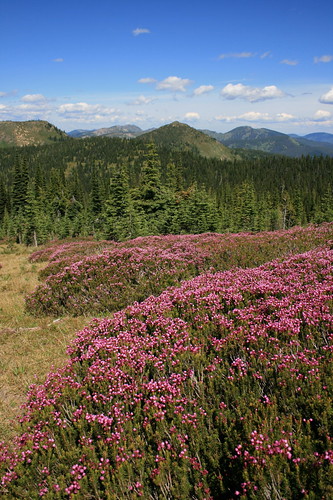
The route is mostly open, grassy forest with gentle ups and downs. In fact, the terrain bears a resemblance to hiking in Scotland or the Australian Alps, especially with the abundant pink mountain heather, top. I was also quite surprised by the variety of wildflowers in bloom - bluebells, a few varieties of penstemon, bracted lousewort, purple shooting stars, heather, yellow pasqueflower, mountain gentian, phlox and more.

At about 1 3/4 miles, the path passes above the uppermost of the three Oregon Lakes, with its deep blue water. The trail steepens at four miles and climbs through some interesting rocks - look for the ripples of old seabed. At about 4 1/2 miles, take the east fork through two junctions, then it's up the final push to the grassy summit of the 7,690-foot mountain.

illinois peak_20100720_187

A great start to a week of vacation!

Here are some photos.

Distance: 10 miles round trip.

Trailhead: From Superior, follow Diamond Match Road on the west side of Interstate 90 about 1 1/4 miles southeast, then Cedar Creek Road (Forest Road 320) 25 miles southwest to Cascade Pass.

July 5, 2009

The big bloom

morrell_falls_20090705_020

Last weekend, it was hiking with my mom - this weekend, Jen's mom. With more family in town, we took a short drive up to the Seeley Lake area to hike to Morrell Falls.

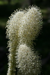
We get to the falls nearly every year, but this year our walk coincided with the beargrass bloom. For weeks, I've been hearing through my other blog - WildflowerWalks.com - that the big, white flowers have been particularly plentiful this season, but I haven't been able to get out hiking anywhere where they are until now.

morrell_falls_20090705_058

I've seen beargrass on the Morrell Falls trail before, but not like this. Along the path, the trees are fairly evenly spaced a couple of arm lengths apart, and between most of them the puffball-like flowers were growing in patches.

If you get the chance, see it while you can. Oh, yeah - and cool off in the mist of the falls.

See the pictures here.

Distance: 5.2 miles round trip.

Trailhead: From the north edge of Seeley Lake, follow Morrell Creek Road east about 1 mile and then north about 5.7 miles. Drive east again 0.8 miles to the end of the road, turning north where it forks.

March 22, 2009

Buttercups at Blue

blue_mountain_20090321_012

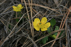
Buttercups are coming up at the Blue Mountain National Recreation Area on the southwest side of Missoula.

The snow is melted, the mud is drying out and green leaves are sprouting from the brown ground - spring is officially here.

I first saw these flowers only a day after it snowed last week. And there are more on the way: Prairie smoke leaves and either yellow bell or shooting star shoots are poking through.

February 22, 2009

Sunny Sentinel stroll

sentinel_20090222_035

It was quite a nice weekend, and after spending a day finishing up some work and running errands, it was good to get out and stretch our legs on a walk up Mount Sentinel.

Only two weeks ago, I was skiing up Crazy Canyon Road at the Pattee Canyon National Recreation Area. While there's still a decent base of snow on the old dirt track, it's quickly turning to slush and mud. Aside from the warm weather, other signs of spring's approach were the many chirping birds and the season's first green leaves poking out from the ground.

I've been up Mount Sentinel too many times to count, so I didn't take too many pictures (and Jen left her camera at home), but there are a few here.

Distance: 7 miles round trip. (Numerous side trails can be used to shorten or lengthen the hike.)

Trailhead: In Missoula, drive 3.5 miles up Pattee Canyon Drive from South Higgins Avenue to the Crazy Canyon trailhead.
November 30, 2008

Snow dogs

heart_lake_20081123_078

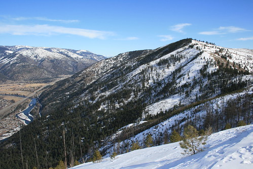
After a month of weekends spent raking leaves, cleaning gutters or indoors due to rain, we finally got back out into the woods with the dogs - and while it's still brown around here, we got up high enough to get into our first real snow of the season.

Check out the latest photos of us at Heart Lake, west of Superior, here.

Distance: 4.4 miles round trip.

Trailhead: From Superior, follow Diamond Match Road southeast and Trout Creek Road southwest - one turns into the other - for 19 miles.