July 20, 2014

Beating the heat at 3 Bitterroot lakes

baker_lake_2014-07-13_100

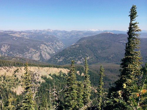
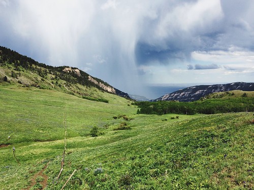
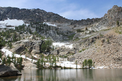
To beat the heat last Sunday, we took the dogs on a hike to to a trio of lakes that lie just below 10,157-foot Trapper Peak, the highest in the Bitterroot Mountains. The trail to Baker, Middle and Gem lakes is short and steep, but worth the view.

baker_lake_2014-07-13_017

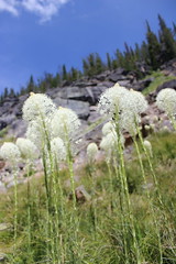
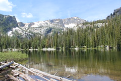
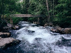
The trail begins uphill to the south of the parking area, then switchbacks steeply west to Boulder Point at a little less than half a mile. After a short section through the forest, the trail crosses a south-facing slope, descending slightly and passing through several open stretches filled with beargrass. The trail then climbs into the forest to Baker Creek, where fallen trees block the way. From here, it's easiest to walk uphill over the flat rock along the creek to the shore of Baker Lake at about 1 1/2 miles. Several campsites are available here, and Trapper Peak stands above the drainage to the west.

baker_lake_2014-07-13_034

Rounding the lake on either side - we went north, through a small boulder field - the trail continues along a marshy stretch of creek though the forest about another mile to Middle Lake, entering the Selway-Bitterroot Wilderness along the way.

baker_lake_2014-07-13_063

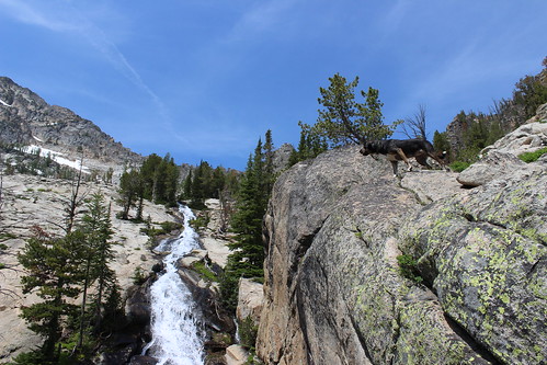
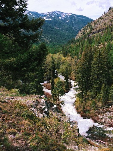
From Middle Lake, the trail stays north of the creek and rises steeply out of the forest onto more flat rock and along a cascade about 1/3 of a mile to Gem Lake. The clear pool of water sits with snow at its edge even in July, with the false summit of Trapper Peak directly above it to the west. The water was so cold, in fact, that the dogs opted not to swim at Gem.

After a short break - mostly spent swatting at mosquitoes - we made our way back downhill to the trailhead.

Here are more photos from Baker, Middle and Gem lakes.

Distance: 5 1/2 miles round trip.

Trailhead: From Darby, drive about 4 1/3 miles south on U.S. Highway 93 and turn onto West Fork Road. Follow West Fork Road south for 7 miles, then turn northwest onto Pierce Creek Road. (While this turn is listed as being signed in guidebooks and on websites, we found none; the road is adjacent to mile marker 7 and has fenced pastures on each side.) Drive uphill northwest through an intersection; at a second intersection about one mile up, continue northwest as directed by a sign 9 miles to the Baker Lake trailhead.

July 17, 2014

Sheep Mountain marathon before the marathon

My Missoula trail marathon today: Out Rattlesnake Creek, back over Sheep Mountain

Last Saturday - the day before the Missoula Marathon - a friend and I decided to run a marathon of our own up Rattlesnake Creek and back over Sheep Mountain and Blue Point.

The day was hot, so we started early, and after a few short side trips ended at 26 1/2 miles and nearly 5,100 feet of elevation gain.

My Missoula trail marathon today: Out Rattlesnake Creek, back over Sheep Mountain

From the main Rattlesnake National Recreation Area trailhead, we followed the wide Trail 515 for eight rolling miles to Franklin Bridge, stopping there to filter some water. A short distance up the hill from the bridge, we turned east on Trail 514 and climbed about 1 1/2 miles through the forest above the East Fork of the creek. When the trail reached another junction, we continued southeast downhill, still on 514, and crossed the creek, then climbed again through the forest thick with beargrass. At the next junction, a little more than 1 3/4 miles later, we continued southeast again a short distance until reaching Trail 513 between Sheep Mountain and Mineral Peak.

My Missoula trail marathon today: Out Rattlesnake Creek, back over Sheep Mountain

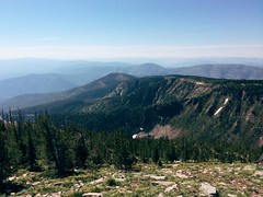
Turning west on 513, we followed the wide ridge southwest then switchbacked steeply up to the top of 7,646-foot Sheep Mountain at about 15 1/2 miles, where we took another break at a small stone-walled shelter. After eating and taking in the view, we continued about 3 3/4 miles along the open ridge over another small point, down below treeline and back up to the Blue Point junction. After a 1/2-mile out-and-back detour to the overlook, we returned to Trail 513 and followed the ridge down about 4 miles into Woods Gulch. After another brief stop to refill our packs with water, we continued west down to the trailhead and followed roads about a mile back to the main Rattlesnake trailhead.

After about six hot hours out we had our mountain marathon.

(Note: My GPS malfunctioned, resulting in all laps being recorded, but only half a map, so it isn't posted here.)

July 4, 2014

The road home through Yellowstone

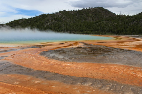
midway_geyser_basin_2014-06-22_083

After the Bighorn Mountain Wild and Scenic Run near Sheridan, Wyoming, we turned back toward home - but as with the drive down, we took the slower road and came through Yellowstone National Park.

On the first of day of our two-day drive, we came west through Cody and the east entrance, over Sylvan Pass, past Yellowstone Lake, north to the geyser basins along the Firehole River and down the Madison River to West Yellowstone. The second day, we drove back up the Madison, then the Gibbon River to the Norris Geyser Basin, departing the park on the north at Gardiner. Along the way, we saw full rivers and waterfalls, colorful thermophiles, bubbling mud and steaming pools - and got stuck in summer wildlife jams, first for bison and then for a bear.

Since it was a tour of roadside attractions, I decided to put my photos together in a slideshow.

July 3, 2014

Big canyon, bighorns, wild horses on the state border

devil_canyon_2014-06-18_002

On our trip to Wyoming recently, we took the longer, more scenic route south and camped for a night at Bighorn Canyon National Recreation Area, which straddles the border with Montana north of Lovell.

While it's perhaps better known as a boating destination, we found a couple of short trails with spectacular views of the canyon's colorful cliffs, as well as wildflowers and wildlife. (I was taking it easy before the Bighorn Mountain Wild and Scenic Trail Run, anyway.)

The day we arrived, we drove the main road north from our campsite at Horseshoe Bend along the west rim of the canyon to its end, stopping at a few spots along the way.

Devil Canyon Overlook

devil_canyon_2014-06-18_148

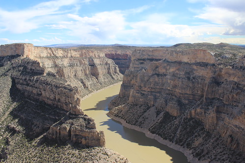
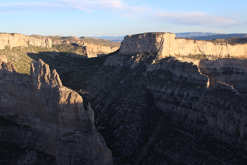
The first was Devil Canyon Overlook, where you can look down 1,000 feet to Bighorn Lake from a fenced-off parking lot. Below, Porcupine Creek enters the lake from the east.

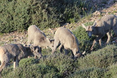
That evening, we returned to the overlook and found ourselves amid a herd of grazing bighorn ewes and lambs. We also caught the last daylight rising up the canyon walls and lighting the rocks at the top.

devil_canyon_2014-06-18_032

Location: From Lovell, drive about 2 1/2 miles east on U.S. Highway 14A, 15 1/2 miles north on Wyoming Highway 37 and 1/2 mile east on the overlook road.

Sullivan's Knob Trail

sullivans_knob_2014-06-18_007

A short distance north on the road, we pulled over and hiked the Sullivan's Knob Trail, rounding a rocky outcrop and dropping slightly to the edge of the canyon.

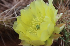
Along the way, we found an abundance of prickly pear cactus in bloom, as well as birds.

Distance: 1 mile round trip.

Trailhead: From Lovell, drive about 2 1/2 miles east on U.S. Highway 14A and 16 miles north on Wyoming Highway 37.

Ranger Delight Trail

ranger_delight_2014-06-18_057

After driving to the Barry's Landing boat ramp at the end of the paved road, we turned back and stopped south of the overlook at the Ranger Delight Trail.

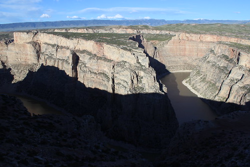
Here, the trail climbed to the canyon edge above a large bend in the lake and provided a view back to the red rocks near our campsite.

Distance: 1/2 mile round trip.

Trailhead: From Lovell, drive about 2 1/2 miles east on U.S. Highway 14A and 14 miles north on Wyoming Highway 37.

crooked_creek_2014-06-19_133

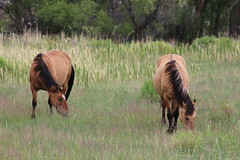
Before we departed for Sheridan the next morning, we made another quick drive up to the overlook. On the way, we found a few wild horses just inside the Pryor Mountain Wild Horse Range near Crooked Creek.

More photos of Bighorn Canyon are here.

June 29, 2014

50 miles of muddy running in the Bighorns

Remnants of a lightning storm that struck on The Haul at the Bighorn Mountain Trail Run

Mud and snow. Sun. Sweat. Thunder, lighting and rain. More mud. Oh, and a lot of junk food.

That about sums up my first 50-mile ultramarathon, the Bighorn Mountain Wild and Scenic Trail Run last weekend in Wyoming. Sure, it was difficult - but it was fun and I'd do it again.

After a couple of months of preparation - and a stop at Bighorn Canyon National Recreation Area with Jen - I woke early and drove with friends to the Jaws Trailhead near 8,800 feet in the Bighorn Mountains west of Dayton before sunrise. It was in the high 30s - not as cold as anticipated - so I didn't bother with gloves or a warm hat.

Sunrise at the start of the Bighorn Mountain Trail Run

At first light, and after a brief moose sighting at the trailhead, we were off, starting out on singletrack through forest and meadows, with plenty of mud and short stretches of snow. After about five miles, the terrain was mostly open, descending through grassy slopes and the occasional stand of trees, and crossing several streams. I had to take care not to start too fast as I have done in other races - there was a long day ahead. The canyon closed in around the Little Bighorn River and we returned to the forest before reaching the Footbridge checkpoint at about 18 miles.

After eating, changing my socks and grabbing my trekking poles from a drop bag at Footbrige, I made my way up The Wall, rising from about 4,800 feet to 6,300 feet in three miles. The going was slow, and clearings along the way provided opportunities for brief stops to take in the view of the Little Bighorn drainage below and the surrounding cliffs. Above the Dry Fork of the Little Bighorn, the singletrack continued up and down through forest and meadows for about seven miles. As the day warmed, the trail turned to a double track and opened up, climbing again to the Dry Fork checkpoint at about 34 miles and 7,600 feet.

A meal, sock change and pole drop later, I continued from Dry Fork back up to about 7,900 feet then down the Sheep Creek drainage. Here, the trail returned to singletrack and the last real ascent, a few hundred feet up The Haul at 7,600 feet. On The Haul, clouds moved in, rain fell, and thunder and lighting struck overhead - disconcerting when you're on an open pass, but also cooling in the hot afternoon. Unfortunately, the rain turned the trail to mud again, which stuck to my shoes and made it feel as if I were wearing bricks.

About five steep miles down through open meadows, the singletrack trail reaches forest again and continues along the Tongue River for a couple of miles to a trailhead at the end of Tongue Canyon Road. There, family, friends and others are allowed to follow runners, and Jen arrived on her bike with perfect timing while I was at the final aid station. She rode around me for a bit, falling back and going ahead to take some pictures.

Five more miles brought me back to Dayton and the finish in a park along the river at about 3,900 feet. After passing an encampment of people under a Run Wild Missoula tent on the final stretch, I crossed the line at about 52 miles in 11 hours 33 minutes and 42 seconds, 39th out of 117 runners. Ten feet beyond, I cooled off for a few minutes by sitting in the river.


In the days that followed, I had a few realizations - random and revealed by the information from my GPS:

At the aid stations, I ate a lot more food than during training, some healthy and some I haven't had in at least a decade. In addition to the water and gels I carried and consumed on the trail, here's what I remember eating and drinking:

  • Orange slices (usual favorite)
  • Watermelon slices (perhaps new favorite)
  • Pineapple slices
  • A plum
  • Red grapes
  • Almond-pistachio-dried cherry mix 
  • Green olives with pimentos (surprisingly good)
  • A peanut butter cookie (probably had sometime in the past decade, but don't remember when)
  • Cheez-Its (probably had sometime in the past decade, but don't remember when)
  • Cheetos (don't know the last time had)
  • Fritos (don't know the last time had)
  • Ruffles (probably had sometime in the past decade, but don't remember when)
  • Hummus, vegetarian "pepperoni," sriracha and tortilla wraps (homemade training food packed in drop bags)
  • An American cheese, yellow mustard and tortilla wrap (I like mustard)
  • An American cheese and tortilla wrap (different aid station; out of mustard)
  • A slice of mushroom and spinach pizza (wary of melted cheese, but so good)
  • Heed
  • Sprite (don't know the last time had)
  • 7-Up (don't know the last time had)
  • Ginger ale (probably had sometime in the past decade, but don't remember when)
  • A green apple freeze pop (while running with a couple of miles to go; don't know the last time had, but perfect)

While I feel like I hiked more of the uphill stretches than I did during training, I had less non-moving time than on those same runs. On my longest training runs - 26 and 31 miles - I had about and hour of non-moving time, compared with about 45 minutes during the 52-mile race.

My fastest mile was the last mile, at about 8:45. I had been told the last stretch of road was a grueling march for many, but vowed I would only walk a couple of small hills on it.

And, most of all, Missoula's enthusiastic and supportive running community was reinforced with the large, loud crowd under the Run Wild tent at the end.

On the way home, Jen and I took a couple of days to drive through Yellowstone National Park, so you'll likely see some pictures here. And back in Missoula, I removed the dried clumps of mud from my shoes, socks and compression sleeves using the garden hose with the nozzle on the "jet" setting.

I'm already on the run again and need to start thinking about The Rut 50K in September.
June 5, 2014

The run down to Bighorn

Rattlesnake Creek rapids through the forest

The taper has begun!

I've run my longest weekend - more than 54 miles, with a 31-mile Saturday and 23-mile Sunday - and longest week - 83 miles - and am in my last couple of weeks of preparation for the Bighorn Mountain Wild and Scenic 50-mile race.

A few statistics for Jan. 1 through June 1:

  • Number of runs: 96
  • Total miles: 1,123
  • Total elevation gain: 134,667 feet

In the middle of that period, I literally ran until my shoes fell apart - after more than 750 miles on that pair, the sole ripped in two places and peeled away during a race.

In the snow at Blue Mountain

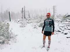
Missoula's particularly cold and snowy winter made for some challenging runs, even on roads. After a springlike weekend run through Hells Canyon on the Idaho-Oregon border in late March, I turned more to local mountains, but still managed to find lingering drifts and get caught in a late storm.

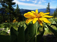
While the high-country snow is holding on, mountains around town have traded flakes for wildflowers. A friend and I even managed to get in a marathon over three of the city's iconic summits: Mount Sentinel/University Mountain, with the "M"; Mount Jumbo with the "L"; and the North Hills/Randolph Hill, with the peace sign.

The hillsides of Mount Jumbo’s North Zone are alive with arrowhead balsamroot

If all goes according to plan, my long back-to-back weekend runs will be compressed into a single 50-miler through the Bighorn Mountains near Sheridan, Wyoming, on Saturday, June 21.

May 23, 2014

Faster finish and faster field at Paradise


I ran the 11 Miles to Paradise trail race Sunday and crossed the finish well more than 7 minutes faster than last year. While I moved up place-wise compared to last year, the change wasn't as great due to a fleeter field.

My training has been greatly increased through winter and spring as I prepare for the Bighorn Mountain Wild and Scenic 50-mile race, but when a couple of people told me they thought I'd finish Paradise in 1 hour and 20 minutes or less I wasn't so sure. Later, after calculating the pace - 7:37 per mile - it seemed within reach. The course is fairly level, but it would depend on the hillier second half.

I started with a 6:26 first mile - perhaps a bit too fast - but maintained through the hills and finished right at 1:20:2.05, in 34th place overall. Last year, when I finished in 46th at 1:27:53, that time would have put me in 20th place.

Still, I'm pleased, and I'm slowing down to go longer at Bighorn!

April 21, 2014

11 Miles to Paradise twice, and more


Last weekend marked a big step in my ultramarathon training - it was the first time I've put in back-to-back runs of 20 miles or more. In all, I covered about 46 miles.

On Saturday, a training partner and I ran partway up Missoula's Rattlesnake Valley on road, then continued on trail along the creek through the main corridor of the recreation area. By the time we turned around, we were crossing short patches of snow left from the hard winter. Once back in town, I made a warm, sunny detour to Reserve Street to pick up the car from Jen at work, ending at about 25 miles.

Sunday was something of a treat: Before Saturday's run, we were invited to join a small group in an Easter Sunday tradition of running out and back on the course for the 11 Miles to Paradise race.

After a brief stop at the Runner's Edge store downtown, we met the rest of the group at the Ferry Landing picnic area along the Clark Fork River 11 miles east of St. Regis on Montana Highway 135. The picnic area serves as the finish line for the race and would be our starting and ending point.

In the race, most of the hills are in the second half, meaning our run would put hills at both the start and the end. Our group of eight set out west through the forest, with glacier lilies and trillium blooming on the mossy ground and creeks flowing to the river below the trail. We stuck together to the race starting area, scrambling over a few downed trees and stopping to fuel a couple of times along the way. After a break at the race starting area, we backtracked to the finish a little short of 22 miles, stopping another couple of times and splitting up as legs tired.

When I woke that morning, I was a little concerned about how my legs would feel after the long weekend, but while tired in general I don't feel worse for wear than normal. That's probably a good thing, considering more of these weekends lie ahead on the way to the Bighorn Mountain Wild and Scenic 50-mile race.

March 24, 2014

A weekend run through Hells Canyon

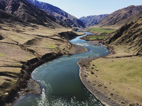
Gorgeous views from the weekend’s 24.5-mile Hells Canyon Run

My running year is officially underway, although the first event was the unofficial Hells Canyon Run this past weekend. While I had a couple of problems, it wasn't a race and I had a great day overall.

On a March weekend, runners from around the Northwest arrive at Pittsburgh Landing on the Snake River, in the Hells Canyon National Recreation Area near White Bird, Idaho. There's a potluck dinner the night before, and you board the boat and pay the driver the next morning - the only parts appear even semi-organized. Runners then are ferried upriver to one of two dropoffs - at roughly 15 and 25 miles away - and make their way back along the Snake River National Recreation Trail. There are no aid stations, and you are responsible for your water, food, garbage and safety.

I heard about the run last year and decided to go after learning that this year's event might be the last. Friends let me carpool down with them and share a campsite, bringing the Missoula contingent to about 12 to 15. After the snowy winter at home, it was nice to find spring weather in the canyon - partly cloudy skies, warm days, chilly nights and the season's first wildflowers blooming.

Gorgeous views from the weekend’s 24.5-mile Hells Canyon Run

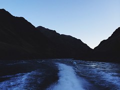
In the still-dark canyon at 6:15 Saturday morning, we boarded the first boat for the longer distance. About an hour later, we were dropped off on the rocky bank below Granite Creek rapids. After getting our gear organized, we started back down the trail in a line about 10 runners long.

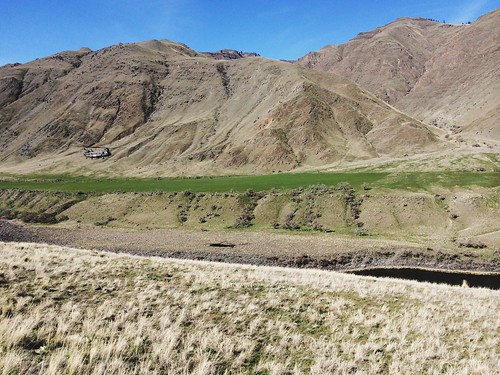
The first 10 miles of trail steadily rose and fell through the trees and grassy fields, crossed the occasional creek and passed a couple of historic homesteads. At the first creek, a friend in the lead of our group made it across dry, a few others splashed a foot, wetting the rocks, and I slipped and sank both of my shoes. We kept moving - now in a group of three Missoulians - and after a few miles my feet warmed.

After occasional stops to eat and take pictures, we arrived at Sheep Creek, the dropoff for the shorter distance. A little more than five miles farther and we stopped again to eat and take pictures. Just after we started again, a Chinook helicopter came into view low over the river, which prompted another picture break. We would later learn it was part of a search for a missing man after a boat sank farther upriver.

Gorgeous views from the weekend’s 24.5-mile Hells Canyon Run

My real problem came with about nine miles to go, when I tripped and fell, bloodying my hand and knee and dazing myself. I've fallen several times during winter and gotten the occasional scrape, but this was the worst I've done. After a few minutes of collecting myself, we started again with the two bigger climbs of the day ahead.

A short distance later, we were standing on cliffs and looking down at the winding Snake directly below - one of the best views of the day. After dropping back to river level, we reached the historic Kirkwood Ranch and stopped to look in the small museum there that's accessible only by trail. Departing the ranch with about six miles to go, we made our steepest climb of the day up a series of switchbacks to a long traverse high above the river and watched as the search helicopter passed below us.

A couple of miles farther, we dropped to the river for the final stretch along the cliffs back to Pittsburgh Landing. My running partners graciously kept with me until the last two miles as I slowed after my fall, and I ran in with two other people we caught.

In the end we covered about 24.5 miles and 4,300 feet of elevation gain, although my GPS became disconnected from satellites a couple of times and logged a mile less.

Despite the problems, it was a beautiful day, and we followed it up with dinner back at camp in a group of about 10 Missoulians. The next day, we drove out of the canyon and headed for home.

Gorgeous views from the weekend’s 24.5-mile Hells Canyon Run

Here are more photos from Hells Canyon.

February 4, 2014

Canine-friendly cross-country skiing at Como Trails

como_trails_20140202_066

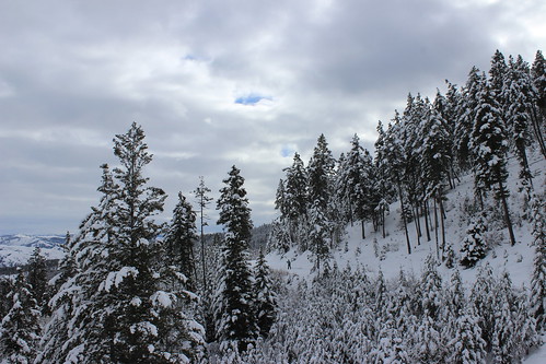
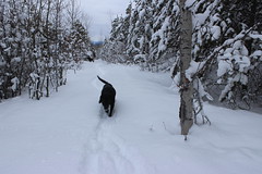
On Sunday, we traveled south of Hamilton to give the dog-friendly Como Trails cross-country ski area a try and found near solitude, encountering only a handful of people in the first and last mile.

There are plenty of places around Missoula to ski with dogs, but Como is one of only two that allows them on groomed trails. (The other is at Lubrecht Experimental Forest.) It's also the newest cross-country ski area in the region, opening in the winter of 2009-10, and this was our first trip there.

The trails begin above the shores of Lake Como, weaving over and among the ridges to the south. Not being familiar with them, we chose a loop that included Panorama Point, hoping for a good view.

como_trails_20140202_024

Our route began on a groomed road, then turned onto a narrower trail through the trees. After about 1 1/2 miles, we ascended a steep, untracked section of powder called Uff-Da to Panorama Point. Atop the ridge, we could see the surrounding mountains - the Bitterroots continuing to the west and the Sapphires across the valley to the east - but Lake Como was out of sight, beyond a ridge to the north.

After stopping briefly at the point, we followed a flat trail along the ridge to the next junction, then turned south and skied down to the Chute, which drops steeply to a lower trail at about three miles.

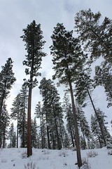
From the bottom of the Chute, it's five miles back to the parking lot on a wide, groomed trail that rolls through a relatively open forest of tall pine trees. Along the way, we passed a couple of parcels of fenced-off property that required a little dog calling - there were horses in one area - but otherwise were no trouble.

como_trails_20140202_070

We never did get a view of the lake, but there are more trails to explore in the future.

Here are more photos from skiing at Como Trails.

Distance: 8-mile loop. The area has a total of more than 30 miles of groomed trail.

Trailhead: Parking for Como Trails is 12 1/2 miles south of Hamilton on U.S. Highway 93, then 4 miles west on Lake Como Road, above the boat ramp.