March 24, 2014

A weekend run through Hells Canyon

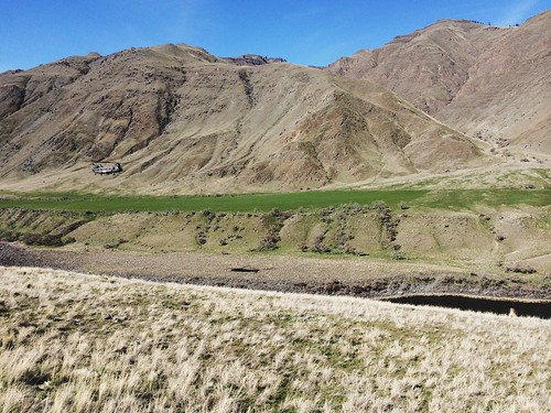
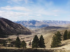
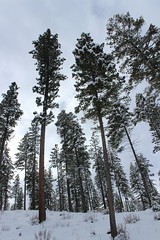
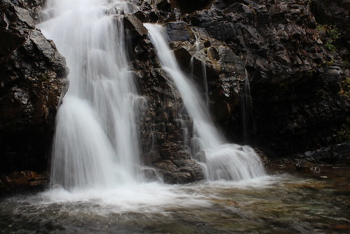
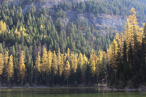
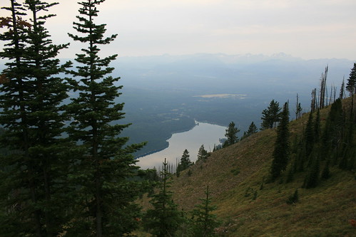
Gorgeous views from the weekend’s 24.5-mile Hells Canyon Run

My running year is officially underway, although the first event was the unofficial Hells Canyon Run this past weekend. While I had a couple of problems, it wasn't a race and I had a great day overall.

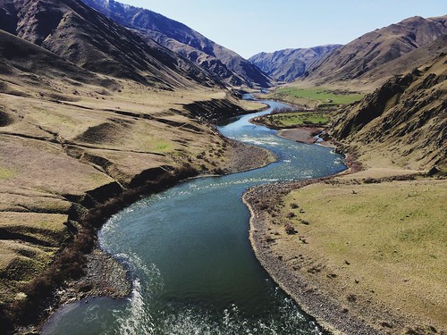
On a March weekend, runners from around the Northwest arrive at Pittsburgh Landing on the Snake River, in the Hells Canyon National Recreation Area near White Bird, Idaho. There's a potluck dinner the night before, and you board the boat and pay the driver the next morning - the only parts appear even semi-organized. Runners then are ferried upriver to one of two dropoffs - at roughly 15 and 25 miles away - and make their way back along the Snake River National Recreation Trail. There are no aid stations, and you are responsible for your water, food, garbage and safety.

I heard about the run last year and decided to go after learning that this year's event might be the last. Friends let me carpool down with them and share a campsite, bringing the Missoula contingent to about 12 to 15. After the snowy winter at home, it was nice to find spring weather in the canyon - partly cloudy skies, warm days, chilly nights and the season's first wildflowers blooming.

Gorgeous views from the weekend’s 24.5-mile Hells Canyon Run

In the still-dark canyon at 6:15 Saturday morning, we boarded the first boat for the longer distance. About an hour later, we were dropped off on the rocky bank below Granite Creek rapids. After getting our gear organized, we started back down the trail in a line about 10 runners long.

The first 10 miles of trail steadily rose and fell through the trees and grassy fields, crossed the occasional creek and passed a couple of historic homesteads. At the first creek, a friend in the lead of our group made it across dry, a few others splashed a foot, wetting the rocks, and I slipped and sank both of my shoes. We kept moving - now in a group of three Missoulians - and after a few miles my feet warmed.

After occasional stops to eat and take pictures, we arrived at Sheep Creek, the dropoff for the shorter distance. A little more than five miles farther and we stopped again to eat and take pictures. Just after we started again, a Chinook helicopter came into view low over the river, which prompted another picture break. We would later learn it was part of a search for a missing man after a boat sank farther upriver.

Gorgeous views from the weekend’s 24.5-mile Hells Canyon Run

My real problem came with about nine miles to go, when I tripped and fell, bloodying my hand and knee and dazing myself. I've fallen several times during winter and gotten the occasional scrape, but this was the worst I've done. After a few minutes of collecting myself, we started again with the two bigger climbs of the day ahead.

A short distance later, we were standing on cliffs and looking down at the winding Snake directly below - one of the best views of the day. After dropping back to river level, we reached the historic Kirkwood Ranch and stopped to look in the small museum there that's accessible only by trail. Departing the ranch with about six miles to go, we made our steepest climb of the day up a series of switchbacks to a long traverse high above the river and watched as the search helicopter passed below us.

A couple of miles farther, we dropped to the river for the final stretch along the cliffs back to Pittsburgh Landing. My running partners graciously kept with me until the last two miles as I slowed after my fall, and I ran in with two other people we caught.

In the end we covered about 24.5 miles and 4,300 feet of elevation gain, although my GPS became disconnected from satellites a couple of times and logged a mile less.

Despite the problems, it was a beautiful day, and we followed it up with dinner back at camp in a group of about 10 Missoulians. The next day, we drove out of the canyon and headed for home.

Gorgeous views from the weekend’s 24.5-mile Hells Canyon Run

Here are more photos from Hells Canyon.

February 4, 2014

Canine-friendly cross-country skiing at Como Trails

como_trails_20140202_066

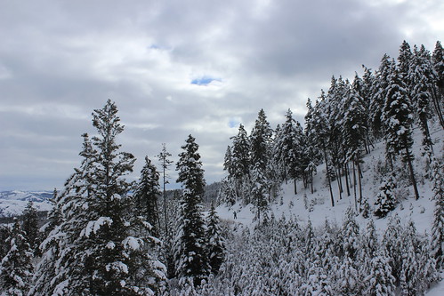
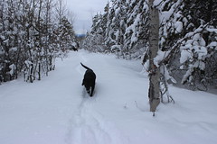
On Sunday, we traveled south of Hamilton to give the dog-friendly Como Trails cross-country ski area a try and found near solitude, encountering only a handful of people in the first and last mile.

There are plenty of places around Missoula to ski with dogs, but Como is one of only two that allows them on groomed trails. (The other is at Lubrecht Experimental Forest.) It's also the newest cross-country ski area in the region, opening in the winter of 2009-10, and this was our first trip there.

The trails begin above the shores of Lake Como, weaving over and among the ridges to the south. Not being familiar with them, we chose a loop that included Panorama Point, hoping for a good view.

como_trails_20140202_024

Our route began on a groomed road, then turned onto a narrower trail through the trees. After about 1 1/2 miles, we ascended a steep, untracked section of powder called Uff-Da to Panorama Point. Atop the ridge, we could see the surrounding mountains - the Bitterroots continuing to the west and the Sapphires across the valley to the east - but Lake Como was out of sight, beyond a ridge to the north.

After stopping briefly at the point, we followed a flat trail along the ridge to the next junction, then turned south and skied down to the Chute, which drops steeply to a lower trail at about three miles.

From the bottom of the Chute, it's five miles back to the parking lot on a wide, groomed trail that rolls through a relatively open forest of tall pine trees. Along the way, we passed a couple of parcels of fenced-off property that required a little dog calling - there were horses in one area - but otherwise were no trouble.

como_trails_20140202_070

We never did get a view of the lake, but there are more trails to explore in the future.

Here are more photos from skiing at Como Trails.

Distance: 8-mile loop. The area has a total of more than 30 miles of groomed trail.

Trailhead: Parking for Como Trails is 12 1/2 miles south of Hamilton on U.S. Highway 93, then 4 miles west on Lake Como Road, above the boat ramp.

January 7, 2014

Stepping up my ultramarathons in 2014

After a successful year of running in 2013 - including my first ultramarathon, the Trail Rail Run 50K, and the Blue Mountain 30K - I've decided to push myself farther and harder in 2014.

Over the weekend, I registered for a couple of major regional trail ultras: The Bighorn Mountain Wild and Scenic Trail Run 50-mile race and The Rut 50K. The 50-mile race is about 20 more than my longest run and both have significant elevation gain compared to last year's mostly level 50K.

In it's 22nd year, the Bighorn starts west of Dayton, Wyo., and runs back to the town just north of Sheridan. It starts above 8,800 feet, reaches as high as 9,300 feet and runs down to 3,900 feet, with 12,800 feet of elevation gain in between.

The Rut 50K at Big Sky Resort south of Bozeman is in its second year, but has quickly risen to prominence. Organized by local shop the Runner's Edge and world-class ultramarathoners Mike Foote and Mike Wolfe, who both call Missoula home, it recently was named the 2014 Skyrunner World Series Ultra Final. It gains 10,000 feet of elevation over its course between 7,500 and 11,100 feet.

I'd be lying if I said I wasn't at least a little nervous, but I've been running well for the past year - building speed and distance, and taking to the trails no matter the weather. I've also joined a spring marathon training group through Run Wild Missoula to continue that progress through winter.

There probably still will be smaller races along the way, and as always I'll be posting updates here!

January 1, 2014

My 2013 in photos

Google+ recently created a slideshow of photos I uploaded to the social network last year - here's what my 2013 looked like:


December 28, 2013

Climbing out of the fog in the Columbia Gorge


We've hiked the Columbia River Gorge many times, but until this month always on the Oregon side.

While in Portland, Ore., for a holiday visit in mid-December, we decided to spend a foggy day hiking to a couple of waterfalls in Beacon Rock State Park, on the Washington side. We didn't expect to find sun, but we did.

The trail to Hardy Falls, Rodney Falls and the Pool of Winds begins by climbing steadily northeast through the forest, the fog thick among the mossy limbs on the day we visited. After a little less than half a mile, it passes a clearing where another trail merges, then re-enters the forest and continues north.

The waterfall area begins at about one mile, where a side trail provides limited views of Hardy Falls spilling over a cliff and back into the forest. Here, we found mist clinging to spider webs as the sun began to burn through the fog.


A short distance back up the main trail, another side route climbs to a railed-off overlook where Hardy Creek carves through the rock into the Pool of Winds on one side and cascades over Rodney Falls and down a cliff on the other.


The main trail continues down a short distance, crossing a bridge over the creek, and back up into the forest again.

With the hike to this point only a little more than a mile, we decided to continue up the trail to Hamilton Mountain. At two miles, it passes a junction with a trail that continues above the creek.

Past this junction, the main trail steepens and begins swtichbacking northeast up to the first in a series of rocky cliffs that provide some of the nicest views of the hike. When we arrived, we found ourselves above an inversion and could see the ridge on the Oregon side, out the gorge to the east and west, and the top of Mount Hood to the south.


Past a saddle below the rock side of the mountain that overlooks the Bonneville Dam, the trail begins switchbacking steeply through the trees again. At four miles, it leaves the forest at the brushy, 2,455-foot summit of Hamilton Mountain. The view at the top is somewhat obscured by bushes, but Hood can be seen to the south, as well as Table Mountain and Mount Adams to the northeast.

From the top, a loop trail continues northwest then south, returning to the main route lower down along Hardy Creek and adding a little less than 1 1/2 miles to the out and back distance. We returned the way we came, however, then stopped at a viewing platform at Franz Lake National Wildlife Refuge on the drive home.


See more photos from Hamilton Mountain here.

Distance: 8 miles round trip.

Trailhead: Beacon Rock State Park is about 35 miles east of Vancouver, Wash., on Washington Highway 14. The trail begins at the lower picnic area.

December 1, 2013

Fast-paced Turkey Day 8K


I decided to enter one more race this year at the last minute - and came away with a bit of a surprise.

The Turkey Day 8K on Thanksgiving is the only race less than 10 miles that I've entered in several years. I prefer running a bit longer and on trails instead of pavement - but the hat looked nice.

I crossed the finish line in 18th place out of more than 600 at 31 minutes and 38.38 seconds, a pace of 6:22 per mile. That is, by pace, the fastest race I've run since high school track and cross country, more than 20 years ago. (And if I ran faster back then, it would have been at a shorter distance.)

I don't plan to start entering a lot of short races, but it'll be interesting to see how I run in longer events in the next year.

October 27, 2013

Golden trees and lower flows at Morrell Falls

morrell_falls_20131020_115

Morrell Falls, outside of Seeley Lake, is a classic western Montana hike, and now is one of the best times of the year to see it.

In the spring, beargrass grows thick in the open forest near the start and a torrent of whitewater cascades over the cliff at the end. In the fall, larch on the front of the Swan Range are golden and the water flows less voluminously, revealing more detail.

Recently, we set out from the parking lot northwest through the level forest, the floor covered in the remnants of spring's beargrass bloom. Slowly, larch began to appear - a yellow tree here and there among evergreens.

The route climbed a couple of short stretches, beginning near the halfway point, then passed two small lakes at about two miles. Here, stands of golden trees could be seen around the shore and up the side of Crescent Mountain.

morrell_falls_20131020_054

Just past the lakes, the trail crossed a bridge over Morrell Creek, curved back east at the foot of a steep hill and arrives at the falls.

After a break for some long-exposure photographs of the water streaming down the rocks and to let the dogs splash in the creek, we turned back to the trailhead.

The drive back to Missoula, past Salmon Lake and through the Blackfoot River canyon was equally as enjoyable, with more fall colors and bighorn sheep.

marco_flats_20131020_024

Here are more photos of Morrell Falls.

Distance: 5.2 miles round trip.

Trailhead: From the north edge of Seeley Lake, follow Morrell Creek Road east about 1 mile and then north about 5.7 miles. Drive east again 0.8 miles to the end of the road, turning north where it forks.

October 22, 2013

A fall 30K to finish my race year


I recently ran my first Blue Mountain 30K - Missoula's second longest race and a beautiful fall event!

The course climbs and descends the trails and forest roads of the Blue Mountain National Recreation Area on the southwest edge of town, gaining 3,500 feet of elevation and topping out at Hayes Point. Held in early October, the morning began brisk but warmed as the sun rose in the sky and the forest was awash in greens, yellows and oranges. (Speaking of oranges, the mimosa with a mile to go was a nice touch!)

After running most of the course in September with a couple of friends, I figured I'd finish in about 3 hours and 15 minutes. With about three miles to go on race day, I realized I had a chance at being under 3 hours. In the end, I crossed the line in 18th place overall at 2:53.35.

Blue Mountain was likely my final race of the year, but I'll be back at it in 2014 with some of my favorite events and, hopefully, some new ones.

October 9, 2013

Hiking Oregon's snow-covered crater country

crater_lake_20130923_055

There's something about us, travel and volcanoes - and snow.

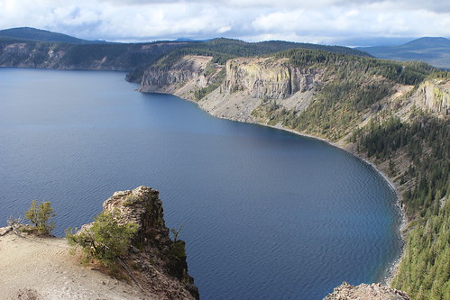
We recently returned from Oregon, where we checked off a trip that's been on our list for a while: Crater Lake and the Shakespeare Festival in Ashland. The vacation with family from Portland had been in the works for a while, with reservations coming in the form of a gift last Christmas, but not everything went according to plan.

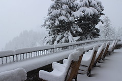
Days out from our arrival, the forecast called for partly to mostly cloudy skies with little chance for precipitation. The morning of our only full day in Crater Lake National Park, however, we saw our first snow of the season. When we woke the next day, a record 8 inches had piled up. As a result, the road around the rim was closed, cutting off access to several trails we had intended to hike, including to Mount Scott.
crater_lake_20130925_003

In recent years, it's never failed: If we're traveling to a volcanic area, there will be snow. Mount St. Helens had a dusting of snow when we climbed it. We've visited Yellowstone National Park several times, but only with snow on the ground. Then there was the storm in Iceland. OK, we probably should have expected that last one. Back to Oregon ...

We got a break in the weather the night we spent in Ashland, with only a brief rain shower during a performance of "Cymbeline" on the outdoor Elizabethan Stage at the Oregon Shakespeare Festival.
moraine_lake_20130927_099

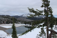
During our pass through Bend on the way home, however, we found more snow from the earlier storms and opted for indoor accommodations rather than camping. We had wanted to hike to the top of the South Sister, but it was socked in so we went partway up the trail to Moraine Lake instead. We also took in several sights at Newberry National Volcanic Monument.

A bit farther north, we stopped at Smith Rock State Park for a short walk to break up the drive home to Montana.

While we were able to get out despite the snow, we didn't hike as much as planned. Still, we enjoyed the journey and will have to return.

Crater Lake East Rim Drive
crater_lake_20130923_006

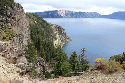
After driving from Portland - with stops in Salem for breakfast with friends and Eugene to visit a microbrewery - we arrived at Crater Lake National Park in the afternoon, as the sun was breaking through the clouds.

We took our time driving from the north entrance to the park around the east side of the rim to Crater Lake Lodge, where were staying. We didn't know it then, but it would be our only chance to see the lake during the trip.
crater_lake_20130923_112

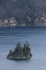
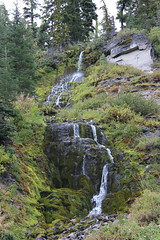
Along the way, we stopped to view Wizard Island, the Phantom Ship rock formation and Vidae Falls.
crater_lake_20130923_129

Here are more photos from the the drive into and out of Crater Lake.

Discovery Point
discovery_point_20130924_016

With snow falling steadily and the the rim drive closed the next morning, we set out on one of the few hikes available to us from Crater Lake Lodge.

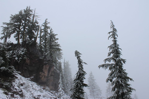
Heading west from the lodge and roughly paralleling the West Rim Drive, the trail passes several overlooks of the lake - or clouds, in our case. Nonetheless, there were some interesting cliffs and snags, as well as some lingering wildflowers frosted over by snow.
discovery_point_20130924_021

The trail continues past Discovery Point, but we turned around there and walked back to the lodge for lunch.

See more photos from Discovery Point.

Distance: 2 1/4 miles round trip.

Trailhead: Follow the paved path along the rim west from Crater Lake Lodge; it turns into a dirt trail as it leaves the parking area.

Annie Creek Canyon
annie_creek_20130924_027

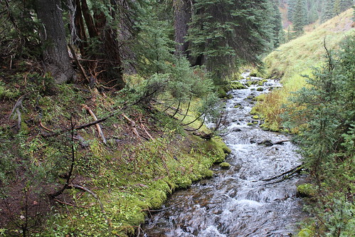
That afternoon, we drove south and west down to Mazama Village - the name taken from the one given to the mountain that became the crater - where we found rain instead of snow, and a short hike along Annie Creek.

The trail loops along the top and through the bottom of the canyon containing the creek, beyond the campground on the west side of the village.

We started southeast along the top of the canyon, then turned back northwest as the trail dropped into it. Near the bottom, the view across the creek included some eroded rock features. Continuing northwest, the trail crosses the creek a couple of times before climbing back to the top of the canyon and the campground.

Here are a few photos of Annie Creek.

Distance: 1 3/4 miles round trip.

Trailhead: We parked in the lot just west of the Annie Creek restaurant and gift shop, but there is also limited parking available in Loop E at the campground.

Paulina Peak
paulina_peak_20130926_021

After leaving Crater Lake for a night in Ashland, we turned back north to Bend. Once we were checked in to our hotel, we returned to Newberry National Volcanic Monument south of the city in search of a trail.

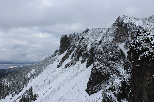
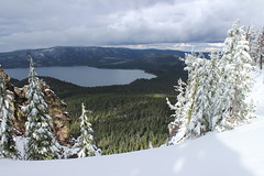
We ended up in the Newberry Caldera area, where two lakes and an old lava flow sit below Paulina Peak. On the advice of a park staffer, we decided to hike through the snow to the summit.

The trail begins by climbing steeply through the forest to the southeast, occasionally offering views northwest toward Mount Bachelor and the Three Sisters.

Eventually, the forest thins and the trail skirts cliff edges below the peak, and over Paulina and East lakes and the old lava flow. The trail then returns to the ascent through the trees, before a final stretch along cliff edges to the top at 7,984 feet.
paulina_peak_20130926_042

After carefully taking in the view near the top, we turned back to the car.

See more photos of Paulina Peak.

Distance: 4 miles round trip.

Trailhead: About 23 miles south of Bend, Ore., on U.S. Highway 97, turn east on Paulina Lake Road. Follow it about 13 miles, then turn south on Paulina Peak Road. The trailhead is past the end of the pavement, after about one-third of a mile.

Paulina Falls
paulina_falls_20130926_016

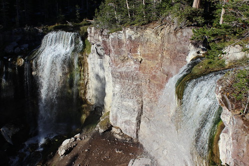
On the way back to Bend for the night, we stopped for a short walk to see the twin drops of Paulina Falls, viewable from above and below by short trails.

Here are a few more photos of Paulina Falls.

Distance: One-half mile round trip from the top of the falls to the bottom.

Trailhead: The parking are for the falls is 12 1/3 miles up Paulina Peak Road from U.S. Highway 97, 23 miles south of Bend.

Moraine Lake
moraine_lake_20130927_110

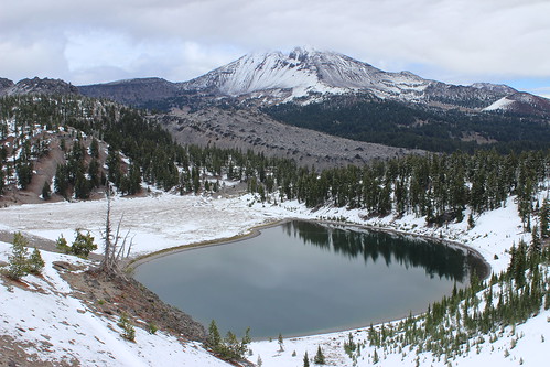
Before leaving for Oregon, friends had pointed us toward the hike up the South Sister, which at 11 miles round trip and nearly 5,000 feet of elevation gain would have been possible given the initial forecast. With snow on the ground and the summit in the clouds, however, we opted to stay on the lower part of the hike and see Moraine Lake.

Starting at the Devils Lake Campground in the Deschutes National Forest, the route follows the South Sister Climber Trail north through the trees and across the highway. Here, the trail briefly meets Hell Creek as it cascades out of the forest.
moraine_lake_20130927_019

The trail soon enters the Three Sisters Wilderness and begins a steep climb through the trees - and snow at the time we were there. After about 1 3/4 miles, the trail levels and leaves the forest at a junction. Turning northwest, the route continues about a mile down open land with views of the South Sister and Broken Top to Moraine Lake.
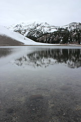
moraine_lake_20130927_079

After a break at the lake, we backtracked a short distance and followed a cutoff a little more than one-third of a mile east, back to the Climber Trail. About another quarter-mile up the trail to the north, a flat area  provides 360-degree views of Moraine Lake below and the South Sister, Broken Top, Mount Bachelor and beyond.

With more clouds moving in from the north, we turned around here and followed the Climber Trail about 2 1/2 miles south, down through the snow and back to the trailhead.

moraine_lake_20130927_124

See more photos of Moraine Lake.

Distance: 6 miles round trip.

Trailhead: Follow the Cascade Lakes Scenic Byway about 28 miles west of Bend and park at the trailhead at the Devils Lake Campground.

Smith Rock State Park
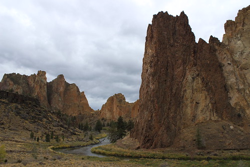
smith_rock_20130928_008

On the way back to Montana from Bend, we stopped for a short hike at Smith Rock State Park. While the park's colorful rock formations are a draw for climbers, there's also a good network of trails.

We started by crossing the Crooked River footbridge and climbing steeply to the northwest over the mile-long Misery Ridge Trail, taking in views from the cliffs along the way. Descending back to the Crooked River on the other side, the route passes the Monkey Face spire and connects with the Mesa Verde Trail for a quarter mile.
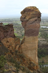
smith_rock_20130928_085

Out of the cliffs, we joined the River Trail, which rounds the rock formations southwest and then northeast for about 2 1/4 miles. Passing groups of climbers on the rock walls, we returned to the footbridge and then crossed to the parking area.

Here are more photos from Smith Rock State Park.

Distance: About 4 miles round trip.

Trailhead: In Terrebonne, Ore., follow B Avenue east from U.S. Highway 97 about 1 1/2 miles as it turns into Smith Rock Way. Turn north on Northeast 17th Street and continue one-half mile, then east on Northeast Wilcox Avenue and continue another half-mile. Turn north on Northeast Crooked River Drive and follow it about three-quarters of a mile into the park.
September 6, 2013

A long-weekend loop in the Swan Range

sapphire_lake_20130902_069

The long Labor Day weekend provided us the opportunity to take a three-day foray into the Swan Range, our dog Josey's first backpacking trip.

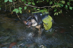
Our other dog, Belle, has been out on one-nighters before, but we haven't camped in the backcountry since Josey joined us about a year and a half ago. In anticipation of the trip, we outfitted her with a backpack to carry food for both dogs, which didn't slow her down in the slightest.

sapphire_lake_20130901_036

We began under a blue sky at Holland Lake, climbing along a creek to Upper Holland Lake then higher to Sapphire Lake, where we set up camp. The second day we hiked over a pass to Necklace Lakes in the Bob Marshall Wilderness and back. Clouds and a haze of wildfire smoke moved in during the day, and we saw a series of showers that night. The third day was considerably grayer, and we made quick work of packing up and hiking through a notch in the Swan Crest and back down to Holland Lake.

Having hiked into Sapphire on Sunday and out on Tuesday, the first night was quite crowded, but we had the place to ourselves the second.

Day 1: Holland Lake to Sapphire Lake

sapphire_lake_20130901_146

The hike begins by following Trail 415 east up through the forest above the north shore of Holland Lake. After passing a couple of junctions, the landscape opens up along a steep mountainside, providing a panoramic view of the lake and the Mission Mountains to the west.

sapphire_lake_20130901_030

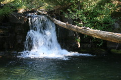
After about 3 3/4 miles, the route crosses Holland Creek and continues up the drainage, joining Trail 35 that starts on the south side of the lake. The trail climbs past several small cascades and pools and crosses the creek again before leveling out and reaching Upper Holland Lake at about 6 3/4 miles, where we made a short stop and the dogs went for a swim.

sapphire_lake_20130901_041

From Upper Holland, the route turns northwest onto Trail 120 and climbs into more open, rocky forest that reveals the basin below and surrounding peaks. After about 1 2/3 miles, a short spur trail drops to Sapphire Lake.

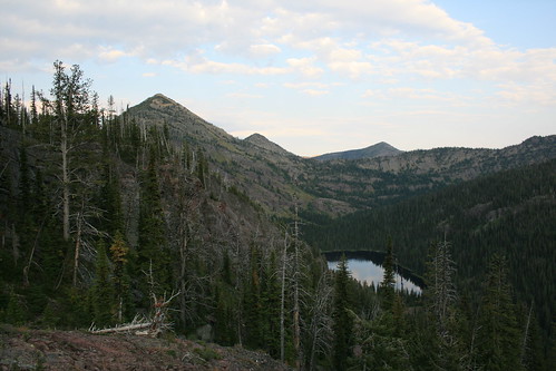
Several campsites can be found around the lake, which sits high on the edge of the Holland drainage, most with beautiful views to the south and west. After wading across a narrow part of the lake to avoid a longer walk around, we set up our tent on a peninsula jutting in from the south.

sapphire_lake_20130901_220

The rest of the day was spent lounging on the rocky shore and taking in the view at sunset.

Here are more pictures of the hike up to Sapphire Lake.

Distance: 8 1/2 miles one way.

Trailhead: Trail 415 starts 20 3/4 miles north of Seeley Lake on Montana Highway 83, then 3 3/4 miles east on Holland Lake Road, just past Holland Lake Lodge.

Day 2: Necklace Lakes

necklace_lakes_20130902_027

The next day, we went on a short dayhike over Necklace Pass to Necklace Lakes in the Bob Marshall Wilderness.

From Sapphire Lake, Trail 120 continues west for a mile up to a forested junction, then turns north and climbs about one-third of a mile through a rocky valley to the pass, which provides views down both sides to the mountains beyond.

necklace_lakes_20130902_101

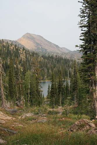
Turning northeast, the trail drops to a large lake that can be seen through a gap in the trees, then follows Smoky Creek to the shore of another lake about a mile from the pass. Here, we found a small, flat outcrop of land that made for a nice stopping point. Wildflowers were still blooming around the lake and kingfishers swooped through the sky as the dogs swam.

necklace_lakes_20130902_064

After a break, we hiked back up to the pass and down to Sapphire. With all of the other campers gone, we went for a swim that afternoon before rain clouds moved in later.

See more pictures from Necklace Pass and Necklace Lakes.

Distance: We hiked about 4 2/3 miles round trip, but the trail continues.

Day 3: Sapphire Lake to Holland Lake

sapphire_lake_20130903_054

After a series of brief showers overnight and more clouds moving in, we decided to get an early start on our return to the trailhead on our third day.

To complete the loop, we hiked to the junction a mile west of Sapphire Lake on Trail 120, but instead of continuing up to Necklace Pass turned onto Trail 48 and switchbacked a short distance up to a notch in the Swan Crest. Here, the view of the Swan Valley opens, but with threatening clouds overhead we quickly continued downhill.

sapphire_lake_20130903_023

The trail switchbacks numerous times, first across the fairly open mountainside and past a junction with a trail to the site of the Holland Lookout, then into thicker forest. About five miles from the Trail 120 junction, the route returns to Trail 415 and levels somewhat as it reaches the floor of the valley.

sapphire_lake_20130903_061

After another 1 1/3 miles, we were back at the Holland Lake trailhead and our vehicle. The rain held off just long enough for us to turn onto the highway for home.

Distance: 7 1/3 miles one way.