February 21, 2011

Achilles healing near home

tower_street_20110220_046

While I haven't been able to run, snowshoe or cross-country ski due to injury lately, I have been getting out on my usual morning walks with the dogs.

We've been taking it easy to give my Achilles tendon time to heal and hiking the short, level trails at the Tower Street Conservation Area on the edge of Missoula. It's not far from home and there isn't much to it - stands of cottonwood trees along the Clark Fork River - but it has been interesting to see through the winter.

Earlier this season, the river fully froze over and produced a big ice jam. When the water reaches the right temperature, slushy frazil ice forms and gathers in eddies along the river. And there's been a good variety of birds, including pileated woodpeckers, above, great blue herons, bald eagles and Canada geese, below.

tower_street_20110220_017

See a collection of photos from the past month here.

Trailhead: A little more than 1 mile west of South Reserve Street on South Third Street West in Missoula, then about a quarter-mile north on Tower Street.

Distance: There are a variety of trails; the main loop through the cottonwoods, along the river and back to the parking lot is about three-quarters of a mile.

February 7, 2011

New view at Hike MT

With a little downtime from running and cross-country skiing, I decided to give Hike MT a new look. This is only a stock Blogger template, but a bit more modern. And I've learned how to manipulate the background image, which I'll probably change from time to time depending on the season or where we've been.

A run of bad luck?

I had been debating whether I wanted to run a marathon or a series of half-marathons this year - there are interesting road and trail races around Missoula in every season. Now, it looks like I'll be focusing on getting back on my feet after a month of irregular activity and setbacks.

I finished December with a short family vacation sans running in the Yellowstone National Park area, then caught an out-of-the-ordinary cold, then Missoula was coated by freezing rain, then I ran into a minor complication with blood pressure medication.

Just when I was getting into my routine again, I injured my Achilles tendon. Around mile eight of a 13-mile run into the North Hills a week ago Saturday (below), I started to feel a little sore. I kept running, when in hindsight I probably should have walked the shortest route home. I stretched afterward, which felt OK. Later, pain set in. Sunday was worse. By Tuesday, the soreness had subsided some, but I was at the physical therapist.


I'd like to chalk it up to an increase this winter in running on snow- and ice-packed trails with uneven footing when I previously stuck to roads in the cold months, but I don't really know the cause.

I do know that an Achilles injury should be taken seriously and addressed as soon as possible. The PT put me on some specific stretches and the bike machine in my living room. It's not the North Hills, but I'm still moving. (Cross-country skiing is out, too.)

The first half-marathon of the year - the Snow Joke in Seeley Lake - is out, but I hope to be ready for some other races, or even a full, by summer. We'll see, though.

January 28, 2011

Photography fun on the go

tower_street_20110127_001

Jen and I both recently bought smartphones with decent cameras and have been putting them to use in our travels and everyday life.

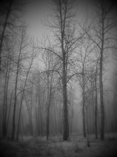
You won't usually see the snapshots we take with them among the photos from our adventures, but you can find them online. My Twitpic collection is here, and Jen's is here. I've also started to use Picplz, which has some creative filters. The photo above is an example, from a foggy day at one our favorite dog-walking haunts.

As always, you can find galleries of our hiking and travel photos here, and my Flickr stream here.

January 24, 2011

We skied the CDT

chief_joseph_20110123_026

Over the weekend, we decided to check out the cross-country ski trails at Chief Joseph Pass, south of Hamilton where the Continental Divide sidles up to the Idaho-Montana border, for the first time.

With 5 1/2 feet of snow on the ground and a fresh dusting of powder, it was worth the 95-mile drive.

There were a handful of vehicles and people in the parking lot when we arrived, but on the trail we found ourselves mostly on our own.

The Bitterroot Cross Country Ski Club maintains a network of 24 kilometers of well-marked, groomed trails that are easy to link together into loops of varying lengths.

chief_joseph_20110123_005

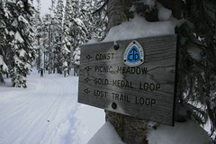
Never having skied at Chief Joseph before, we chose to start on the Continental Divide Trail.

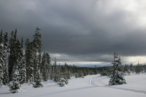
About half a mile in, on the edge of Picnic Meadow, we caught a glimpse of a "snowbow" arcing over the Gordon Reese Cabin. After a brief stop to check out the cabin, we skied up and down, through lodgepole pine forest and meadows along Broadway, the Gold Medal Loop, Timber, Solitude and the Vista View Loop. For a while, the sun was shining through breaks in the clouds, and despite the noise of wind, it was never too blustery.

After another stop at the cabin, the sky turned gray and we skied back to the trailhead via Moose and the Lost Trail Loop, shy of 7 miles and satisfied.

chief_joseph_20110123_090

See photos from Chief Joseph Pass here.

Distance: About 6 3/4 miles. (24 kilometers of groomed trails available, with more ungroomed terrain.)

Directions: The Chief Joseph Pass trailhead is about 47 miles south of Hamilton on U.S. Highway 93, then 1 mile east on Montana Highway 43.

January 1, 2011

1,500 miles on foot


View Larger Map

With the new year here, I thought it would be interesting to take a look back at the ground I covered running with my GPS in the past 12 months. The map above is the result.

I ran 1,508.58 miles with my GPS in 2010. My total mileage was a bit higher, due to setting out without the device a handful of times. More stats?
  • Number of runs: 196
  • Time: 211 hours, 28 minutes, 43 seconds
  • Elevation gain: 60,963 feet
  • Average speed: 7.1 mph
  • Calories burned: 195,678
I didn't really have a goal for the year, but as a member of Run Wild Missoula logged my miles for the 1,200 Mile Club. One hundred miles a month didn't seem like much, and I surpassed it.

As you can see from the map, I both pounded the pavement and hit the trail. Click here to view individual runs, or zoom out to see runs that weren't in the Missoula area. Everything from 5Ks to half-marathons to a full is in there.

Next year? No goal again, but I'd like to improve my long-distance pace and endurance, and do more trail runs.

Year-end Yellowstone ski

indian_creek_20101228_028

With family visiting for Christmas this year, we thought it would be fun to take a quick trip down to Yellowstone National Park. Mom had been to the area before, but was busy with work so didn't get to see the wilderness or wildlife - both of which we found.

Normally when we visit Yellowstone in winter, we look for an inexpensive room in Gardiner. This being the holidays and with family in tow, we booked rooms early at Chico Hot Springs Resort. We had never visited before, and the pools and food lived up to friends' hype.
tower_junction_20101227_009

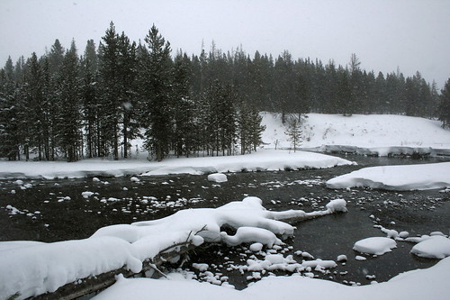
The first afternoon in the area, we took a drive out the park's north road to the Lamar Valley, viewing winter-white scenery, bison, coyotes and elk along the way. On the way back out of the park, we scheduled an early snowcoach shuttle to go cross-country skiing the next morning. At Chico that night, we ate well and took a quick dip in the warm pool before turning in.

The next morning, we rose before dawn and drove back to the hotel at Mammoth Hot Springs in the park, to rent gear for Mom and catch the shuttle up to the Indian Creek warming hut for some skiing. After a bumpy snowcoach ride to Indian Creek - and a brief panic over the frozen-shut door of the hut - we skied a short loop in windy, snowy weather, then waited for our pickup to return to Mammoth.
mammoth_20101228_080

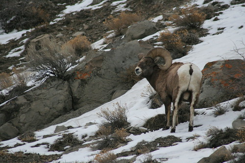
On the way out of the park that afternoon, Mom got another wildlife treat - foraging bighorn sheep on the slopes above the road. Back at Chico, we ate and soaked some more, then hit the sack.

The next morning, the forecast for western Montana was foul, so we skipped a morning trip to the park and headed for home. The drive was harrowing, but the trip was worth it.

See photos from our winter visit to Yellowstone here.

Indian Creek Loop

The easiest way to reach Indian Creek is by snowcoach shuttle from the hotel in Mammoth Hot Springs. Compared to other snowcoach tours, it's a bargain at a little more than $16, including taxes. Maps of the trails are available at the ski shop in Mammoth or here.

The trail we set out on from the warming hut makes a 2 1/4-mile counterclockwise circuit through a summer campground and along Indian and Obsidian creeks. It has gentle ups and downs, and the Gallatin Mountains are visible when there's no snow. With a little exploring, we covered about 3 1/10 miles.

Distance: About 2 1/4 miles round trip.

Trailhead: From the hotel in Mammoth, take the snowcoach shuttle about 8 1/2 miles south on the snow vehicle road to Indian Creek.

December 25, 2010

Jen's picks for Glacier National Park

We received a new issue of Backpacker magazine recently and opened it to find Jen's smiling face inside.

The January issue contains the annual Readers' Choice Awards, and while we knew Jen was to be featured as an expert on Glacier National Park we weren't expecting its arrival before Thanksgiving.

Turn to the "Our Backyard" feature on Page 56 to see her picks for the park:
  • Go to Two Medicine for solitude. Jen suggests the Dawson-Pitamakan loop, which at 16 miles (with an additional boat ride) was one of her most challenging dayhikes.
  • Big bloom at Cobalt Lake. Also in the Two Medicine area, the fields of red monkeyflower near Cobalt Lake can be spectacular. It's about 11 1/2 miles round trip.
  • Sneak a peek from Mount Oberlin. Check with the rangers at Logan Pass to make sure the easy 1 1/2-mile scramble is open - there are sensitive plants along it. From the 8,180-foot summit, look down on Bird Woman Falls.
  • Don't forget winter. The park is still open, even though Going-to-the-Sun Road is closed to vehicles. Park at Lake McDonald Lodge and ski or snowshoe instead.
Also, in the masthead on Page 7, Jen's "Where I'd Take an Editor Hiking" pick is Piegan Pass. With an allotment of just five words, the suggestion omitted the stop at the Many Glacier Hotel's Swiss Lounge after the 12 3/4-mile trek from Siyeh Bend.

Update: Backpacker recently put Jen's "Our Backyard" feature online here. Click "The Experts" to see her bio.

December 6, 2010

Cross-country season is here

lubrecht_20101205_036

We recently brought our cross-country skis up from the basement and over the weekend went on our first real outing of the season. With partly cloudy skies in town we made the short drive up the Blackfoot Valley to the Lubrecht Experimental Forest.

We arrived to only two other cars in the lot and set out on firm, groomed snow. We chose the 6.4-mile "D" loop, one of five marked trails that can be combined for a distance of your liking.

lubrecht_20101205_023

The counterclockwise loop begins in rolling forestland - a nice mix of up, down and around. At a couple of spots along the way, logs were still piled up from a recent tree-thinning operation in the battle against pine bark beetles.

On the north side of the loop, after the grooming ends but before the trail briefly crosses onto Paws Up Ranch property, the trees open. Here, the forest offered a beautiful sunny view of the surrounding Garnet Range.

lubrecht_20101205_058

Down through the forest again and off of Paws up Property - be sure to close any gates you open - the trail climbs up through a narrow gully called the Luge. Due to the shade of the forest, heavy frost was clinging to moss hanging from branches. This season, there are also a few downed trees to duck under and navigate around.

Out of the gully, the grooming begins again where the loop reconnects with shorter trails. We glided down past Jones Pond and a shelter before returning to a full parking lot. The entire circuit, we saw only one other party until nearing the cars.

lubrecht_20101205_069

See photos from Lubrecht here.

Distance: 6.4-mile loop. (Variety of loops available, from 1 mile to 8.3 miles.)

Trailhead: From Missoula, drive 5 miles east on Interstate 90 to Bonner, then 26 miles east on Highway 200 to the University of Montana's Lubrecht Experimental Forest facilities.

December 5, 2010

Fall wasn't forgotten

blue_mountain_20101017_047

Been a while since I've posted anything, but we did get out and about in western Montana this fall before the snow fell, albeit close to home.

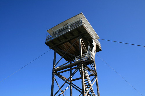
With Mom visiting in October, we took a stroll up to the lookout atop Blue Mountain. Saw a lot of yellow larch and aspen, some red huckleberry leaves and some drying thistles. See photos here.

tower_20101031_005

We've also gone on plenty of morning walks at Missoula's Tower Street Conservation Area. Since first visiting a little more than a year ago, this has become our go-to spot to take the dogs in the morning; it's not far down the road from the house, but is away from the hustle and bustle of the riverfront downtown. Photos are here - they were a test of sorts from my fairly new cell phone.