July 21, 2010

Geography lesson

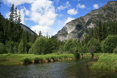
illinois peak_20100720_060

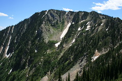
Where can you see Montana, Idaho, Oregon and Illinois - Illinois? - on the same dayhike? On the Stateline Trail, southwest of Superior.

In the five miles southeast of Cascade Pass, Montana and Idaho make up the ridge that the trail tracks, then there are the Oregon Lakes and Oregon Peak, and Illinois Peak.

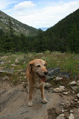
There are a variety of access points to the Stateline Trail, Cascade Pass being a relatively easy, but long approach. It's about 25 bumpy, dusty miles by car from Superior. On Tuesday, my dog Belle and I had the trail to ourselves - only one other vehicle was in the parking area, but we never saw anyone else.

From the pass, I've been northwest to Bonanza Lakes before, but this was the first time I've headed southeast to Illinois Peak.

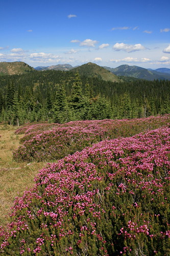
The route is mostly open, grassy forest with gentle ups and downs. In fact, the terrain bears a resemblance to hiking in Scotland or the Australian Alps, especially with the abundant pink mountain heather, top. I was also quite surprised by the variety of wildflowers in bloom - bluebells, a few varieties of penstemon, bracted lousewort, purple shooting stars, heather, yellow pasqueflower, mountain gentian, phlox and more.

At about 1 3/4 miles, the path passes above the uppermost of the three Oregon Lakes, with its deep blue water. The trail steepens at four miles and climbs through some interesting rocks - look for the ripples of old seabed. At about 4 1/2 miles, take the east fork through two junctions, then it's up the final push to the grassy summit of the 7,690-foot mountain.
illinois peak_20100720_187

A great start to a week of vacation!

Here are some photos.

Distance: 10 miles round trip.

Trailhead: From Superior, follow Diamond Match Road on the west side of Interstate 90 about 1 1/4 miles southeast, then Cedar Creek Road (Forest Road 320) 25 miles southwest to Cascade Pass.

July 19, 2010

Bluebells, a bighorn and bison


We took a drive up to the National Bison Range over the weekend, where the wildflowers are still blooming and the wildlife was out for viewing.

We arrived early enough to beat the afternoon heat and for me to make it back to Missoula in time for work. Bluebells and wild bergamot were in abundance going up the 19-mile Red Sleep Mountain Drive, and the way back down and around to the start again featured a lone bighorn sheep, plenty of bison and a handful of pronghorn antelope.

The drive also gave me a chance to play with a new Flip UltraHD camcorder. Watch the short video above.

Also, there are pictures here and here.

Distance: 19-mile loop drive. Near the top of the mountain, there are two short trails: the half-mile round-trip Bitterroot Trail and the 1-mile round-trip High Point Trail.

Trailhead: From Missoula, drive 35 miles north on U.S. Highway 93 to Ravalli, then turn west on Highway 200. After about 6 miles, turn north on Highway 212 and drive about 4.5 miles to the entrance at Moiese.

July 13, 2010

The finish


That's me in the white shirt, gray shorts and hat, starting on the right and cutting to the left around two people. Thanks to the Missoula Marathon, KECI-TV and FinishCam.com for providing video of the runners.

July 12, 2010

Off my mark

Last weekend's Missoula Marathon didn't go quite as planned.

After months of training with the goal of finishing in 3 hours, 40 minutes, I came in at 4:10:12. Slightly disappointing considering all of the improvement I've made in the last year in training and shorter races - all of my 20- and 22-mile training runs were at a faster pace than last year's 4:01 marathon finish, and last winter and spring I ran my best half-marathon and 5K.

Ultimately, a few things did me in. I choked down a cup of water around mile 17 and promptly coughed it back up. As a result, I fell back from my pace group and never caught up again. This year's race also was considerably warmer than last year's, and I've found in training that heat can quickly drain me. I also have noticed that my body doesn't seem to like energy drinks. I usually hydrate with water, and could feel myself getting sluggish as the cups of energy drink began to add up. Toward the end of the race, I switched back to water and soon felt better. (I suppose some of these could be mental, but I don't feel like I ever hit "the wall.")

All is not bad though - I finished another marathon and feel good today. While I like to see improvement in my running, to me it's more about being outside, being active and clearing my head of everything but the rhythm of my feet. Tomorrow, I'm going for a run.

July 8, 2010

On my mark

The Missoula Marathon is nearly here, and I've got just one more short run before race day.

Training went well, and the taper felt great - the short distances are easy and speedy. Now, it's all down to a little visualization and rest.

If my work pays off, I'll be crossing the finish line downtown on Higgins Avenue at about 9:40 a.m. Sunday. If you're in town, come on out and cheer!

July 5, 2010

Back on the trail, and still going

bass_creek_20100704_038

It's been a while since we've gone on a real hike here at home in Montana. The last time was months ago, when there was still snow on the ground.

It's not that we haven't gotten out; we walk the dogs on trails in and around Missoula almost daily, and we took a spring hiking vacation to Oregon and Washington's Olympic National Park. Mostly, it's because I've been focusing on my training for the Missoula Marathon next weekend. That and one of our dogs is getting older and has understandably been slowing down (more about that later).

Yesterday, we decided to get the dogs out and tired before the Fourth of July fireworks started in hopes that we wouldn't have a bark-fest after sunset.

We've been up the Bass Creek trail a short distance a couple of times - both in the snow - but with a campground at the trailhead, it always seemed like it would be crowded in warmer weather. We decided to give it a try anyway because it's not that far from home. The trail was fairly busy at the start, but about halfway through our hike we found ourselves mostly on our own.

bass_creek_20100704_015

The wide path starts out by steadily climbing west through the forest along the north side of Bass Creek; there are several places to access the water on the way. Just past 1 3/4 miles, it passes an old log dam with a pond behind it where the valley opens up and you can see the surrounding mountains.

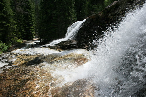
From here, the trail travels a fairly level mile through the forest, into the Selway-Bitterroot Wilderness and to a junction. Continuing on the narrower path to the north, you wind up the side of the canyon to an open parklike area with plenty of views down the valley, then above a big cascade at a little more than 3 3/4 miles.

bass_creek_20100704_077

A rough path leads down to the falls, and we took turns snapping pictures from below and keeping our older dog, Gigi, above and out of danger. As previously noted, she's getting up there - we believe she's about 16, but there's no way to know for sure because she was a stray. She remains our very faithful hiking partner and will follow us almost anywhere, albeit with a little help over logs and rocks.

The trail continues about another 3 1/4 miles up to Bass Lake, but this marked our turnaround point for the day.

See some more pictures here.

Distance: 14 miles round trip to Bass Lake. (We hiked about 7 3/4 miles round trip to the cascade.)

Trailhead: From Missoula, travel about 20 miles south on U.S. Highway 93, then turn west on Bass Creek Road and follow it about 2 3/4 miles to the trailhead parking area.

June 14, 2010

Marathon run-up

Training for this year's Missoula Marathon is well under way, and so far, so good.

The goal this year is to finish with the 3-hour, 40-minute group that I started my first marathon with last year, but fell back from. I finished that race at about 4:01.

Pace-wise, 3:40 works out to about 8 minutes, 20 seconds per mile. In training, I've maintained that speed up through my 16-mile workouts, and all of my runs have been under last year's marathon pace of 9:16. I've got a couple of 20-milers under my belt that I ran at about 9 minutes per mile, but with those I also introduced some hills - 1,400-plus feet of elevation gain on the North Loop Trail at Mount Jumbo.

Those hills were part of a run-up to last weekend's Pengelly Double Dip, a fairly grueling half-marathon here from the valley floor up University Mountain and Mount Sentinel, then back down. It's billed as having 2,700 feet of elevation gain, but my GPS reported about that in elevation change from base to summit and nearly 3,300 feet of total gain.

Up until a few weeks ago, I had never really run anything like that. I've done the smaller Mount Jumbo a few times and some short segments of the Double Dip, and have hiked almost the entire course in the past, so am familiar with it.

Fresh back from a recent vacation, I ran the lower part of the course - up through the saddle but omitting the two summits for about 1,800 feet of gain - and felt good, so I decided to enter. Based on that training run, I figured I'd finish the Double Dip in about 2:30, which turned out to be fairly accurate as I came in at 2:34:41.

What I forgot about was how steep the upper part of the course is, particularly on University Mountain. In a couple of places, I don't know that anybody ran - all you could see was a line of single-file walkers. The downhill was much faster, but it was clear that many people fell from all the bloody knees and shins at the finish.

Below, you can see the basic details from my GPS; click through to the player and you can watch my run.


While rather difficult, the Double Dip was fun and rewarded with plenty of beautiful scenery, so I could see myself doing it again.

As for the Missoula Marathon, I've got a couple of weeks of long training runs left - including a 22-miler next week - before tapering off to conserve my energy for July 11. There may even be one more race in the lineup: the Mountain-to-Meadow half-marathon, a beautiful run through the forested mountains near Lolo Pass on the Montana-Idaho border.

June 4, 2010

Rain, and more rain

rialto_20100527_176

Last week, we spent most of our vacation in Olympic National Park in Washington, one of the wettest places in the continental United States - ideal for a spring vacation.

We went into the trip knowing we would probably see a lot of rain, and we were right. Our tent got soaked twice, and we were forced to bail out on camping and seek shelter in a cabin and with relatives. While camping was a bust, we still got out on foot in the Hoh Rain Forest, Sol Duc Valley and on the Pacific Coast. We did see some sun during our day at the beach, but a trip up Hurricane Ridge was pretty much a bust due to clouds.

See pictures from the entire trip here.

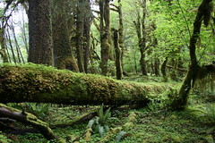
Hoh Rain Forest

hoh_20100525_015

This classic Olympic hike tracks through temperate rain forest along the Hoh River. On the way, see dense, mossy forest and wildflowers. We hiked a short section after setting up camp the evening we arrived. We cooked and ate under a tarp rigged to the side of our car, and awoke to a soaked tent.

Distance: 17.5 miles one way to Glacier Meadows. (We hiked about 3 miles round trip.)

Trailhead: The trail begins at the Hoh Rain Forest Visitor Center, 13 miles south of Forks, Wash., on U.S. Highway 101, then 16 miles east on Upper Hoh Road.

Sol Duc Valley

sol_duc_20100526_048

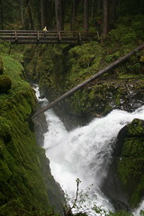
Our second and third nights in the park were spent in the Sol Duc Valley, first drying out in a cabin at Sol Duc Hot Springs Resort, then getting wet again in the campground. In between, we hiked the Lover's Lane Trail from the resort to Sol Duc Falls and back. More lush forest, cascading creeks and waterfalls.

Distance: 6 miles round trip.

Trailhead: The Lover's Lane Trail begins in the resort parking lot, 28 miles west of Port Angeles, Wash., on Highway 101 and 12 miles southeast on Sol Duc Hot Springs Road.

Rialto Beach

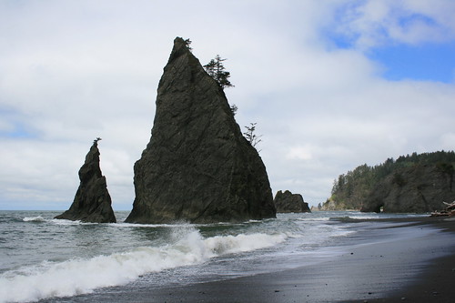
rialto_20100527_147

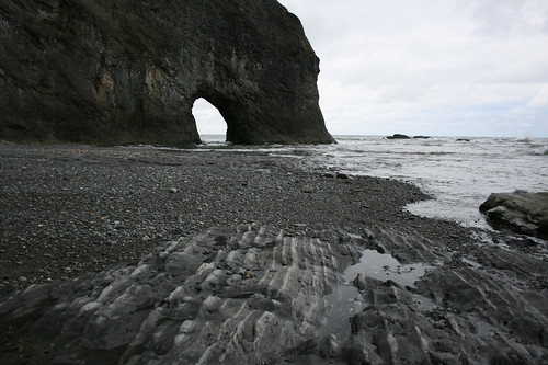
The first stop during our day at the coast was Rialto Beach, where we hiked north to sea stacks, Hole-in-the-Rock and beyond. Saw a lot of interesting polished rocks and driftwood, as well as a couple of small crabs.

rialto_20100527_136

Distance: 4 miles round trip.

Trailhead: From Forks, travel 1 1/2 miles north on Highway 101, then turn west on Highway 110 and follow it about 7 3/4 miles to Mora Road. Take Mora about five miles to the Rialto Beach trailhead.

Third Beach and Taylor Point

third_taylor_pt_20100527_050

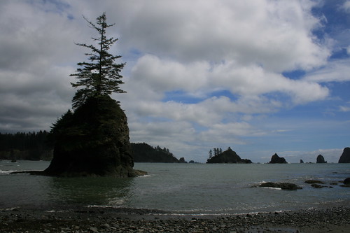
With decent weather - hardly a drop of rain - and plenty of time, we opted for a second hike on our day at the coast. The trail begins in the forest before dropping to sandy Third Beach. A short distance down the beach, a second, muddy trail climbs up and over Taylor Point, dropping you at a bay filled with sea stacks.

Distance: 6 miles round trip.

Trailhead: From Forks, travel 1 1/2 miles north on Highway 101, then turn west on Highway 110 and follow it 12 miles to the trailhead, just before La Push.

Marymere Falls

marymere_20100528_020

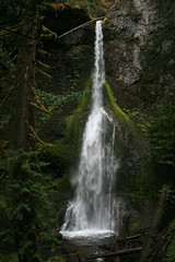
We started the day by driving through heavy rain and fog to Cape Flattery, Wash. - the farthest northwest one can travel in the Lower 48 - and not walking to see the lighthouse there. When we returned to Lake Crescent, it was only sprinkling, so we took a short hike through the forest to Marymere Falls.

Distance: 1.8 miles round trip.

Trailhead: The trail begins at the Storm King Ranger Station, about 19 miles west of Port Angeles on Highway 101.

June 1, 2010

Gorge green

herman_creek_20100524_153

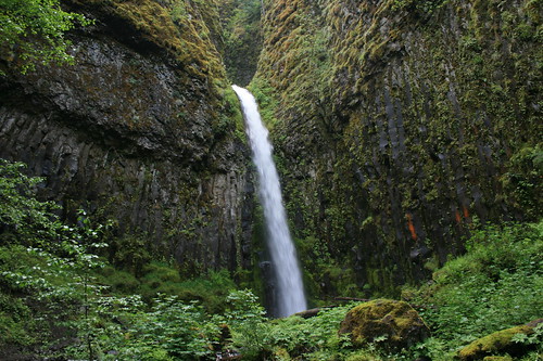
Last week, we started off our annual spring vacation with a walk through the lush Columbia River Gorge National Scenic Area east of Portland, Ore.

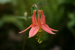
On the recommendation of Backpacker magazine, we linked segments of the Herman Creek, Pacific Crest and Dry Creek trails for a hike in the Mount Hood National Forest and Mark O. Hatfield Wilderness. There were plenty of green leaves, running creeks, wildflowers and a waterfall.

herman_creek_20100524_053

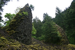
From the Herman Creek Campground, the trail switchbacks uphill, then down to a bridge over the creek at about 1 1/4 miles. A little more than half a mile farther, join the Pacific Crest Trail. Along the PCT, you'll pass smaller creeks, basalt pinnacles and rocky slopes. At about four miles, cross Dry Creek on a bridge, then its a short two-tenths of a mile up a dirt road to a 50-foot waterfall.

herman_creek_20100524_193

Check out the pictures here.

Distance: 8.7 miles round trip.

Trailhead: From Portland, take Interstate 84 about 41 miles east to Cascade Locks. Follow U.S. Highway 30 through Cascade Locks for 1.9 miles, then continue on the frontage road for 1.5 miles to the Herman Creek Campground.

May 2, 2010

Alpine outing

fourth_of_july_20100425_017

A family gathering last weekend brought us to the Wenatchee, Wash., area, a place I haven't been to in years, and I was reminded there are mountains out there beyond the scablands.

Just northwest of Wenatchee is Leavenworth, which I remember as the Bavarian-style tourist town that it still appears to be. But since I last visited as a child, it has perhaps become better known as an outdoor recreation destination.

West of town are the Okanogan-Wenatchee National Forest and Alpine Lakes Wilderness. On a free morning, we took a drive along Icicle Creek and went on a short hike up the Fourth of July Trail to stretch our legs.

fourth_of_july_20100425_021

From the parking area, the trail switchbacks up the east side of the canyon. The wildflowers are plentiful this time of year, and once above the trees there are views of the still-snowy peaks, beckoning for another visit.

See a few more pictures here.

Distance: The Fourth of July Trail runs 5.3 miles one way before connecting with the Icicle Ridge Trail on the edge of the wilderness. We hiked only a couple of miles up and back.

Trailhead: 9.4 miles south and west of Leavenworth on Icicle Road.