August 6, 2012
Iceland on the agenda
View Iceland 2012 in a larger map
We recently celebrated our 10th anniversary, and to celebrate we'll soon be taking a trip to Iceland!
Why Iceland? A variety of reasons - we've been thinking about it for a while, the effects of the economy supposedly making it less expensive, just because.
We'll be starting and finishing in the west at Keflavik and Reykjavik, and driving counterclockwise around the country.
First, we plan to backpack in the rhyolite hills of Fjallabak Nature Reserve, then it's on to Vatnajokull National Park South at Skaftafell for some glacial adventures. To the east, we'll stop in Seydisfjordur, where we want to do some hiking or kayaking. Heading to the northeast of the country, we'll stop at Lake Myvatn for some hiking and soaking in the volcanic region. Not far from there, we'll take in the largest waterfall in Europe (by volume) and the Arctic Ocean, then stop in Akureyri, the cultural center of the country. After that, it's back to Reykjavik. We'll treat ourselves to a stop at the Blue Lagoon hot springs on the way to the airport before we depart.
We'll have Wi-Fi most of the way and plan to send text, photo and video updates on a regular basis by Twitter and other social media for all to follow along. For a preview, take a look at this Pinterest board I created.

July 24, 2012
Dogs, elephants and mosquitoes on the trail to Fly Lake
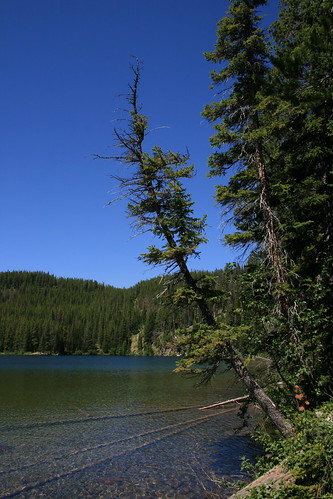
With time off last week, I took a short hike with the dogs to a lake in the back of the Rattlesnake Wilderness and saw no one else on the trail.
Fly Lake is nestled among some small, forested mountains on the northern edge of the wilderness. Despite its name, it wasn't that buggy - but the trail there passes through prime mosquito habitat.
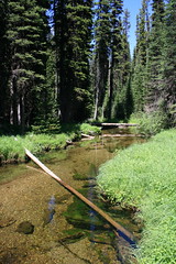
The route begins by dropping less than half a mile from the trailhead, then crossing Gold Creek. A logjam just upstream is passable if you don't want to get your feet wet. From here, the trail roughly parallels the creek northwest, though it isn't always visible, then turns back and crosses the water again at about 1 2/3 miles. Another logjam here is passable.
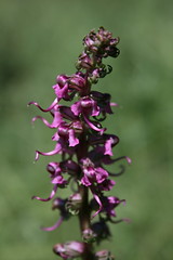
After turning west again, the trail arrives at a large, open meadow with several small channels of water crossing it. Look for wildflowers such as elephanthead and bog rein orchid along the edge of the forest at this time of year.
The next mile of trail was the buggiest when I was there, with standing water in several places and a lot of mud. At about 2 2/3 miles the trail again crosses the creek - there's another logjam, too - then arrives at a junction at about 3 miles.
From the junction, follow the trail to Fly Lake northwest as it climbs almost 1 1/2 miles out of the creek bottom, into drier terrain, then drops slightly to the lake. Friends have camped here in the past, but I've only ever day hiked in and out.
In addition to bugs, many downed trees crossed the trail when I was there - the worst blockage was about half a mile before the lake.
See more pictures from Fly Lake here.
Distance: About 8 3/4 miles out and back.
Trailhead: Fly Lake is accessed from the main Gold Creek trailhead (not West Fork). From Bonner, drive 8 1/2 miles northeast on Montana Highway 200. Turn north on Gold Creek Road and follow the signs 17 miles to the main trailhead along forest roads 126 and 2121.
July 20, 2012
Josey goes on the road to Oregon
Earlier this month, we made our way out to Portland and the Oregon coast for a friend's wedding, and our new dog Josey got to come along.
A former Humane Society dog that we adopted at the end of March, Josey has firmly attached herself to our family and was not ready to stay in a boarding facility; the only choice was to pack a bag for her and see how she did on a long trip.
Fortunately, she did great in the car and everywhere we took her, and we conveniently were stopping at relatives' house and the wedding was at Beverly Beach State Park, where we camped. She even lucked out and got to go to a dog-friendly restaurant and microbreweries - one even prepared her a bowl of rice and pork!
And as with most of our trips, we found some trails to hike and other spots to get out in the Columbia River Gorge and at the beach.
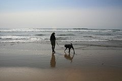
Upper McCord Creek and Elowah falls
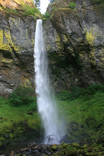
On the way into Portland, we stopped in the Columbia River Gorge National Scenic Area to take Josey on a walk before our arrival. A quick search on my iPhone turned up the Friends of the Columbia Gorge's hike planning website. There, we found the route to Upper McCord Creek Falls and Elowah Falls, which we had never been to.
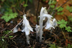
The hike begins by paralleling Interstate 84 up through the trees for the first two-thirds of a mile to a junction. Along the way, we found red columbine and white Indian pipe flowers.
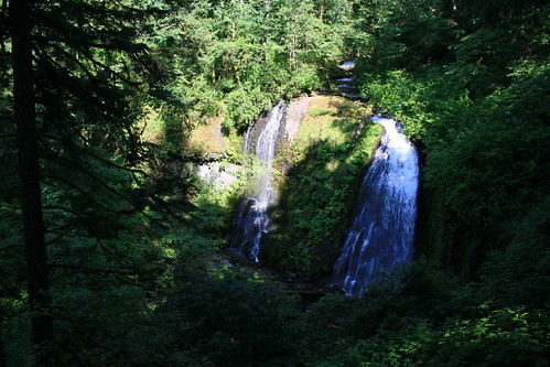
From the junction, we switchbacked about three-quarters of a mile uphill, then rounded a cliff to Upper McCord Creek Falls, a small divided waterfall in a lush gulch.
After returning to the junction, we continued four-10ths of a mile down a few switchbacks and back into a large amphitheater at the base of 289-foot Elowah Falls. Here, we stopped for a bite to eat - and Josey for a drink from the creek - then went back to the car and on to the city.
See more photos of Upper McCord Creek and Elowah falls here.
Distance: About 3 1/2 miles out and back.
Trailhead: About 27 miles east of Portland on Interstate 84, take Exit 35. Turn left, then right and follow the Northeast Frontage Road a little over two miles east to the trailhead parking area.
Ponytail, Oneonta and Triple falls
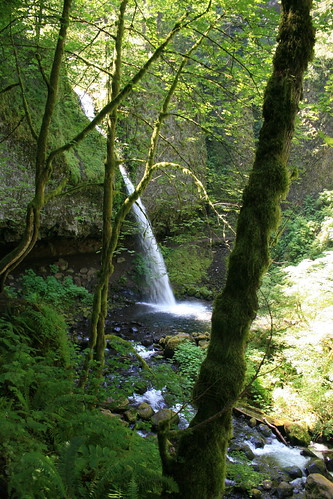
The next day, we returned to the Gorge for a hike that we had done on a previous visit when the weather wasn't as nice.
Follow the trail next to 176-foot Horsetail Falls uphill to the east for about a quarter mile, then switch back to the west. Ponytail Falls is around a bend after about another quarter mile; here, walk behind the stream of water pouring from a rocky overhang.
In the next three-quarters of a mile, the trail passes overlooks from cliffs above the Columbia River to the west, then turns south and switchbacks down to a bridge over Oneonta Gorge and a 60-foot waterfall. Josey was skeptical of the bridge, with its slotted surface revealing the creek below, but eventually crossed.
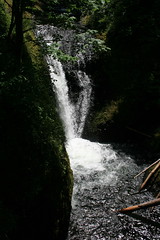
Uphill from the bridge, continue south at the junction with the Oneonta Trail upstream to an overlook of the 64-foot Triple Falls at about 2 1/4 miles. Slightly farther up the trail, another bridge provides access to the creek above the falls. We ate a little here, then turned around.

More photos of Ponytail, Oneonta and Triple falls are here.
Distance: About 4 1/2 miles out and back.
Trailhead: About 27 miles east of Portland on Interstate 84, take Exit 35. Turn right and drive about one-quarter of a mile, then turn left onto the Historic Columbia River Highway. Continue west about 1 1/4 miles to the Horsetail Falls parking area.
Cape Meares
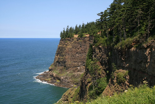
Driving south between Tillamook and the Newport area, we opted for the Three Capes Scenic Route. The Cape Meares State Scenic Viewpoint, with its 1890s lighthouse, is the northernmost of the three - Cape Lookout and Cape Kiwanda are the other two - and the only one we stopped at due to time and crowds.
Here, a half-mile trail loops the cape's cliffs to the lighthouse, providing coastal views to the north and south.
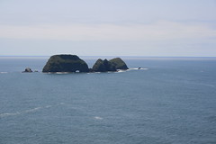
Here are some photos of the view from Cape Meares.
Distance: 1/2 mile loop.
Trailhead: Cape Meares is 10 miles west of Tillamook on U.S. Highway 101.
Yaquina Head
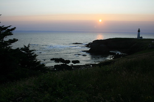
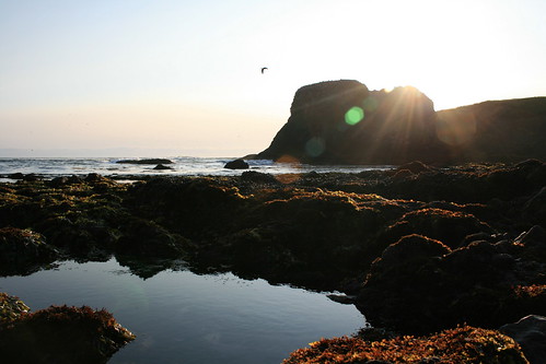
After arriving at Beverly Beach State Park and eating dinner, we drove south to the Yaquina Head Outstanding Natural Area on the north end of Newport to view the setting sun.
Parking at the lighthouse at the end of the headland, we walked down to Cobble Beach, where we saw tide pools, a variety of seabirds and seals basking on the rocks offshore.
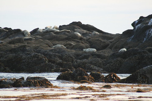
Here are more pictures from Yaquina Head.
Distance: Minimal.
Trailhead: The Yaquina Head entrance station is about 1/3 of a mile west of U.S. Highway 101 on Northwest Lighthouse Drive at the north end of Newport.
Devil's Punchbowl

The morning of the wedding, we took a couple of short drives to do some sightseeing - the first was to Devil's Punchbowl State Natural Area.
Devil's Punchbowl is a basin in a rocky headland into which seawater crashes. It can be viewed from above, or from the inside by walking down to the beach from a short trail near the end of C Avenue, then south on the sand. Tide pools are also found here.
More pictures from Devil's Punchbowl are here.
Distance: Minimal.
Trailhead: To get to Devil's Punchbowl, drive about 7 miles north of Newport on U.S. Highway 101, then veer left on Otter Crest Loop. After a little less than 1/2 mile, turn west on First Street and continue a little less than 1/2 mile to the parking area.
Cape Perpetua
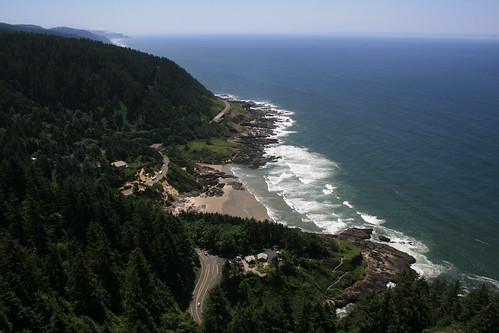
At the Cape Perpetua Scenic Area, the Siuslaw National Forest meets the sea at the base of steep cliffs.
Here, we drove up to a scenic overlook then hiked down most of the St. Perpetua Trail and back up, viewing several wildflowers along the way. There were more trails in the area, but we were on a schedule to be at the wedding, so didn't really explore much.
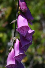
More pictures from Cape Perpetua are here.
Distance: About 2 1/2 miles out and back.
Trailhead: Cape Perpetua is 2 1/2 miles south of Yachats on U.S. Highway 101. The top of the St. Perpetua Trail is about 3/4 of a mile up Forest Road 55 then nearly a mile up Forest Road 5553.
July 1, 2012
13.1 miles to wildflowers in Idaho
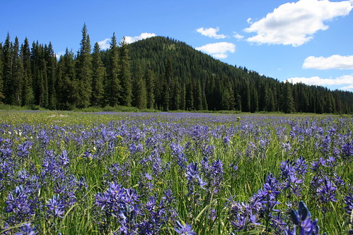
Saturday saw us at Lolo Pass, off U.S. Highway 12 along the Montana-Idaho border, for two reasons: I was running the Mountain to Meadow Half Marathon, and camas flowers were blooming in Packer Meadows.
Every year in late June, the meadows fill with blue flowers, and the run passes by the fields and is usually around the peak bloom - fitting two of my interests.
The run on forest roads just inside Idaho went well and might have been one of my best half marathon finishes, although it should come with an asterisk. The last time I ran the race, it was two weeks before the Missoula Marathon, making it ideal for a final long run before tapering. This year, it was just one week before the marathon, likely limiting the field. Nonetheless, I finished in 1 hour, 50 minutes and 13 seconds, about 8 1/2 minutes faster than my previous best on the course. The time was good enough for 21st overall, 15th among men and fifth in my category.
After the race, we took a stroll about a mile back down the road to the meadows for some photos of the flowers. The bloom was about at its peak last Wednesday, according to the Lolo Pass Visitor Center's Facebook page. Although they were beginning to wilt, the blue blooms still were plentiful.
Here are a few more views of the flowers.
June 10, 2012
A quicker Pengelly Double Dip
Yesterday's Pengelly Double Dip trail race up University Mountain and Mount Sentinel far exceeded my expectations. My time of 2 hours, 18 minutes and 26 seconds was about 16 1/2 minutes faster than the only other time I've run the race and, more importantly, I accomplished it without any injury.
If you've been reading this blog or my Twitter stream for the past year and a half, you know I've been working back from an Achilles tendon injury. That time has been filled with physical therapy and slow progress. I got back to running races this year with a plan to enter some of the more fun events in the area, and started with the Snow Joke Half Marathon in January and the 11 Miles to Paradise trail race in May.
The Double Dip, however, is much more work - a trail half marathon with more than 3,000 feet of cumulative elevation gain up two mountains on the edge of town. It first switchbacks up to the "M" from the valley floor, then crosses the Sentinel fire road and works its way around into Pattee Canyon. It then ascends University Mountain, drops back to a saddle and rises up Sentinel. After returning to the saddle, it switchbacks down to the Clark Fork River and returns to the start.
My main concern in getting back to races has been reinjuring my leg, especially at the Pengelly, with all of the climbing. About a week and a half ago, I ran the course at what I thought was a slow pace to make sure I could handle it - turned out, I did it slightly faster than the first time I raced.
At the start yesterday, I again set out to run it slowly. I also purposely didn't look at the time or pace elements on my GPS until I had reached the valley floor with about a mile to go. To my surprise, I was well ahead of my previous time.
Looking back at the stats, I started the race at a slightly slower pace and was able to run the top mile - with the steepest climb - much faster than last time.
As for my plan to stick to more interesting races this year, I've got at least one more this summer - the Mountain to Meadow half marathon at Lolo Pass - and possibly a short road/trail race - the Ten Spoon 10K on the summer solstice at a local winery!
May 28, 2012
A hillwalk close to home
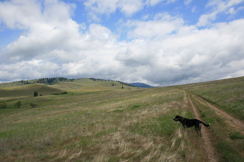
When the holiday weekend's rain gave way to a some sun on Monday, we took the dogs out for a walk in the North Hills - our coats in tow, but not on our backs.
I've started to use the Orange Street access to this local open space area when I run because it's just a little more than a mile from our front door. Recently, we've also found it to be an easy way to take out the dogs, too, but being that it's just off Interstate 90 they stay leashed until getting up the hill a ways.
The trail starts out by switchbacking up the slope then splits at about half a mile. The eastern side rises to the popular ridge trail at about 1 mile, and the western side rounds the hill to the Moon-Randolph Homestead at about 1 1/2 miles then reaches the ridgeline. Go either direction and follow the ridge trail for a 4-mile loop.
On our walk, we found death camas and long-plumed avens in the grassy hills near the homestead, and fuzzytongue penstemon, the last of the season's lupine and the first of the bitterroots along the gravelly ridgeline.
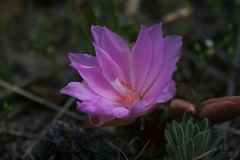
The best part of the walk was not having to towel off the dogs before getting back in the car!
More pictures of this North Hills walk are here.
Distance: 4-mile loop.
Trailhead: Park in the lot at the north end of Orange Street, alongside the Interstate 90 on- and off-ramp. The trail starts at a gate at the base of the hill a short distance to the west.
On the run, and on the trail
I ran my first race of the spring/summer season last weekend, and it was a fast, fun one. The 11 Miles to Paradise race takes place on a trail through the Lolo National Forest between St. Regis and Quinn's Hot Springs, outside of Paradise.
Being that it follows the Clark Fork River downstream, there's an overall elevation loss - which probably helped to increase the pace - but there are a few climbs. The first half is fairly level and fast with one notable rise, while the second half has most of the uphill and ends with a quick descent.
This year was only the second for the race, but it's well-organized, with shuttles to the start and back from the finish and lunch and a soak in the hot springs provided for all runners!
Being that it follows the Clark Fork River downstream, there's an overall elevation loss - which probably helped to increase the pace - but there are a few climbs. The first half is fairly level and fast with one notable rise, while the second half has most of the uphill and ends with a quick descent.
This year was only the second for the race, but it's well-organized, with shuttles to the start and back from the finish and lunch and a soak in the hot springs provided for all runners!
May 14, 2012
Flowers, falls and a first hike
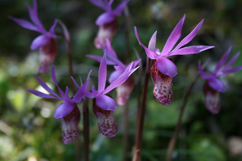
We took advantage of a beautiful spring day to drive up the Bitterroot Valley and take our new dog on her first real hike, to Bear Creek.
After a month of walking on leash and getting familiar with her new family, Josey got to run under voice control for the first time last week. After an initial burst of excitement, she did well, sticking close to our other dog Belle.
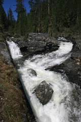
On Sunday, we went into the woods near Victor, following the trail along Bear Creek an easy 1 1/2 miles up. The creek was full, with two channels spilling over the falls, and along the way we found plenty of wildflowers - fairy bells, fairy slipper orchids and some fading trilliums and glacier lilies.
We also found out a couple of things about Josey: She's a water dog, always looking for a way down to the creek or into a mud puddle. And she's a roller; we'll have to be on the lookout for horse droppings.
Here are more photos from Bear Creek.
Distance: 3 miles round trip.
Trailhead: From Victor, drive 3.3 miles south on U.S. Highway 93, 2.3 miles west on Bear Creek Road, 0.8 miles north on Red Crow Road and 3.2 miles west on Red Crow and Bear Creek roads.
April 22, 2012
Josey says hello!
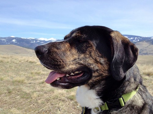
Meet our new dog, Josey!
Josey was a stray found in the Bitterroot Valley that we adopted from the Humane Society of Western Montana recently. She's a 2-year-old rottweiler/hound cross, and large - she was listed at 94 pounds at the Humane Society, but weighed in at 88 at our vet.
After a few weeks, she's settled in quite well at the house and with our 8-year-old Lab/hound Belle. The two are enjoying playing and going on walks together, and sharing the couch when we're out, apparently.
We're looking forward to getting out into the mountains with Josey after a bit more training!
March 27, 2012
Foggy at Freezout Lake

We took a long weekend and spent part of it across the Continental Divide, checking out the spring waterfowl migration at Freezout Lake Wildlife Management Area between Fairfield and Choteau.
While halfway decent weather and more than 50,000 snow geese were in the forecast before we left, we found a lot of fog and fewer birds. Still, the trip was worth it for the ease of viewing and the species present.
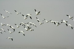
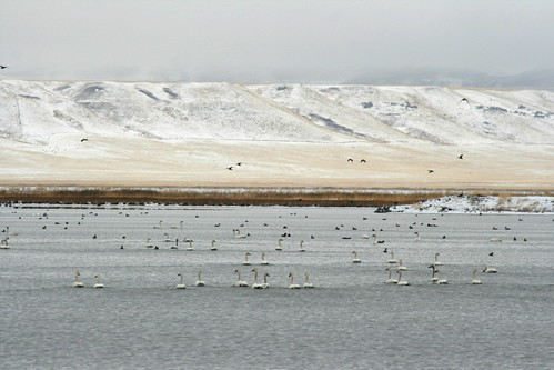
Freezout offers several roads and trails among the main lake and a series of ponds on the plains just east of the Rocky Mountain Front. Every year in mid- to late March thousands of snow geese stop in the area on the migration north. Several other species can be seen, as well, including Canada geese, tundra swans, American white pelicans, northern pintails, great blue herons and more.

The last time we visited Freezout, more snow geese were passing through and the lake and ponds were still partially frozen, concentrating the birds on open water. This time, a Montana Fish, Wildlife and Parks representative told us, the fog kept what geese there were in nearby fields. We saw a number of species, but overall numbers were low.
If you're thinking of visiting Freezout, check the spring waterfowl hot line at (406) 467-2646.
See pictures from Freezout Lake here.
Distance: Several roads run through the wildlife management area, from which you can walk among the lake and ponds.
Trailhead: From Fairfield, drive 4 miles north on U.S. Highway 89 to the main entrance and information kiosk.
Subscribe to:
Posts (Atom)