After spending recent months recovering from leg injuries, we finally got out on our first real hike of the summer in western Montana last weekend.
(Over the winter, I developed very painful Achilles tendinitis in my left leg, and while recovering from that I overcompensated and developed less serious post-tibial tendinitis in my right leg. I've been working with a physical therapist on my running stride and hope to avoid recurrences.)
Jen recently declared her intention to hike up St. Mary Peak in the Bitterroot Mountains south of Missoula for the first time this summer. I've been up it before - once with each of the dogs - but she never has even though she's hiked steeper trails and to higher elevations. On Sunday, we set out early without the dogs and checked it off her list.
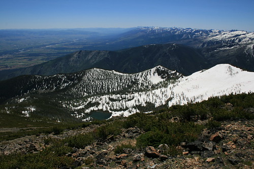
The day was beautiful - blue sky, not too hot on the mountain and a slight breeze - and the trail started out clear with abundant wildflowers off to the side. Through the first switchbacks, at about a mile, that changed as snow overtook the path. Though deep, it was firm and the route fairly obvious, so we continued. At one point, we did briefly lose the trail, but turned uphill until we found other tracks in the snow and followed them.
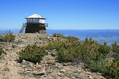
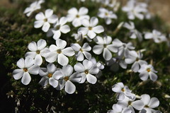
Eventually, the snow disappeared as the trail rose above treeline and revealed a sweeping view of the Bitterroot Valley. In the final mile, we crossed the rocky top of the mountain - which was covered in a variety of cushion plants - and one final patch of snow to the lookout at the top.
After lunch and some pictures, we started down for home, playing in the snow along the way.
More photos can be seen here.
Distance: 7.6 miles round trip.
Trailhead: From Missoula, drive about 25 miles south on U.S. Highway 93, past the Stevensville turnoff, and turn west on St. Mary's Road. Follow the signs about 11.6 miles up to the trailhead.