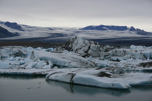
The next stop after our trip inland in Iceland was Skaftafell in Vatnajökull National Park, where massive glaciers push down from the mountains along the country's southeastern coast.
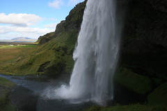
Along the way, we turned a short distance off of the Ring Road about 33 kilometers east of Hella and stopped to stretch our legs on a short trail at Seljalandsfoss. Here, water pours over a cliff into a grass-ringed pool 60 meters below. The walk leads behind the falls and a short distance along the cliff to two smaller cascades.
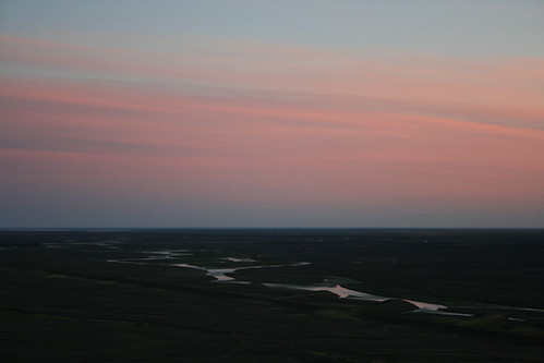
The last 125 kilometers of the drive to Skaftafell passes through the sandar - plains of dark gray glacial sand. The terrain is so level and view so unobstructed that the mountains of Vatnajökull could be seen nearly the entire way. The 1,000-square-kilometer Skeiðarársandur, just west of Skaftafell, is the largest glacial sand plain in the world, and the reflection of the setting sun on rivers running across it makes for an impressive sight.
Founded in 2008, Vatnajökull National Park merged two existing parks and other lands spanning Iceland from north to south. The resulting 14,000-square-kilometer park is the largest in Europe; the 8,100-square-kilometer glacier it is named for also is the largest on the continent.
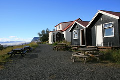
At Skaftafell, we stayed at the Bölti guesthouse, an old farmhouse on the hillside above the park visitor center and campground. It's likely one of the oddest accommodations we've stayed in on our travels. The property includes the main house, two small bunkhouses and another building with a shared kitchen. The decor and structures obviously have been added to over many years.
Late that afternoon, we strolled out an easy trail through a moraine and to a glacial lagoon. The next day, lacking the necessary equipment ourselves, we hiked on a glacier with a guided group. Later, we checked out a few waterfalls near the guesthouse. The day we departed, we stopped at another glacial lagoon filled with icebergs and seals.
After the stop at the lagoon, we were on our way through Iceland's eastern fjords to the small, picturesque town of Seyðisfjörður for a night before traveling to the north of the country.
Our main takeaway from Vatnajökull was how small the glaciers in our own backyard are. (We've never been to Alaska.) North of our home in Missoula, sits Glacier National Park, where we often hike and cross-country ski. The park recently has been emphasizing its glacial geology, rather than the glaciers themselves. Vatnajökull really reinforces that Glacier is much closer to the end result of the process.
Day 1: Skaftafellsjökull moraine
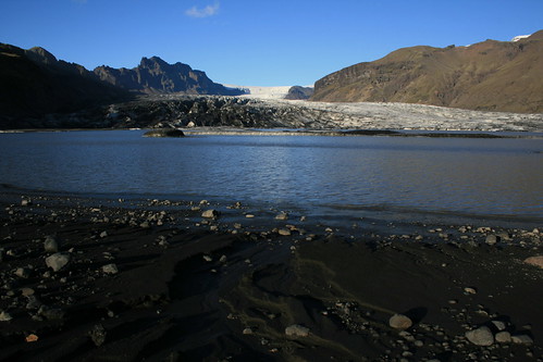
After a day of driving, the short and mostly level walk out the Skaftafellsjökull moraine to the lagoon at the base of the glacier was easy to do before dinner.
Leaving from the visitor center area, two parallel trails - one mostly paved and accessible, the other rougher - track northeast along the base of a mountain. At the lagoon, we explored the sandy beach for a little while and marveled in the size of the glacier, the returned the way we arrived.
Here are more pictures from the Skaftafellsjökull moraine.
Location: The trail begins north of the park visitor center at Skaftafell, 231 kilometers southeast of Hella on the Ring Road.
Day 2: Falljökull
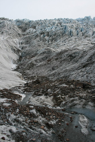
The next day, we woke early and made our way to one of the guide offices adjacent to the visitor center. We usually don't go on guided tours while traveling, but thought it wise this time because we wanted to get out on a glacier but lacked the proper safety equipment.
Our group was small, and only one of two that got an early start on Falljökull after a shuttle ride southeast of the visitor center. After a short walk through the moraine, we donned our crampons and ice axes and stepped onto the ice.
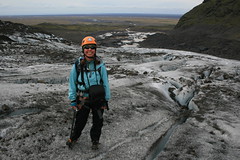
Looking at a map, you can tell that Falljökull is one of the smaller glaciers in the area, dwarfed by Skeiðarárjökull to the west, but it still was impressive. We've trekked through snowfields and on smaller glaciers in western Montana's mountains, and we'd never seen anything like the jagged blue-gray spires of ice above us up close.
The guide led us uphill to the northeast, stopping to explain glacial features such as caves, streams, crevasses, moulins and ice falls. Depending on where we were standing, the ice was 400 to 600 meters thick.

As we continued up, we hopped small crevasses and listened for the delayed crack of rocks the guide dropped down moulins. When the angle of the glacier steepened at the bottom of an ice fall, we stopped for lunch.
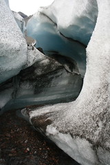
Soon, we were on our way back down a different route. Along the way, we stopped to step inside a water-carved channel through the ice, which was illuminated blue by the light from above.
After about five hours on Falljökull, we were back on the shuttle headed for the visitor center.
Here are more pictures from Falljökull.
Location: Falljökull is about 8 1/2 kilometers southeast of Skaftafell on the Ring Road, then up a short unpaved access road. Guide companies have offices across the parking lot from the park visitor center at Skaftafell.
Day 2: Svartifoss
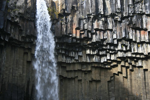
After returning to the guesthouse where we were staying, we set out on a nearby trail to explore the waterfalls and viewpoints uphill to the northeast.
Shortly, we passed Hundafoss and Magnúsarfoss, then climbed higher. After reaching an open area, the trail turned west and dropped slightly to Svartifoss. This frequently photographed waterfall spills from a shelf into an amphitheater formed by basalt columns.
From there, we continued uphill to the west, then turned north on another trail and arrived at the Sjónarsker viewpoint. Here, we could take in peaks higher up, vast Skeiðarársandur and across it to the giant Skeiðarárjökull beyond.
Afterward, we turned south and followed the trail back to the guesthouse.
Here are more pictures from Svartifoss.
Location: The trail to Svartifoss begins at the park visitor center; we joined it uphill to the northwest, where it passes near the Bölti guesthouse.
Day 3: Jökulsárlón
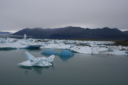
The next day was gray and rainy, and as we drove east from Skaftafell we stopped at Jökulsárlón, where large pieces of ice that have calved off of a glacier float in a lagoon just in from the coastline.
We arrived early enough to watch seals and birds feeding in the water after a short walk around the edge of the lagoon.
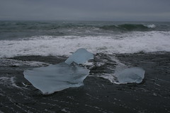
After a while, we crossed the Ring Road and briefly explored the black-sand beach, where smaller chunks of ice polished nearly transparent by the water wash ashore in the waves.
Here are more pictures from Jökulsárlón.
Location: Jökulsárlón is about 55 kilometers east of Skaftafell on the Ring Road. Parking is available on both sides of the outlet river; a visitor center is located on the east side.