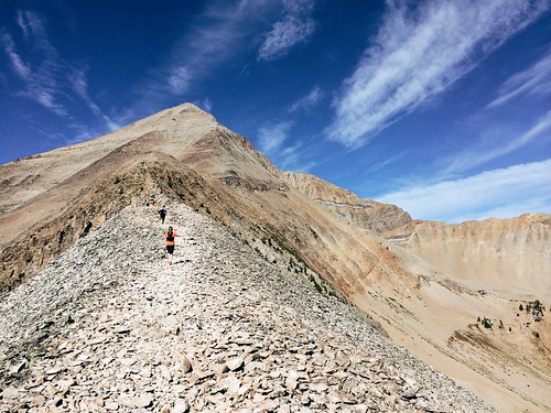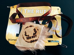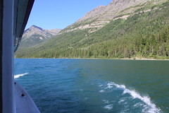
After running The Rut 50K at Big Sky Resort back in September - I know, I'm behind - we continued south to Yellowstone for our first stay in the national park.
We've been to Yellowstone several times - usually for a long weekend in winter or just driving through at other times of the year, staying in gateway towns. Considering how much we get out, it's odd that we've never really spent time there. Driving from home, after all, takes a similar amount of time as getting to the east side of Glacier National Park.
This time, we camped inside the park four nights and spent one rainy night in a hotel in Cooke City. And for the first time aside from our winter visits, we left the park roads and boardwalks behind for a few trails.
Our trip began in the Madison and Old Faithful areas, then moved to Norris and the Grand Canyon of the Yellowstone, then the Lamar Valley before we drove home. Along the way, we saw some of the park's most popular sights and occasionally escaped the crowds.
Day 1
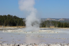
Monument Geyser Basin
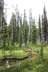
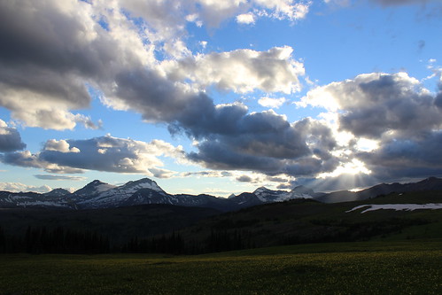
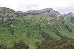
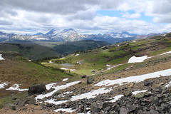
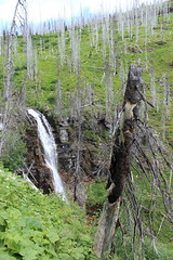
Having raced the day before, we started with a short hike to Monument Geyser Basin after setting up our campsite at Madison.
The trail began along the west bank of the Gibbon River and continued north upstream for a fairly level 1/2 mile. Turning back southwest, we climbed steeply for a little more than 1/2 a mile, taking in views north across forest and meadows to the mountains at the south end of the Gallatin Range.
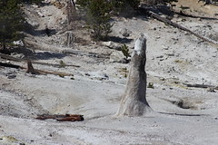
At the top of the trail, we turned west and continued a short distance to the small geyser basin at about 1 1/2 miles. After viewing the steam rising from rocks and cones, we followed the route back to the trailhead.
Here are more photos from Monument Geyser Basin.
Distance: About 3 miles out and back.
Trailhead: Drive about 8 2/3 miles northeast of Madison.. The trail starts at a turnout on the west side of the road, just south of a bridge over the Gibbon River.
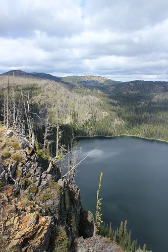
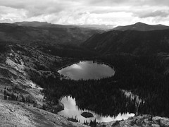
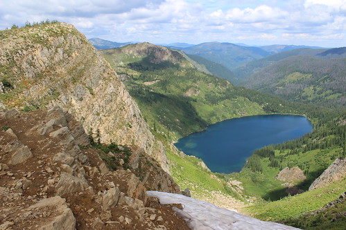
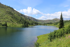
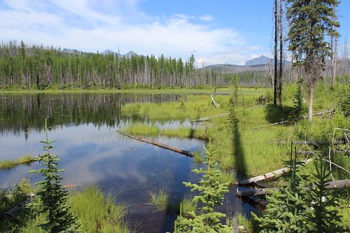
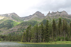
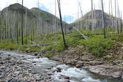
Ice Lake and Little Gibbon Falls
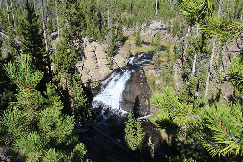
From the Ice Lake trailhead, we followed the level trail west past the south end of the lake to a junction with the Howard Eaton Trail.
Here, we turned north and hiked along the west shore of the lake, past campsites then into the forest to a log crossing over the narrow Gibbon River. Once across, we continued uphill north to a junction with the Wolf Lake Trail at about 2 1/3 miles and turned southeast.
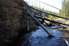
We followed the Wolf Lake Trail to a second log crossing, just above Little Gibbon Falls, then uphill a short distance to good views of the falls through the trees.
After taking in the falls, we continued down the trail through Virginia Meadows to the road. Back on pavement, we hiked about 1/2 mile southwest to the Ice Lake trailhead.
View more photos of Ice Lake and Little Gibbon Falls.
Distance: About a 4 1/2-miles loop.
Trailhead: The Ice Lake trailhead is about 3 1/2 miles east of Norris.
Day 2
Lower Geyser Basin
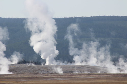
On the way to our hikes for the day, we drove through the Lower Geyser Basin and on a loop back to Firehole Lake.
From the road between Madison and Old Faithful, we could see across the meadow to a bison herd and the steaming geysers.
Here are more photos from Lower Geyser Basin and Firehole Lake.
Directions: The Firehole Lake Drive begins about 9 miles south of Madison.
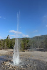
Lone Star Geyser
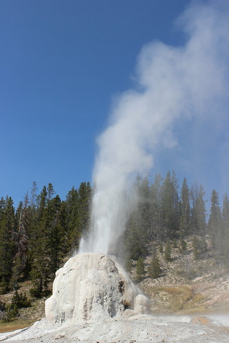
We chose the hike to Lone Star Geyser because it's known to have one of the more regular and predictable eruptions in the park, about every three hours. Unfortunately, we missed the main eruption, but did see a smaller one.
From the trailhead, we followed the nearly level old road south along the Firehole River, crossing it on a bridge after about 2/3 mile. The road continued along the river south, curving east to a junction with the Spring Creek Trail then west again to the geyser at 2 1/2 miles.
After watching a smaller eruption, we decided to hike a bit farther and turn back in time to see the larger one. The main eruption came early, however, and we just missed it. Rather than wait, we backtracked to the trailhead.
View more photos from Lone Star Geyser.
Distance: About 5 miles out and back.
Trailhead: The Lone Star Geyser trailhead is about 3 3/4 miles southeast of Old Faithful.
Biscuit Basin and Mystic Falls
We finished our second day with a hike up to the Biscuit Basin overlook and back to Mystic Falls.
We started west on the boardwalk, past the colorful, steaming pools of water, and continued onto the trail that led to the Little Firehole River. After a short distance, we turned uphill at a junction, switchbacking north to an overlook of the basin.
From the overlook, we continued west to a junction with the Fairy Creek Trail. Here, we switchbacked south down to a viewpoint for Mystic Falls, where the Little Firehole cascades out of a narrow canyon to the rocks below.

From the viewpoint, we followed the river east, back to the junction then the boardwalk.
Here are more photos from Biscuit Basin and Mystic Falls.
Distance: About 3 miles round trip with a large loop beyond the boardwalk.
Trailhead: Biscuit Basin is about 2 1/2 miles north of Old Faithful.
Day 3
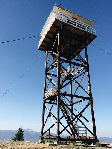
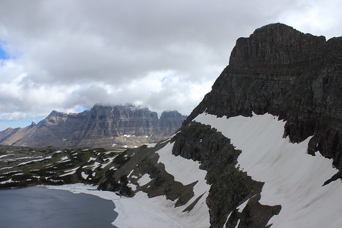
Mount Washburn
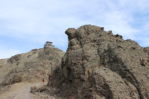
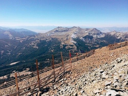
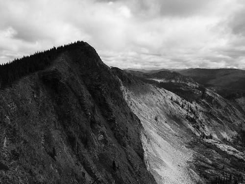
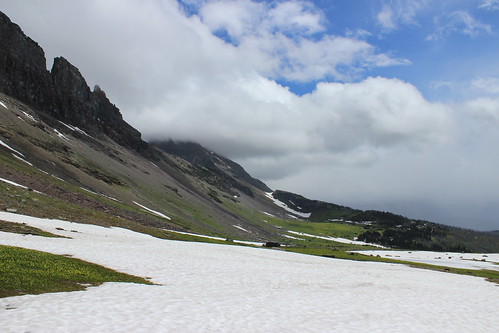
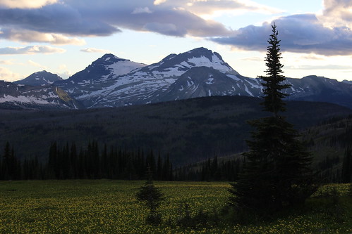
After moving to the Norris campground the next morning, we started with an uphill hike to the top of 10,243-foot Mount Washburn.
The summit is most easily reached from two trailheads - Dunraven Pass and Chittenden Road. We chose the route from Dunraven Pass because it was about 3/4 mile longer.
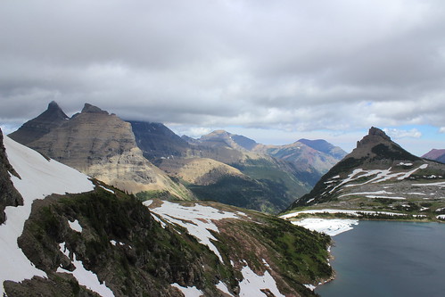
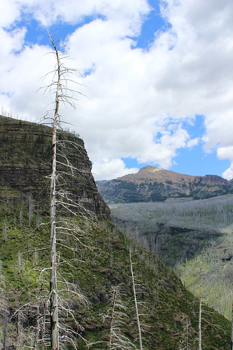
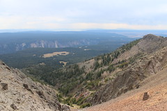
The trail - an old road - started steeply to the east, with Dunraven Peak behind us. After about 2/3 mile, we turned north and began a series of long switchbacks up through and eventually above the forest. At the southern switchbacks, the Grand Canyon of the Yellowstone could be seen cutting through the plateau below; on the northern ones, the lookout could be seen atop Mount Washburn.
After the last switchback at about 2 1/2 miles, we followed a rocky ridge to a junction with the Chittenden Road and Washurn Spurt Trail. From here, we hiked the last short 1/3-mile loop up to the lookout.
The lookout is more modern than those we've been to on mountaintops around home, with an indoor observation room, an outdoor viewing platform, living space for a ranger and numerous antennas. (And full cellphone service.) It's also a fairly popular destination, and we saw numerous people at the top.

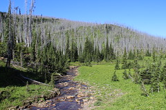
After a brief stop to take in the 360-degree view, we started down. On the way back, we hiked a short distance out the singletrack Washburn Spur, where we briefly found solitude. The trail continued down to the Grand Canyon, and will have to be fully explored on a future visit.
View more photos from Mount Washburn.
Distance: About 7 miles out and back to the top of Mount Washburn. We added about 1/2 mile on the Washburn Spur Trail.
Trailhead: The Dunraven Pass trailhead is about 4 3/4 miles north of Canyon Village.
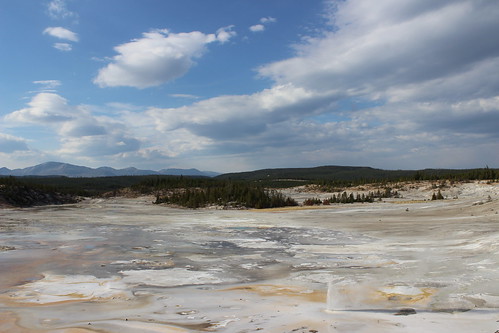
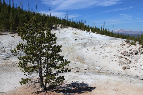
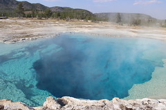
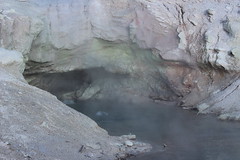
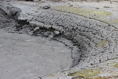
Norris Geyser Basin
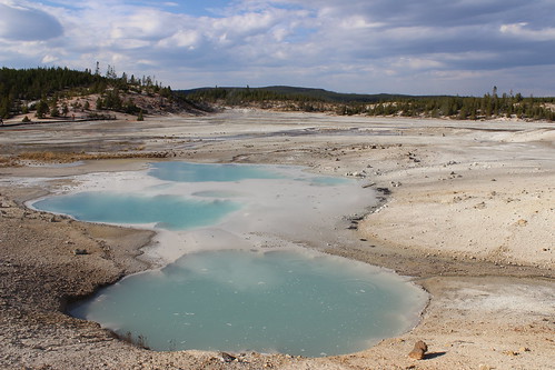
On the way back to camp that afternoon, we stopped at Norris to take in the geyser basin - one of the most surreal parts of the park with it's high concentration of thermal features. We briefly stopped at Norris in June, but were on a tight schedule so didn't see the entire area.
Two loops round the Porcelain Basin and Back Basin on trail and boardwalk. We started with the Porcelain Basin, highlighted by the jetlike Porcelain Springs, the Colloidal Pool and regularly erupting Constant Geyser.
The walk around the Back Basin Was highlighted by the Vixen Geyser and the bubbling Green Dragon Spring. Cistern Spring, which is connected to Steamboat Geyser, was blue when we visited in June. After an eruption of Steamboat two weeks earlier, however, it appeared muddy.
Here are more photos from Norris Geyser Basin.
Distance: Two loop trails totaling about 2 miles. A couple of short spurs can add about 1/4 mile.
Trailhead: At Norris.
Day 4
Grand Canyon of the Yellowstone
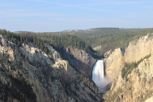
The next day, we went to one of the most popular parts of the park - the Grand Canyon of the Yellowstone - but we got far enough off the pavement to leave the crowd behind.
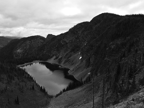
We started at Artist Point, taking in the view of the Lower Falls from the south rim of the canyon, and hiked to Sublime Point, about 1 3/4 miles to the northeast. Along the way, sunlight reached deeper into the canyon - highlighting the reds, oranges, yellows and whites of its walls - and eventually to the Yellowstone River at the bottom.
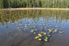
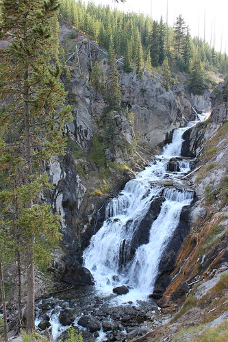
About 3/4 mile back along the rim, we turned south past Lily Pad Lake and continued about 1/3 mile to the Ribbon Lake Trail. After about 1 2/3 miles northeast, we reached the top of Silver Cord Cascade and Ribbon Lake, stopping on the shore for a break.

After hiking back southwest to Lily Pad Lake, we continued about 3/4 mile past a thermal area, taking in a bubbling mud pool and stopping again for a break along the edge of Clear Lake. At a junction a short distance past Clear Lake, we turned west are hiked to the Uncle Tom's Point trailhead, crossing the South Rim Drive.

After taking in closer views of Upper and Lower Falls, we followed the paved South Rim Trail about a mile back the Artist Point trailhead.
View more photos from the Grand Canyon of the Yellowstone.
Distance: About an 8 1/2-mile loop with a couple of out-and-back segments.
Trailhead: The Artist Point trailhead is about 2 1/3 miles south of Canyon, then 1 2/3 miles northeast on South Rim Drive.
Mud Volcano, LeHardys Rapids and the Hayden Valley

After hiking the Grand Canyon, we spent the rest of the afternoon driving south toward Fishing Bridge and Yellowstone Lake, stopping along the way for short walks at Mud Volcano and LeHardys Rapids and to take in the view in the Hayden Valley.
At Mud Volcano, a 2/3-mile trail loops up and back down the hillside, passing several steaming, bubbling and roiling hydrothermal features, including the namesake volcano, Churning Cauldron and Black Dragon's Cauldron.
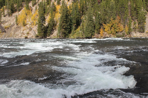
South of Mud Volcano, we stopped at LeHardys Rapids after seeing some colorful trees on the opposite side of the Yellowstone River. Along the short riverside trail, we also found waterfowl paddling among the rapids and rocks.
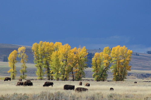
On the way back to Canyon Village and the Norris campground, we pulled off the road in the broad, grassy Hayden Valley as storm clouds rolled above a herd of bison.
Here are more photos from Mud Volcano, LeHardys Rapids and the Hayden Valley.
Distance: The Mud Volcano loop is 2/3 of a mile. The walk along the river at LeHardys Rapids is about 1/4 mile out and back.
Trailhead: Mud Volcano is 10 miles south and of Canyon Village. LeHardys Rapids is about 3 miles farther south. The Hayden Valley is between the Grand Canyon and Mud Volcano.
Day 5
Blacktail Plateau, Lamar Valley and Soda Butte Creek
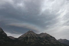
When we woke the next morning, it was obvious the day would be rainy. Based on the forecast, we had already reserved a hotel room in Cooke City, outside the northeast corner of the park, so we decided to drive that way - if the weather cleared enough, we would find a hike; if not, at least it would be scenic.
Over Dunraven Pass and west of Tower Junction, we began our sightseeing on the 7-mile, one-way Blacktail Plateau Drive. As rain fell, we saw a couple of bison and across the plateau to the Gallatin Range.
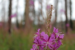
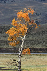
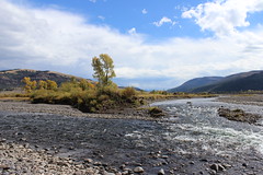
East of Tower Junction, we drove back and forth along park's north road, through the Lamar Valley and up the Soda Butte Creek drainage. We saw plenty of bison, as well as golden cottonwoods and aspens.
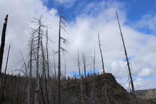
At one point, a break in the clouds seemed as if it would allow us to hike up toward Specimen Ridge through a petrified forest, but when we arrived at the trailhead rangers were temporarily closing the area due to an elk carcass that was attracting wolves and a grizzly bear. A ranger recommended returning the next day, when the carcass likely would be gone.
We drove back toward Cooke City, where we thought we could get in a couple of short hikes to waterfalls just outside the park, but thunder and lightning forced us to head for the hotel.
View more photos from the Blacktail Plateau, Lamar Valley and Soda Butte Creek.
Directions: The Blacktail Plateau Drive begins about 9 miles west of Tower Junction. The Lamar Valley is east of Tower Junction, between Slough Creek and Soda Butte Creek. Soda Butte Creek run between the northeast entrance to the park and the Lamar Valley.
Day 6
Petrified Forest
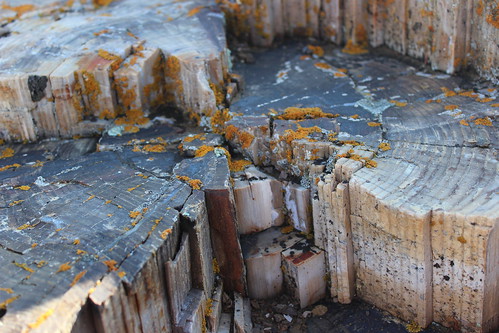
The next morning, we drove back west into the park and stopped to hike up to the Petrified Forest, before going home - the warning signs about the elk carcass having been removed.
We started south up the sage-covered hill in thick fog. Eventually, we could see the outlines of a couple of other people and bison beyond them. We stopped to talk briefly, then continued uphill, curving off the trail to keep the bison at a safe distance.
Up through a stand of trees, we turned west at a junction and soon found our first petrified stump. Hiking higher, we found several more stumps - their intricate rings crumbling in small, angular pieces - before reaching an open ridgeline.

After the fog cleared, we looped east then back north to the trail we came up, then went off through the sage to the west again to avoid the bison. After making our way around the herd, which had moved closer to the trailhead and begun to cross the road, we reached our car and departed for home.
Here are more photos from the Petrified Forest.
Distance: About 3 1/2 miles out and back, with a short loop up to Specimen Ridge. We hiked only about 1 mile up.
Trailhead: The Petrified Forest trail begins at a turnout about 5 miles east of Tower Junction and 3/4 miles west of the road leading to the Slough Creek campground, near a bridge over the Lamar River.