Back in August, a friend and I set out early one morning on what would be our final long run before The Rut 50K, a 32-mile loop to Mosquito Peak in the Rattlesnake Wilderness.
The route took us up the Spring Gulch and down Rattlesnake Creek - trails we had covered earlier in the summer - linking them with the Wrangle Creek drainage. We had never been beyond Stuart Peak in the wilderness and were there on a smoky morning earlier in the summer; despite clouds overhead, we were rewarded this time with better views of the surrounding peaks.
Starting from the main trailhead for the Rattlesnake National Recreation Area, we followed Trail 515 half a mile north then turned up Spring Gulch on Trail 517. We followed this trail north as it rose above Spring Creek and switchbacked to the wilderness boundary at about 7 3/4 miles. From there, we continued as the trail steadily rose and fell on and alongside the ridgeline, past the Twin Lakes below Stuart Peak, then McKinley Lake and Worden Lake.
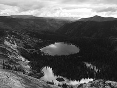
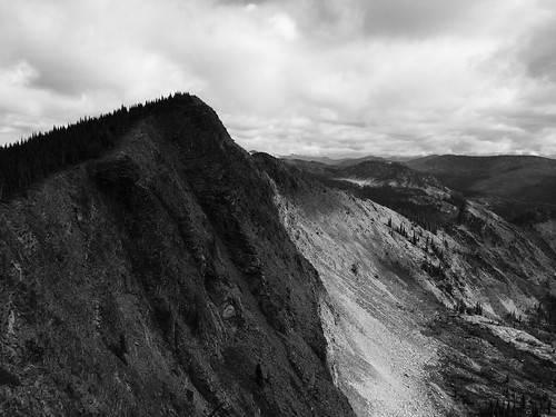
At about 11 1/2 miles, we veered northeast off the trail for a rougher route along the cliff edge, over a false summit and to 8,057-foot Mosquito Peak at about 12 miles. We stopped here to eat and take in the view of Big Lake, Little Lake and Glacier Lake below, and Point Six to the west, McLeod Peak to the north and Mineral Peak to the southeast.
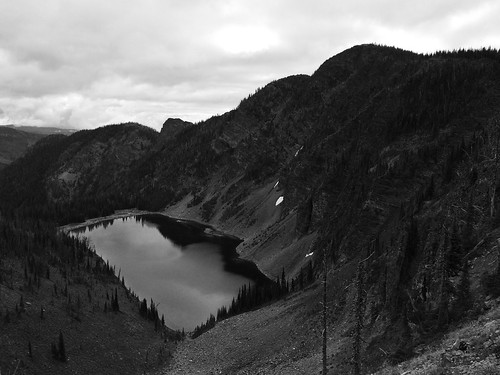
After our break, we continued downhill to the northwest and back to Trail 517, then north slightly to the junction with Trail 502 above Glacier Lake at 12 3/4 miles. Here, we turned northeast on 502 and continued downhill past Glacier Lake, then stopped briefly at Little Lake. Back in the forest, we encountered too many downed trees over the trail as we switchbacked into the Wrangle Creek drainage.
Continuing east along the creek, we left the wilderness at about 18 miles near the confluence with Rattlesnake Creek. After crossing a concrete bridge over the creek where it cut down through bedrock, we rejoined the main Trail 515.
From there, it was about 14 miles back along the wide trail as it dropped to Franklin Bridge, then rose slightly beyond Poe meadow. After passing only two other people in the first 18 miles, we encountered several mountain bikers and hikers, then a full parking lot at the end.
In 7 hours and 45 minutes, we gained nearly 5,300 feet of elevation over more than 32 miles. Three weeks later at The Rut, we would need to double the gain and reach the 11,000-foot summit of Lone Peak in the same distance.