Showing posts with label Glacier National Park. Show all posts

August 23, 2014

In Glacier Park, Fifty Mountain's majesty

fifty_mountain_2014-07-25_212

At the end of July, we made our annual trip north to Glacier National Park, and this year we took shuttling to its extreme.

In recent summers, we've become adept at using the park and private shuttle services to get to a trailhead, then spend a few days backpacking back to our vehicle. Usually, we'd board a shuttle in the morning and be on the trail within an hour or two.

This year, the only backcountry camping permits that were available for our preferred itineraries were at Goat Haunt and Fifty Mountain. After a short hike in the North Fork of the Flathead River drainage on the day of our arrival, we spent the entire second day of the trip in shuttles to Waterton Lakes National Park in Alberta and on a boat back to Goat Haunt in Glacier, the start of our trail, by dinner.

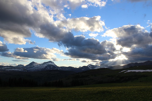
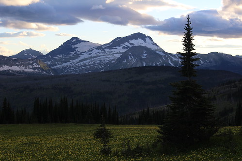
Still, while we're not likely to try that much shuttling again, we ended up in a fairly remote part of the park and enjoyed ourselves once on the trail. Standing in a field of glacier lilies above the Fifty Mountain campground at sunset, the view certainly lives up to the area's name.

Day 1: Howe Lake and Rocky Point
howe_lake_2014-07-22_039

The day we arrived in Glacier, we secured our backcountry permit, set up our tent at the Fish Creek Campground, then drove northwest on the Inside North Fork Road to the Howe Lake trailhead.

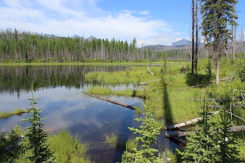
From the road, the trail climbs gently through forest burned in the 2003 Robert fire for 2 miles. Today, new trees stand head high among the remaining gray snags.

Once at the small, quiet lake, the trail continues to Howe Ridge, above the western shore of Lake McDonald. We followed it hoping it would skirt the east shore of the lake, but turned around after about 1/2 mile.
rocky_point_2014-07-22_046

Later that evening, we walked the 2-mile Rocky Point nature loop from the campground, along the shore of Lake McDonald and back through the forest.

See more photos of Howe Lake and Rocky Point.

Distance: 5 miles round trip at Howe Lake; 2-mile loop to Rocky Point.

Trailhead: The Howe Lake trail begins about 5 1/2 miles northwest of the Fish Creek Campground on the Inside North Fork Road. The Rocky Point loop begins and ends in the campground.

Day 2: Shuttle to Goat Haunt
goat_haunt_2014-07-23_003

The second day of our trip was the most logistically challenging, needing to catch three shuttles to Waterton in time to board the last boat before border agents ended their day at Goat Haunt.

Waterton and Glacier make up an international peace park straddling the border with Canada, and Goat Haunt is the only location allowing trail access back to the United States. At this remote station, only U.S. and Canadian citizens with passports are allowed to cross south.

In the morning, we packed our vehicle and drove northeast on Going-to-the-Sun Road to The Loop, where we would be returning days later. From there, we boarded a free park shuttle and drove up the scenic road west to Logan Pass, on the Continental Divide. At the pass, we got off the west-side shuttle and on an east-side shuttle and continued down to St. Mary.

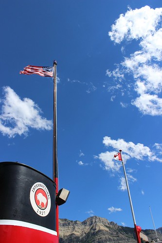
At St. Mary, we walked out of the park to the townsite and that afternoon took the paid Glacier Park Inc. East Side Shuttle to the Waterton visitor center near the Prince of Wales Hotel, crossing the border at Chief Mountain. From the visitor center, we walked to the dock on Upper Waterton Lake and bought tickets to take The International tour boat across to Goat Haunt. Before boarding the boat, we had enough time in the townsite to get a sandwich for lunch.
goat_haunt_2014-07-23_015

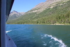
Aboard the 4 p.m. boat, we took a seat on the top deck and enjoyed the cruise south along the lake, viewing the logged swath and obelisks on each side marking the international boundary. Once off the boat, we walked a 1/4-mile path to the Goat Haunt ranger station and checked in with the border agents before returning to the camp adjacent to the dock.
goat_haunt_2014-07-23_074

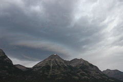
That night, storm clouds moved in - a preview of the weather in the forecast for the next day.

More photos from Goat Haunt are here.

Day 3: Waterton Valley Trail to Fifty Mountain
waterton_valley_2014-07-24_132

The first day of the backpacking portion of our trip, we woke to cloudy skies, and soon after eating breakfast and packing up at Goat Haunt it began to rain.

We've learned from past experience - Scotland, Olympic National Park, Glacier, Iceland - that a good rain coat, rain pants and pack cover make all the difference, so it didn't really faze us. Having checked in with the border agents the evening before, we set out south through the forested Waterton Valley.
waterton_valley_2014-07-24_018

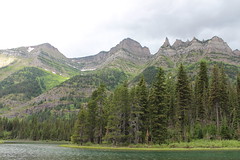
The first 6 miles were fairly uneventful - mostly hiking through the forest with little elevation gain, occasional creek crossings, and views of the mountaintops and the river. Occasionally, we got a break in the rain. At about 2 3/4 miles, we detoured west a little more than 1/3 of a mile and back to see Kootenai Lakes. At 5 miles, the trail over Stoney Indian Pass joined from the east.

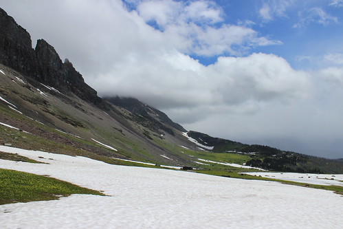
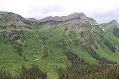
The trail began its ascent toward the Continental Divide at a little more than 6 miles, switchbacking a couple of times before rising steeply to the southeast along a brushy mountainside. After turning east and switchbacking into and out of forest again, the trail reached its high point - a saddle above tree line at about 10 miles. Here, the clouds broke and we got our first real glimpse of the surrounding mountains.
waterton_valley_2014-07-24_077

A little more than a mile downhill from the saddle, across snowfields and slightly into the forest, we reached the camp. It had started raining again, so we quickly set up our tent. After dinner and some card games, we called it a night.

Here are more photos from the Waterton Valley Trail.

Distance: About 11 3/4 miles one way, with detour to Kootenai Lakes.

Trailhead: Goat Haunt, reached by boat at the southern end of Upper Waterton Lake.

Day 4: Northern Highline Trail
north_highline_2014-07-25_050

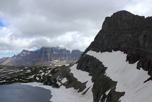
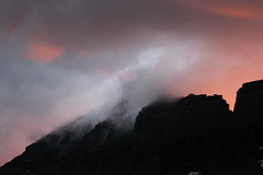
The next morning, I woke at sunrise - as is my habit when camping - and found the rain had stopped, but the sky was still filled with clouds. I wandered to the meadow above camp in time to see the first bright orange rays of daylight cresting Cathedral Peak.
fifty_mountain_2014-07-25_035

In the camp's food preparation area after others woke, we watched a grizzly sow forage on a ridge near the saddle we hiked over the previous day. While we heard the bear had a couple of cubs with her, we never saw them.

After briefly questioning whether we should hike back to The Loop early instead of staying for another day of rain, it became clear the clouds were lifting. As the multitude of surrounding mountains came into view, we set out southeast on the northern Highline Trail for the day.
north_highline_2014-07-25_031

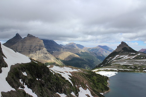
About 1 mile and one switchback above camp, we turned back northwest for a little more than 1/3 of a mile to the Sue Lake overlook. This notch in the ridge between Mount Kipp and Cathedral Peak provides views down to Sue Lake and over Pyramid Peak into the Mokowanis River drainage.
north_highline_2014-07-25_285

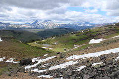
Back on the Highline, we continued southeast again, across rocky slopes and a handful of small snowfields into the Mineral Creek drainage. In the distance, we could see Swiftcurrent Mountain, the Garden Wall, the basin feeding Bird Woman Falls and Heavens Peak. About 2 1/2 miles from camp, we turned back.

That afternoon and evening, we relaxed by flying a kite and, after dinner, taking in sunset in the glacier lily-filled meadow.
fifty_mountain_2014-07-25_230

See more photos from the northern Highline Trail.

Distance: About 5 3/4 miles round trip.

Trailhead: Fifty Mountain campground.

Day 5: Flattop Mountain Trail to The Loop
flattop_mountain_2014-07-26_171

On our final day in the backcountry, we ate breakfast and packed up under scattered clouds.

After leaving camp, we hiked downhill southwest to Kooteani Pass, a low spot on the Continental Divide, then briefly followed Kipp Creek before rising a short distance up Flattop Mountain at about 2 miles.
flattop_mountain_2014-07-26_023

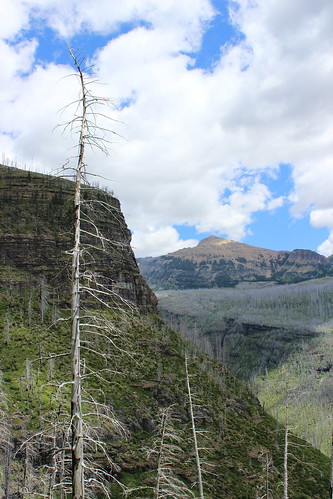
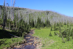
The trail south across Flattop continued, rising and dropping slightly along the way, through forests of gray snags left after the Trapper Creek fire of 2003. At about 4 1/2 miles, we passed a series of ponds in an unburned area, then dropped into the Flattop Creek drainage, where tall stalks of beargrass bloomed among more snags.

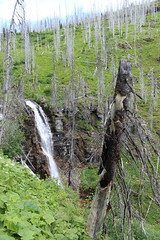
A little more than 6 miles along, we detoured less than a 1/4 mile to the Flattop campground for a break. Back on the main trail below the camp, we descended steeply along the creek, past several waterfalls. After a series of switchbacks and several snags that had fallen over the trail, we reached the valley floor at about 10 1/4 miles. Here, Swiftcurrent Mountain looms to the east and Heavens Peak to the west.
flattop_mountain_2014-07-26_123

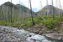
A short distance later, we crossed Mineral Creek and continued about 1 2/3 miles southeast through the McDonald Creek Valley to a junction, then turned back northwest and hiked uphill toward The Loop. About 3/4 of a mile up, we reached the junction with the trail to Granite Park, turned southeast again and arrived at The Loop - and our vehicle - at 13 1/4 miles.
flattop_mountain_2014-07-26_202

Our feet weary from all of the downhill, we stopped along the Sun Road to soak them in McDonald Creek on the way home.

Here are more photos from the trail over Flattop Mountain.

Distance: 13 1/4 miles one way.

Trailhead: Fifty Mountain campground.

August 6, 2013

Belly River to Many Glacier, by shuttle and tunnel

cosley_lake_20130727_005

After not backpacking in Glacier National Park last summer, we returned this year and were able to pick up a permit for a route that's been at the top of our list for a while: Up the Belly River and out to Many Glacier via the Ptarmigan Tunnel.

Over the years, we've been stymied in hiking this route several times. A few times, we've gone too early and the tunnel has been closed. More often than that, we've lost out in the advance reservation process and backcountry campsites have been full when we've tried to get a last-minute "walk-in" permit. This year, we didn't get our advance reservation request, but a couple of sites were still available the morning we arrived in the park.

As has become our habit, we spent the first day lining up details of the rest of our trip, going on a dayhike and settling in for the night at the St. Mary Campground.

After getting our backcountry camping permit in Apgar, on the west side of the park, we began the 50-mile drive over Going-to-the-Sun Road to the campground on the east side. Atop the always-packed Logan Pass, we parked in a pullout along the road, cut through the crowd and scrambled up Mount Oberlin with the mountain goats.

oberlin_20130725_104

The next day, we spent the morning in the Many Glacier area, packing and waiting for a 1 p.m. shuttle to the Chief Mountain trailhead. It made for a late, hot start to our hike, but was the only time the van ran from where we parked at our exit point to our entry near the Canadian border. (I've written in the past about using the park service and Glacier Park Inc. shuttle systems to put together point-to-point trips and still encourage it - you'll see much more than on an in-and-out hike.)

About 2 p.m., we were dropped off at the trailhead and set out for a couple of nights at scenic Cosley and Elizabeth lakes, and a long, uphill hike through Ptarmigan Tunnel and back to our car.

Day 1: Mount Oberlin

oberlin_20130725_172

The 1,500-foot Mount Oberlin climb is one of the easiest in the park, but considering how popular the Logan Pass area is, it gets very little use. The only mention I've seen of it on the park website is on the trail/area closure page, but routes up it are described in the classic guidebook "A Climber's Guide to Glacier National Park."

Before setting out for Oberlin, we usually check with a ranger at the Logan Pass Visitor Center to make sure the area isn't closed due to sensitive plants. The trail begins a short distance northwest of the visitor center - look for the dirt track leading off the paved path behind a chain fence.

The route leads northwest through flower-filled meadows, up past a couple of small cascades on Logan Creek to a scree slope below Oberlin to the north and Mount Clements to the south. Here, the trail splits - the northern route climbs steeply through the scree, while the southern route ascends to the saddle between the mountains, then turns north and follows the rocky ridge.

We went up through the scree to reach the summit, where there are views out the McDonald and St. Mary valleys to the west and east, respectively, and across Clements to Mount Reynolds. At the top, we stopped to eat and were greeted by a mountain goat.

oberlin_20130725_067

Having never taken the ridge route, we decided to try it on the way down. The footing is more stable, and the path fairly obvious if you pay attention to rock cairns. While it's not very technical, there are narrow ledges and a few spots that require lowering yourself down or pulling yourself up.

After passing a few more goats, we reached the saddle between Oberlin and Clements and scrambled - or, in my case, slid on the snow - back to the base of the scree slope. From there, we followed the trail to Logan Pass, stepping over the chain and back into the crowd.

oberlin_20130725_208

Here are more photos from Mount Oberlin.

Distance: About 3 miles round trip.

Trailhead: The trail begins off the paved path northwest of the Logan Pass Visitor Center, 32 miles northeast then southeast on Going-to-the-Sun Road from West Glacier.

Day 2: Chief Mountain to Cosley Lake

cosley_lake_20130726_048

The next day, we parked our car at the Swiftcurrent Motor Inn and caught Glacier Park Inc.'s east-side shuttle from Many Glacier Hotel to the Chief Mountain trailhead, a couple of hundred yards shy of the Canadian border.

The trail begins by descending south into the Belly River Valley through a mixed pine and aspen forest. After three miles, the trail reaches the south bank of the river, then continues into and out of forests and meadows with views of Sentinel and Bear mountains to the west and Chief and Gable mountains to the east. It's an easy, rolling walk with little elevation gain or loss.

belly_river_20130726_114

At about six miles, at the fence just before the Belly River Ranger Station, we turned west on the trail to Cosley Lake. A short distance later, we crossed the Belly River on a long suspension bridge, then climbed over a hill into the Mokowanis River drainage, taking in views back to the ranger station along the way. A little less than two miles later, we split off to see Gros Ventre Falls and the shady pool below it.

cosley_lake_20130726_015

Back on the trail, we hiked a little more than three-quarters of a mile to the campground along the north shore of Cosley Lake. While each campsite was somewhat secluded in the trees just off the lake, all provided easy access to the pebble beach. After a hot afternoon of hiking, a swim in the cool lake relieved before dinner and a cloudless sunset with the last light glinting off Pyramid Peak, Mount Kipp, Cathedral Peak and others.

cosley_lake_20130726_024

The next morning, I woke to see sunrise and the calm lake before we packed up again and headed back into the Belly River drainage.

Here are more photos from the trail to Cosley Lake.

Distance: 8 3/4 miles one way.

Trailhead: The Chief Mountain trailhead is a couple of hundred yard southeast of the U.S.-Canada border crossing on Montana Highway 17.

Day 3: Cosley Lake to Elizabeth and Helen lakes

elizabeth_lake_20130727_056

The next morning, we started at a leisurely pace - we didn't have a long or difficult hike ahead of us, although we did want to explore once we reached our campsite at Elizabeth Lake.

After backtracking east along Cosley Lake, we turned onto a cutoff trail at the outlet. There, hikers must ford the Mokowanis River with the assistance of a cable strung from one bank to the other. Crossing was fairly simple as the water wasn't that deep or swift; Jen wore sandals and I went barefoot after leaving mine in the car to cut my pack weight.

Once on the other side, we followed the trail into the forest, rounding Cosley Ridge to the south. The route began quite overgrown, but we soon came across a trail crew that was cutting back the underbrush. About two miles from the river crossing, we reached Dawn Mist Falls, where a short path leads to the Belly River below and the main trail offers a view from above after a brief climb.

elizabeth_lake_20130727_168

The trail roughly follows the river for about the next 1 3/4 miles, where it reaches a camp at the foot of Elizabeth Lake. We continued south along the west shore of Elizabeth to the camp at the head of the lake, Natoas Peak towering overhead.

After we set up our tent, we decided to continue south up the valley toward Helen Lake. The trail passed along the river, providing a look at fish swimming in the calm pools. After a couple of creek crossings, it arrived at a meadow with a good view up to Old Sun Glacier.

helen_lake_20130727_002

A short distance uphill and we arrived at the outlet of Helen Lake, crossing the creek and continuing on to the shore. The turquoise waters, fed by Ahern Glacier and other snowfields, made for a chilly swim, but we had plenty of time to relax on the gravelly beach afterward.

On the way back to camp, clouds began to build up, and they continued through dinnertime and after sunset. While rain wouldn't be a bother, thunderstorms could complicate the next day.

elizabeth_lake_20130727_215

Here are more photos from Dawn Mist Falls, and Elizabeth and Helen lakes.

Distance: 5 3/4 miles one way to the head of Elizabeth Lake. Helen Lake is a little less than 5 1/2 miles round trip from there.

Day 4: Elizabeth Lake to Many Glacier

ptarmigan_20130728_153

Our last morning in the park, we woke to fairly cloudy skies, hoping they would clear as we had our longest, most strenuous hike ahead of us. Before we started our trip, the forecast had been for thunderstorms to move in late that afternoon - any earlier and we could be forced to re-evaluate our route out through the mountains.

After an early breakfast, we set out back around the lake, spotting a fresh set of moose tracks at the water's edge along the way. At the outlet, we crossed a suspension bridge over the Belly River and began the 2,500-foot climb south up to Ptarmigan Tunnel.

ptarmigan_20130728_042

Here, the trail steadily switchbacks up through the forest before reaching the junction for Redgap Pass and continuing across the mountainside. The pine forest started out tall but grew shorter higher on the trail, eventually disappearing along with any other foliage. With the clouds mostly gone, the views from above the valley extended from the Belly River to the north, across Elizabeth Lake to Natoas Peak, and southwest to Helen Lake and Ptarmigan Wall.

The trail continued across an open, rocky slope, turning into the towering peaks and hugging the side of a cliff. With all the climbing, we were fortunate to be on the shady side of the mountains. At the tunnel, about 4 3/4 miles above the lake, marmots scrambled among the rocks and we began to encounter an abundance of hikers who had started from the Many Glacier side.

ptarmigan_20130728_175

Once through, we found ourselves in the warm sun, and after eating, we switchbacked down to Ptarmigan Lake, where the trail returned to the forest. Another 1 3/4 miles down through the trees and we arrived at the junction with the Iceberg Lake trail and, shortly thereafter, the small Ptarmigan Falls.

Most of the nearly 2 1/2 miles back down the trail from there was uneventful, with only a few views of Mount Wilbur and the Wilbur and Swiftcurrent creek drainages. For the most part, we were hiking against the crowd on their way up to Iceberg Lake, one of the most popular trails in Glacier.

ptarmigan_20130728_222

Back at the trailhead, it was a short walk down the road to the Swiftcurrent Motor Inn, where our car was parked. We arrived with storm clouds towering overhead and a few drops of rain falling to the ground - a good time to head home!

Here are more photos from the hike through Ptarmigan Tunnel.

Distance: 11 3/4 miles one way.

Trailhead: The trailhead for Ptarmigan and Iceberg lakes is on the northwest side of road around the Swiftcurrent Motor Inn complex in the Many Glacier area.

August 4, 2013

Glacier sunset, in 11 seconds


We are recently back from Glacier National Park and are still sorting through photos, so here's a short time-lapse video for now.

The location is Cosley Lake, where we spent the first night of the backpacking portion of our trip, and the view is from the beach on the edge of our campsite.

This lime lapse is about 2 hours and 20 minutes compressed to about 11 seconds. It was created with my old Droid Incredible smartphone and the Lapse It app.

Enjoy!

August 2, 2011

Geography of Glacier's Triple Divide

In the previous post about our backpacking trip in Glacier National Park, I wrote about the hydrological rarity that is Triple Divide Peak. There, water flows to three major North American drainages: the Pacific, Atlantic and Hudson Bay. How rare is this feature? There are two others, one in Canada and one in Siberia.

Here's a map of Glacier's Triple Divide; click the markers for more information.


View Triple Divide Pass in a larger map

July 28, 2011

Glacier's Triple Divide Pass in three days

triple_divide_20110723_258

One of the biggest stories in Montana this spring and summer has been the deep snow left in the mountains from winter, and we encountered plenty on our anniversary trip to Glacier National Park.

This year, we wanted to camp in Glacier's backcountry again and had our sights set on a three-day 19.3-mile route from the Belly River in the northeast corner of the park south through Ptarmigan Tunnel to the Many Glacier area. Unfortunately, the opening date of the tunnel through Ptarmigan Wall was pushed back beyond our trip due to lingering snow. We also just missed the last available campsite on an alternate route over Red Gap Pass.

The night before we left, we settled on a three-day 23.5-mile route from Cut Bank on the park's east side west to Triple Divide Pass, then north to Red Eagle Lake and the town of St. Mary. Campsites were still available the night before we left Missoula, but only parts of the route were described in our hiking guide and the trail report said to be prepared for snow.

The next day, we drove north to the park and made the backcountry office in Apgar our first stop. Campsites were still open, so we secured a permit. All that was left was to cross the alpine Going-to-the-Sun Road - which was under construction and had its latest-ever opening due to snow - to the St. Mary area, where we had a frontcountry campsite reserved for the night. That afternoon, we took a short hike on St. Mary Lake, then had a restaurant dinner before heading to bed. In the morning, we woke early to leave the car at our exit point and catch a shuttle south.

While rain fell most of the first day on the trail - fortunately, our shortest - we were rewarded with few clouds and a lot of sun for the longer second and third days. And while the campsites were full, we passed fewer than two dozen people on the trail the entire trip.

Day 1: Baring Creek to St. Mary Falls

st_mary_20110721_028

After driving up to Glacier from Missoula, we took this short hike around the northwestern side of St. Mary Lake to a couple of waterfalls. The skies looked stormy, but it never rained while we were on the trail.

From the trailhead near Sunrift Gorge, we hiked down Baring Creek to Baring Falls, along the edge of the lake and up to some cliffs, then into the forest to St. Mary Falls and a couple of other cascades.

st_mary_20110721_111

Along the way, we got our first glimpse of the park's abundant wildflowers and trailed a young deer for a short distance.

See more photos of the hike to St. Mary Falls here.

Distance: 4.2 miles round trip.

Trailhead: Sunrift Gorge parking area, about 10.5 miles west of St. Mary on Going-to-the-Sun Road.

Day 2: Cut Bank trailhead to Atlantic Creek

atlantic_creek_20110722_022

The next morning, we woke early and made our way to the stop for Glacier Park Inc.'s East Side Shuttle at the St. Mary Visitor Center. I parked at the nearby 1913 Ranger Station, where we would leave the trail, and returned for our pickup.

As we waited, we watched clouds move in and sheets of rain fall in the mountains where we would soon be backpacking. Luckily, I made an impulse purchase of pack covers a couple of days earlier that would turn out to be worth the money.

On this trip, getting to the trailhead was half the journey. The shuttle took us south from St. Mary, but would only drop us on the side of the highway five miles from the trail in the rain. We were prepared to walk up a dirt road to the trailhead, but lucked out when a couple of women who stopped to take pictures of horses in a field offered a ride instead.

The rain briefly let up at the trailhead, revealing a wildflower meadow and mountains through the clouds, but it soon set in again.

The hike roughly followed North Fork Cutbank Creek upstream in and out of the forest, and up a steep hill to the campground at Atlantic Creek. When we arrived, all that was dry was our packs and the parts of our bodies covered by rain gear - Jen had rain pants and a jacket, while I had only a jacket. (For me, the hike ranked among the top three wettest alongside the Costa Rican jungle and Olympic National Park; I wore rain pants in Scotland.)

We pitched the tent on a site with good drainage and waited out the rain inside before dinner. After eating, the clouds broke and we took a short walk to Atlantic Falls.

atlantic_creek_20110722_055

More photos of the hike to the Atlantic Creek camp are here.

Distance: 4.3 miles one way.

Trailhead: 14 miles south of St. Mary on U.S. Highway 89 and five miles west on Cut Bank Creek Road.

Day 3: Atlantic Creek to Red Eagle Lake

triple_divide_20110723_278

The second day backpacking was our longest and hardest on the trail - and, thankfully, we had partly cloudy to clear skies.

The trail started fairly level, but after a short distance turned uphill at a junction. From the junction, the trail climbs steadily along the southern side of Mount James for about 2.6 miles to Triple Divide Pass.

triple_divide_20110723_097

This section of trail was some of the most interesting of the trip. As it rose out of the trees, Medicine Grizzly Lake, Razoredge Mountain and Triple Divide Peak came into view, and alpine wildflowers grew from the rocks.

triple_divide_20110723_072

This is also where we began to encounter snowfields, short at first, then long on the final stretch to the pass. A couple of these fields provided extra interest. The bottom of one had melted enough to scramble under and cool off in the dripping snowmelt. Another had pulled away from the rock wall next to the trail enough to squeeze through with a pack.

triple_divide_20110723_269

At the 7,397-foot pass, we took a break for food and pictures, and to understand the hydrologic rarity looming above: Triple Divide Peak, above left and at the top of the post. Situated on the Continental Divide, the mountain actually sends water falling on its summit to three different North American drainages. West of the peak, water flows to the Columbia River and the Pacific Ocean. To the east, it flows to the Atlantic via the Missouri and Mississippi rivers. And to the northeast, it ultimately flows to Hudson Bay.

Only about three miles into our day at this point, we began down the Hudson Bay Creek drainage, crossing several more snow-covered switchbacks and passing a group of bighorn ewes and lambs.

triple_divide_20110723_315

Shortly out of the snow, we forded a few creeks as we continued down the valley through shrubby meadows and forest. Soon, we reached forest burned by the 2006 Red Eagle fire, with silvery snags rising into the sky.

triple_divide_20110723_446

After reaching the valley bottom, we crossed Red Eagle Creek on two suspension bridges before rounding the southeastern side of Red Eagle Lake to our campsite above the shore, about eight miles from the pass. A clear night provided for a beautiful sunset and stars.

red_eagle_20110723_022

More photos of the route over Triple Divide Pass are here.

Distance: 11.6 miles one way.

Day 4: Red Eagle Lake to St. Mary

red_eagle_20110724_099

Our final day began by following the trail through rolling burned forestland - thick with soon-to-bloom fireweed - along Red Eagle Creek, crossing it two more times on suspension bridges.

red_eagle_20110724_037

As we moved out of the old burn, meadows thick with wildflowers opened up and stands of aspens provided shade. Red paintbrush, blue lupine, golden blanketflower, white bog orchids and pink geraniums were abundant.

red_eagle_20110724_086

Past a beaver pond, we reached our car at the 1913 Ranger Station. Then it was back across the Sun Road and its construction zones to home.

See more photos of the Red Eagle Lake Trail here.

Distance: 7.6 miles one way.

Trailhead: 1913 Ranger Station, a short distance across Going-to-the-Sun Road from the St. Mary Visitor Center.