October 26, 2014

Running to new heights at The Rut

Over Lone Peak

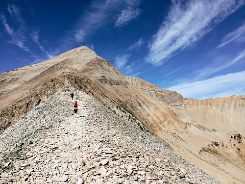
After starting summer with my longest run to date, I finished the season with my highest and hardest run: The Rut 50K, with 11,000 feet of elevation gain over the 11,166-foot summit of Lone Peak.

Organized by Missoula's Runner's Edge store, the race took place in mid-September at Big Sky Resort, between Bozeman and Yellowstone National Park. Being the final ultramarathon in the 2014 Skyrunner World Series, some of the biggest names in the sport were there: Kilian Jornet, Sage Canaday, Emelie Forsberg, Kasie Enman and others.  (I can now add "skyrunner" to my bio, apparently; for a primer, see this Trail Runner magazine article and video.)

We arrived the day before the 50K and settled into the condo we rented before visiting with friends at the start/finish area, attending my race meeting and Jen's aid station meeting, then eating dinner. On the way back to the condo to go to bed, I noticed the light atop Lone Peak appeared as if it were a star.
Start here, run up there, then back

Early the next morning, we walked to the start and Jen departed with her aid station crew. After watching the first wave of runners get underway at 6 a.m., it was my turn five minutes later.

Starting to a pre-dawn elk bugle, the second wave of streaming headlamps made its way gradually uphill. I soon found myself among a handful of familiar voices in as we slowly made our way uphill in a line. At the top of the first climb near 2 miles, the sun had risen enough to see the footing.

The next 5 1/2 miles were downhill to the Madison Village, eventually running on trails and ramps between rows of houses. Turning uphill again, the course steadily rose for 5 miles past the first aid station at 7 1/2 miles and into the forest.

After another couple of short downhill stretches, I left the trees at about 14 miles and arrived at the first major climb for the day: Headwaters Ridge. Here, the course left the trail and scrambled steeply up the scree, rising a little more than 1,000 feet in a little less than 3/4 mile. At the top, a quick descent using a via ferrata line led to the narrow ridgeline and a fast run down 1,700 feet over 1 1/2 miles and into the forest. A couple of patches of snow left from a storm earlier in the week clung to the rocks, and careful footing was required as a misstep could send you tumbling downhill.
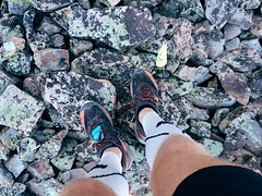
Follow the little yellow flags

Over then next 2 miles, the course climbed again into a sun-baked basin where the 18-mile aid station sat at the Lone Peak tram dock. Here, a small crew of Missoulians - including Jen - helped with drop bags, food and fluids. After refilling my hydration pack and eating some, I headed toward the start of Bonecrusher Ridge. In the end, Jen and the others would make it to the finish line before me.

A mile back down from the tram dock then slightly uphill, the course turned onto Bonecrusher Ridge, the highest climb of the day. In about 1 1/3 miles, the trail climbed 2,000 feet out of the trees and up the hot, rocky ridge - the tram dock directly below a nearly vertical drop to the side. On the steepest section near the top, it wasn't unusual to be on all fours in places. At the summit, it was nice to take another short break at the aid station to eat and catch my breath before continuing.
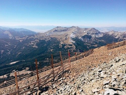
The view from the top of 11,000-foot Lone Peak

The 2,500-foot descent over the next 1 3/4 miles was the roughest part of the race on my the feet as the course took us over plate-sized slabs of rock that would shift underfoot on occasion. At the bottom, I stopped briefly to empty my shoes of gravel as well.

Back in the trees, the trail rain along the border of Big Sky Resort and the exclusive Yellowstone Club, dropping for a mile then climbing almost half a mile past one of the large homes. After two more miles of downhill, the course reached thicker forest and a 1-mile climb up muddy trails and over mountain bike ramps, occasionally aided by ropes. Near 27 1/2 miles, the trail reached the final aid station.

From there, the last 4 1/2 miles of the course were mostly downhill, crossing ski slopes, then rising slightly through the forest again. After passing behind one of the resort's large hotels, I arrived at the finish, covering about 32 miles in 9 hours.


A few post-race notes:

Slowest mile: Mile 21, with 1,424 feet of elevation gain, took 50:13. It also likely included some time at the Lone Peak aid station.

Fastest mile: Mile 4 - in the first downhill section - took 8:32.

Food: The spread wasn't as expansive as at the Bighorn Mountain Wild and Scenic Trail Run (see notes), but the mini dill pickles atop Lone Peak were delicious.

They meant well: As a spectator, what you say might not be interpreted how you intend. "You're almost there - just around the corner," said one spectator. To me, those words of encouragement indicate the finish is nearby, not a ridge called Bonecrusher. "Just eight little hills to go," said another spectator in the last couple of miles. Nothing was "little" at that point.

The "medal": This being The Rut, the elk hide finisher's "medal" was a unique touch - just have to keep my dog from getting it.
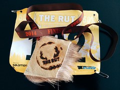
Elk hide, of course - it's The Rut

All in all, it was a great experience - and a fun way to start a weeklong vacation to Yellowstone National Park. And while it was a difficult race, I'll probably return!
October 12, 2014

Celebrating wilderness with solitude in Rattlesnake

boulder_lake_2014-09-01_052

I spent a lot of time in the Rattlesnake National Recreation Area and Wilderness this past summer, so it was only fitting that when we chose a place to hike two days before the 50th anniversary of the Wilderness Act it was there.

While the Rattlesnake is Missoula's backyard, accessed by most from the main trailhead on the north edge of the city, we hiked to Boulder Lake from the more remote West Fork of Gold Creek to the northeast and saw only two other people all day. The rough drive into the trailhead likely accounts for the decreased use - it's the only time the traction control light in our SUV has turned on on a dry road.

boulder_lake_2014-09-01_008

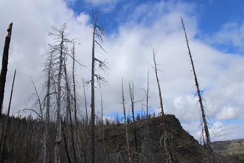
Once there, we hiked north on Trail 333 through an old burn, the Mineral Peak lookout visible to the south through the remaining snags and tall stalks of fireweed. The trail rose and fell gradually, crossed a couple of creeks, then entered forest just before a junction at 2 1/2 miles.

Continuing on Trail 333 to the northwest, we climbed a burned ridge, passing the wilderness boundary at 3 3/4 miles. From there, the trail continued up to a saddle below 7,293-foot Boulder Point. A short distance higher, we hiked a 1/4-mile side trail to the point, where we found the remains of lookout and views 800 feet down to the lake, north to the Mission Mountains and northeast the the Swan Range.

boulder_lake_2014-09-01_035

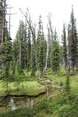
After returning to Trail 333, we continued up into the forest and a junction at 5 miles. Here, we followed the final steep switchbacks down 1 mile along a creek and past a marshy area, then down more to the lake shore and the point looming to the west.

boulder_lake_2014-09-01_082

After eating some food and letting the dogs swim and sniff around some moose tracks, we climbed up from the lake and hiked back to our car.

In Missoula, we truly are lucky to have treasures such as the Rattlesnake Wilderness - and the Selway-Bitterroot, Mission Mountains and Bob Marshall - so close.

Here are more photos from Boulder Lake.

Distance: 12 1/2 miles round trip, including 1/2 to Boulder Point and back.

Trailhead: From Bonner, drive about 8 3/4 miles east on Montana Highway 200, then turn northwest on Gold Creek Road, also known as Forest Road 126, and follow it 6 miles. Turn northwest on Forest Road 2103 and continue 5 miles, then turn onto Forest Road 4323 and continue 5 rough miles northwest to the West Fork Gold Creek trailhead.

October 11, 2014

Late-summer loop to Rattlesnake's Mosquito Peak

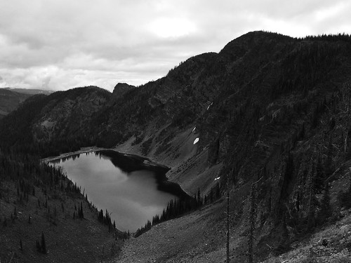
Mosquito Peak in the Rattlesnake Wilderness

Back in August, a friend and I set out early one morning on what would be our final long run before The Rut 50K, a 32-mile loop to Mosquito Peak in the Rattlesnake Wilderness.

The route took us up the Spring Gulch and down Rattlesnake Creek - trails we had covered earlier in the summer - linking them with the Wrangle Creek drainage. We had never been beyond Stuart Peak in the wilderness and were there on a smoky morning earlier in the summer; despite clouds overhead, we were rewarded this time with better views of the surrounding peaks.

Starting from the main trailhead for the Rattlesnake National Recreation Area, we followed Trail 515 half a mile north then turned up Spring Gulch on Trail 517. We followed this trail north as it rose above Spring Creek and switchbacked to the wilderness boundary at about 7 3/4 miles. From there, we continued as the trail steadily rose and fell on and alongside the ridgeline, past the Twin Lakes below Stuart Peak, then McKinley Lake and Worden Lake.

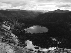
Big Lake, below Mosquito Peak in the Rattlesnake Wilderness

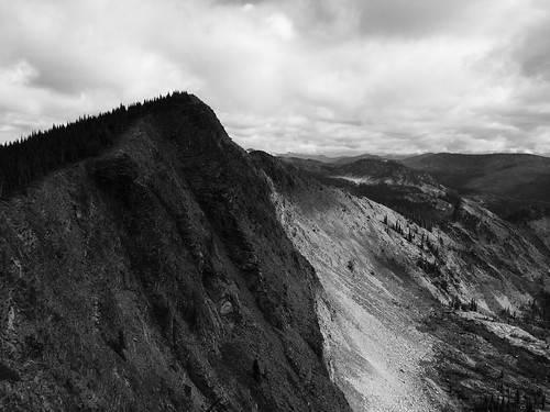
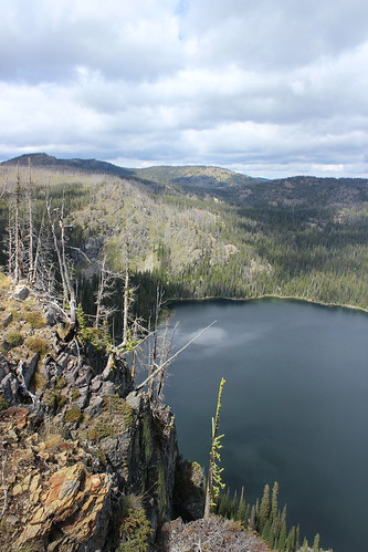
At about 11 1/2 miles, we veered northeast off the trail for a rougher route along the cliff edge, over a false summit and to 8,057-foot Mosquito Peak at about 12 miles. We stopped here to eat and take in the view of Big Lake, Little Lake and Glacier Lake below, and Point Six to the west, McLeod Peak to the north and Mineral Peak to the southeast.

Glacier Lake in the Rattlesnake Wilderness

After our break, we continued downhill to the northwest and back to Trail 517, then north slightly to the junction with Trail 502 above Glacier Lake at 12 3/4 miles. Here, we turned northeast on 502 and continued downhill past Glacier Lake, then stopped briefly at Little Lake. Back in the forest, we encountered too many downed trees over the trail as we switchbacked into the Wrangle Creek drainage.

Continuing east along the creek, we left the wilderness at about 18 miles near the confluence with Rattlesnake Creek. After crossing a concrete bridge over the creek where it cut down through bedrock, we rejoined the main Trail 515.

From there, it was about 14 miles back along the wide trail as it dropped to Franklin Bridge, then rose slightly beyond Poe meadow. After passing only two other people in the first 18 miles, we encountered several mountain bikers and hikers, then a full parking lot at the end.

In 7 hours and 45 minutes, we gained nearly 5,300 feet of elevation over more than 32 miles. Three weeks later at The Rut, we would need to double the gain and reach the 11,000-foot summit of Lone Peak in the same distance.